There is a lot of buzz about Hurricane Matthew in the Caribbean, but, closer to home, there will likely be steady rain in Rhode Island and Southeastern Massachusetts heading into the weekend. Clouds will eventually yield rain on Friday. Showers are possible in the morning, and rain is likely be late in the day. Highs will be in the upper 50s to low 60s with a northeast breeze.
Friday night looks wet. Rain is likely with the temperature falling into the mid 50s. The northeast breeze continues into early Saturday. You can expect more off and on showers on Saturday. Highs will once again be near 60.
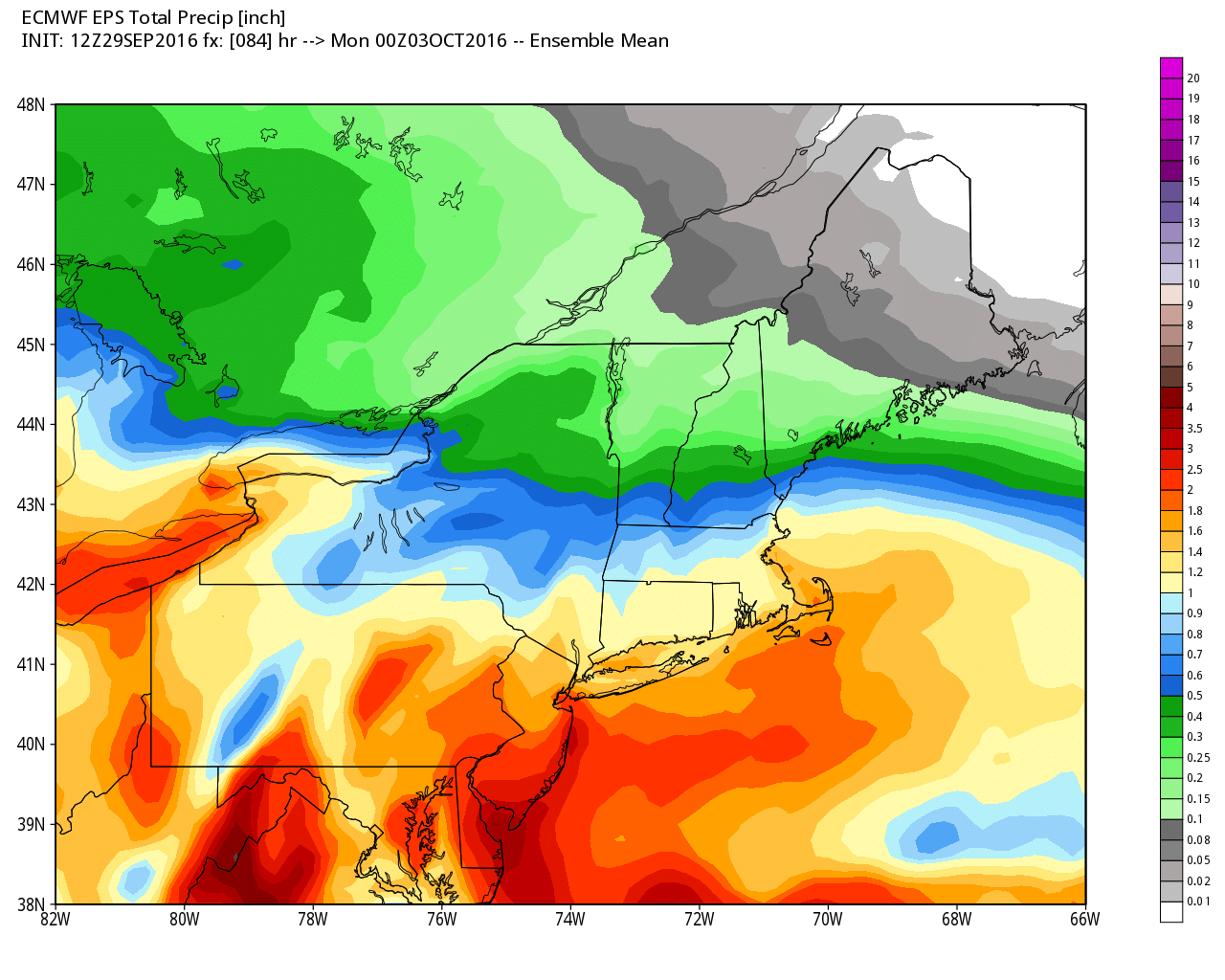
Sunday will likely be less rainy, but showers cannot be ruled out. Highs will be in the low 60s with mostly cloudy skies. The weather does not look awful for the Patriots game in Foxboro….just a gray day. The wind will be lighter on Sunday.
Overall, there will be limited improvement early next week. Clouds may be stubborn into the midweek, and temperatures will be at or below normal during the day, and slightly above normal at night. Expect highs to be in the upper 50s to mid 60s depending on how much sun breaks through each day between Monday and Wednesday.
As for Matthew, the storm became a hurricane on Thursday, and a turn to the north before it reaches Jamaica is likely this weekend. The storm will move into the Bahamas early next week. The forecast becomes very uncertain after that, but the latest trends suggest a more eastward track that takes it off the Eastern Seaboard. The consensus track seems to be far enough offshore that there is no direct impact in RI and SE MA late next week, but there are some computer models that bring it close enough to deliver rain and wind.

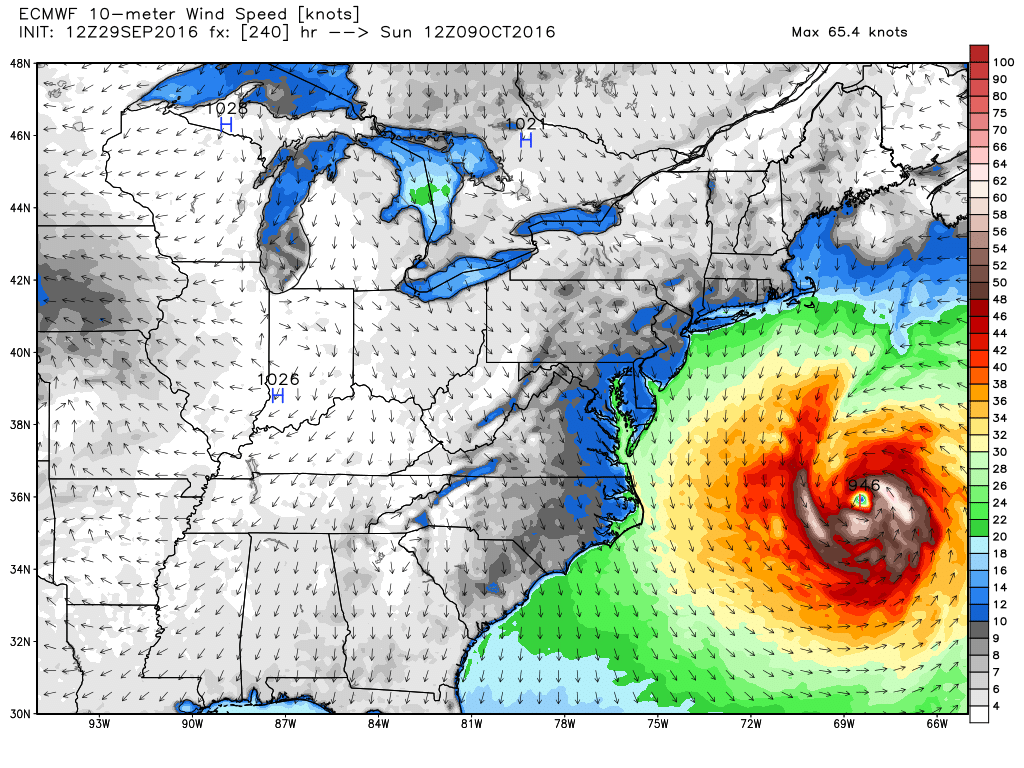

The bottom-line is we need to watch Matthew closely in the next few days, and my confidence level in the forecast should grow over the weekend.
I will be traveling on Friday and Saturday. Unless there is a major developing weather situation, I will have the next forecast update on Sunday.


