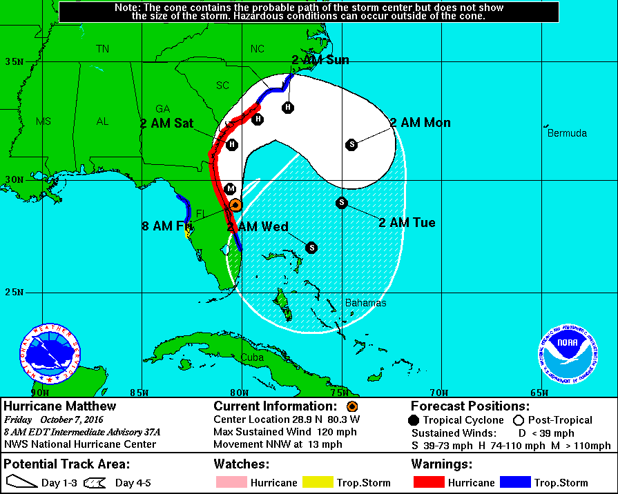
Hurricane Matthew is scraping the Florida coast with strong winds and heavy rain. The eye of the storm stayed just offshore as it moved north parallel to the coast, sparing the east coast of Florida the worst of the hurricane. The storm will continue moving north before turning northeast and paralleling the Southeastern United States coast. Some of the worst conditions from Matthew are possible in coastal South Carolina due to combined wind, flooding rain, and storm surge in low-lying areas.
Matthew will stay well south of Connecticut while looping around off the Southeastern United States coast. The cold front that will keep Matthew to the south will slowly move through New England this weekend. Clouds will be stubborn Saturday and Sunday. The best chance of rain is Saturday night.
Look for gray skies and highs in the mid 60s on Saturday. Some patchy mist and drizzle is possible, especially near the coast. Showers are possible Saturday night with temperatures in the upper 50s to low 60s. You can expect a lot of clouds on Sunday. It may be a damp day. Highs will be in the low 60s.
Quiet weather is ahead for next week. Monday will be brighter with highs in the low 60s. Tuesday looks about the same. More clouds are possible in the midweek, but it will stay dry. Highs will be in the mid 60s. There is a high likelihood that the weather will stay dry through next workweek.


