Hat? Check. Gloves? Check. Scarf? Check. Now, where’s that snow shovel? A shot of very cold weather Friday into the weekend will be followed by a potentially “shovelable” (and “plowable”) snow Sunday night into Monday.
Cold weather arrives early Friday with a strong northwest wind. Gusts over 30 mph are likely on Friday, and the temperature will most likely not get out of the mid 30s. The wind chill will be in the low to mid 20s under partly sunny skies. Friday night looks clear, windy, and cold. Lows will be in the upper teens to low 20s, with wind chills in the teens.
Saturday should be bright, but it will also be very cold. Highs will only be in the low to mid 30s. IT will not be as windy as Friday, but there will still be a noticeable northwest breeze. The temperature will dip into the teens to low 20s under clear skies Saturday night.
Clouds will quickly increase on Sunday following a very cold start to the day. It looks cold and quiet in the afternoon, with highs only in the low to mid 30s. The stage will be set for snow late Sunday into Sunday night. Expect the first flakes between sunset and 10 pm on Sunday, with steadier snow by dawn on Monday.
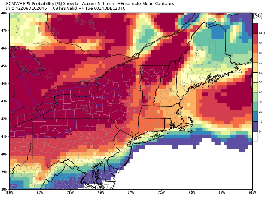
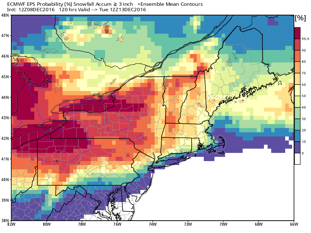
It’s early, but the current consensus storm track favors at least some mixing near the coast on Monday as heavier precipitation arrives. This looks like a “front-end thump” snow event with mixed precipitation or rain after a minor to moderate snow accumulation. Of course, the projected timing is not good with the Monday morning commute. As you can see from the images, the odds of 1″ of snow by Monday evening are quite high for most of Southeastern New England, but the odds of more than 3″ of snow through Tuesday are highest north and west of the I-95 corridor.
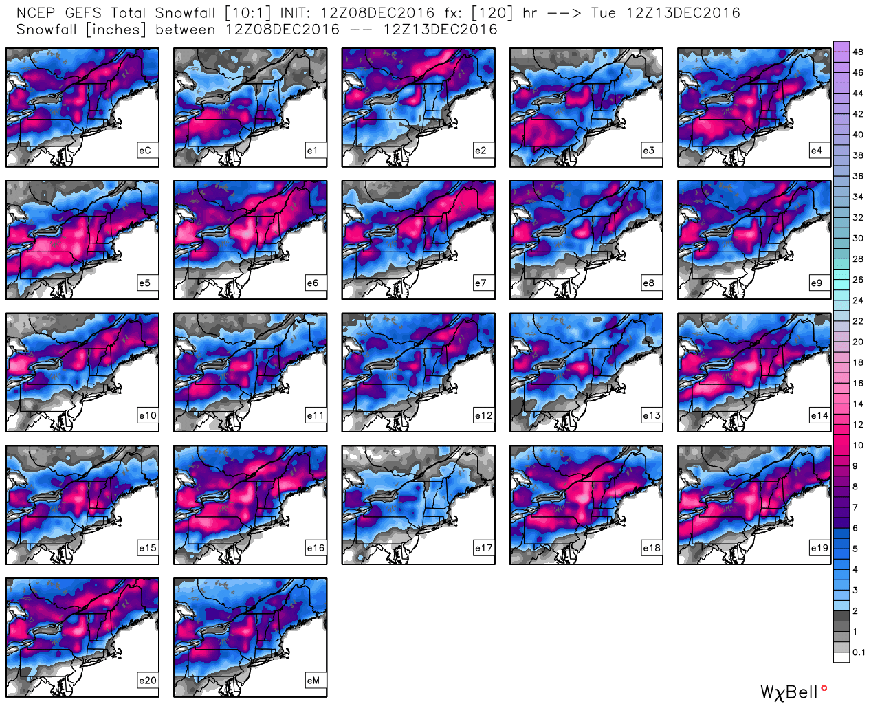
Right now, it looks like the brunt of the storm will be on Monday, but it may linger into Monday night and Tuesday morning with light rain, mix or snow. It’s too early to talk about specific totals, but this is our best shot at a few inches of snow so far this season. It does not look like it will be a very intense storm with strong winds, and a track farther south could lead to a moderate snowstorm with upwards of 6″ of snow.
We are expecting more cold weather with another storm possible late next week or next weekend. This December looks a lot different than 2015 when it was incredibly warm!