An incredibly warm stretch of weather in Southeastern New England will transition to more typical late-January weather in the next couple of days. Ending Thursday, each of the past six days were at least 10° warmer than normal. While it will stay warmer than normal through the weekend, it will not be by as much.
Friday looks partly to mostly cloudy and windy, with highs in the low 40s. There will be a 15-25 mph westerly wind. The temperature will dip into the 20s to near 30 to start the day on Saturday. Look for a fair amount of clouds with highs near 40 on Saturday. It does not look much different on Sunday. Expect highs near 40 with dry skies.
The “WYSIWYG” weather continues on Monday with highs in the mid to upper 30s and lows in the 20s. Clouds will increase on Tuesday. It will be a few degrees colder, with highs in the low to mid 30s. A weak storm system may brush by with some midweek snow showers or flurries Tuesday night and Wednesday. Right now, it looks like a minor event, but these “Alberta Clippers” need to be watched for redevelopment after hitting the Atlantic Ocean.
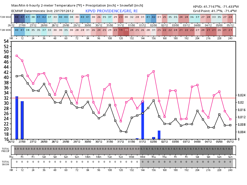
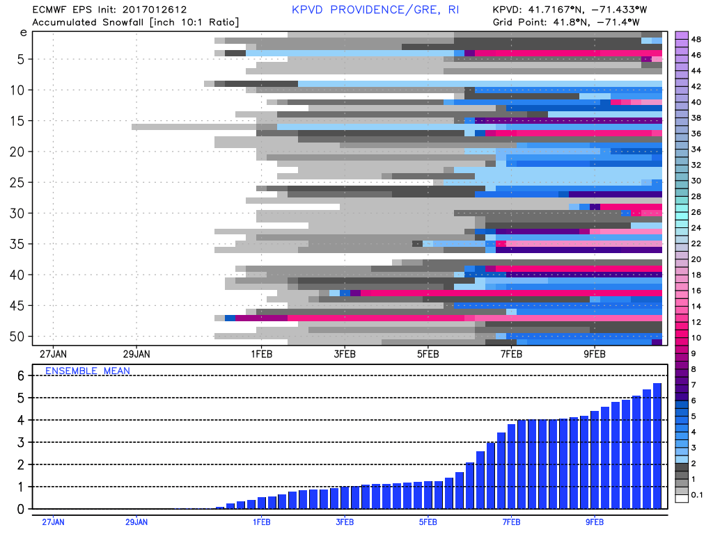
The overall trend is for seasonable weather into early February. It still looks like a reasonable chance for some stormy weather on Super Bowl weekend or early the following week.