Damp and drizzly weather Tuesday morning will give way to steadier rain late in the day. The temperature will slowly climb into the mid 40s by late in the day. It will be breezy to windy at the coast. Steady rain ends Tuesday night, and dry skies are likely to start the day on Wednesday. Enjoy the mild weather Wednesday afternoon. There will be a bit of sun, and highs near 50.
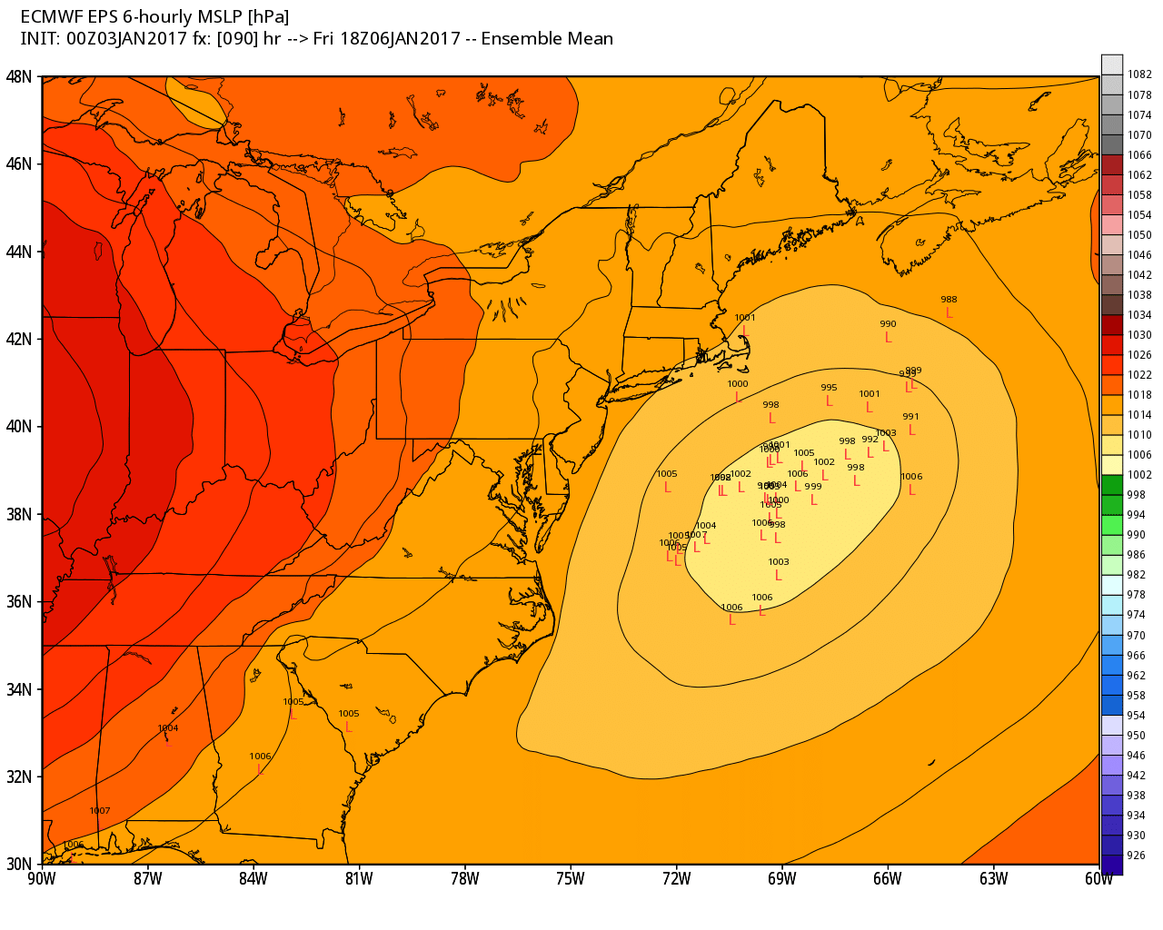
Colder weather arrives on Thursday. It will be dry with highs in the low 30s. We’re watching a storm that will move through the Mid-Atlantic on Friday. The center of the storm will pass south of New England, but it may come close enough for a light to moderate accumulating snow. At this point, it looks like the best chance of more than 2″ of snow is on Cape Cod and the islands. It’s early, and the exact track of the storm will decide the snow amount. If it trends a little closer to the coast, then most or all of RI and SE MA would be in line for at least 3″ of snow. If it trends further offshore, then the weather may stay dry. There should be enough cold air for an all-snow event, regardless of the track.

Regardless of the Friday storm or near-miss, the cold weather stays with us through the weekend. It will likely stay below freezing through Monday, and highs may not reach 30° in many places Saturday through Monday. Lows will be in the teens and possibly single digits on Monday. A second storm will move off the Mid-Atlantic or Southeast coast in the middle to end of the weekend. That’s another close call. Right now, it looks like a glancing blow at worst. The coldest weather of the stretch is likely on Monday morning, with lows in the single digits to teens.


