Wild weather swings are ahead in the next few days. A raw and rainy Tuesday will give way to a damp and chilly evening. The temperature may flirt with freezing in a few inland spots Monday evening. The temperature will rise quickly late at night and early Wednesday. A few showers are possibly Wednesday morning before some sunny breaks develop. It will be unseasonably warm on Wednesday, with highs in the 50s.
The weather changes very quickly Wednesday night into early Thursday. The wind will shift to the north then northeast as a storm develops east of the Chesapeake Bay. Snow will begin between 5-8 AM Thursday, and will become moderate to heavy by midday. The snow continues through the afternoon, tapering off between 5-8 pm. Several inches of snow accumulation is likely in all of RI and SE MA. An early estimate is for 5-9″ throughout the area. There is potential for a bit more than that, and if the storm tracks farther southeast, then it would be less.
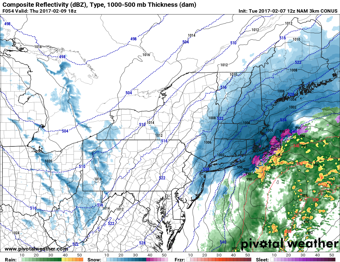
Gusty winds are likely, with northeast 15-30 mph likely in RI, and 20-40 mph possible in Southeastern Massachusetts as the storm passes east of Nantucket. Temperatures will be in the 20s to low 30s early in the storm, and in the 20s by late in the day.
Thursday night looks dry and windy with blowing snow. 15-35 mph winds are likely, and the temperature will fall into the teens. Friday should be a very cold day, with highs only in the low 20s. Expect partly sunny skies.
A weak disturbance moving through the cold air on Saturday could bring an additional 1-3″ of snow. It’s a subtle storm system, and we’ll keep an eye on that part of the forecast for changes. Once again, the timing is during the day.


