Hurricane Jose is meandering in the Atlantic Ocean as a category 1 storm with 75 mph winds. The storm will drift to the southeast on Wednesday before making a turn to the southwest then west Wednesday night into Thursday. The storm is not in a very favorable environment for intensification, so no big strength changes are anticipated in the coming days. The official NHC forecast has it weakening to a strong tropical storm (70 mph) in the next 48-72 hours.
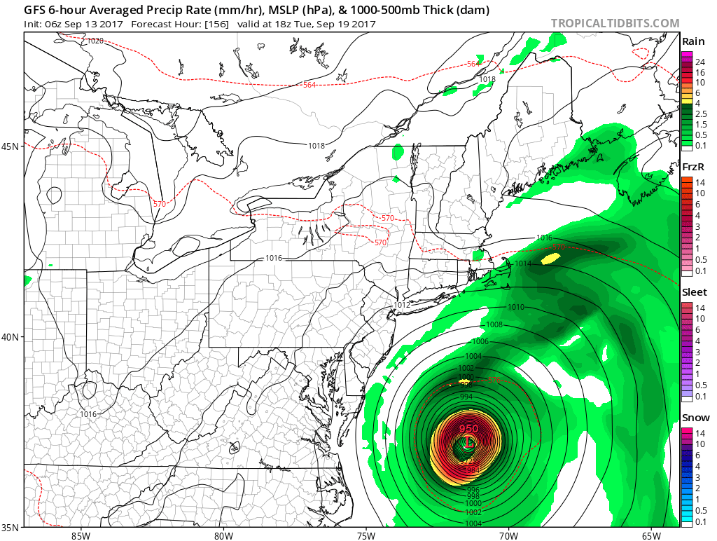

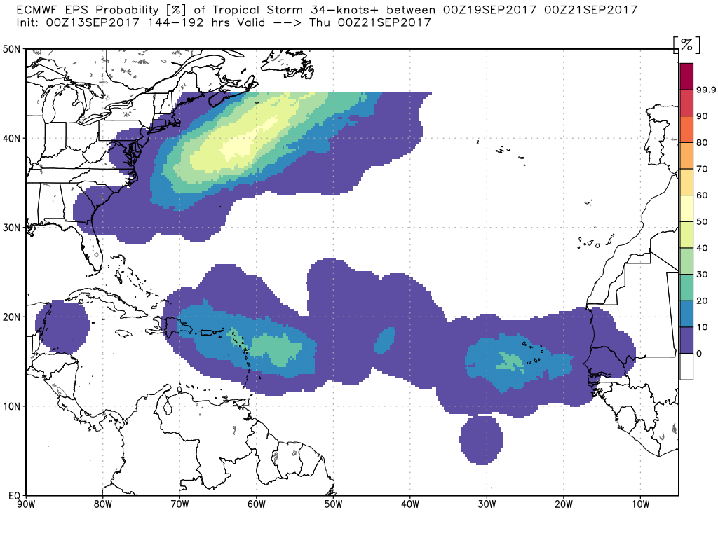
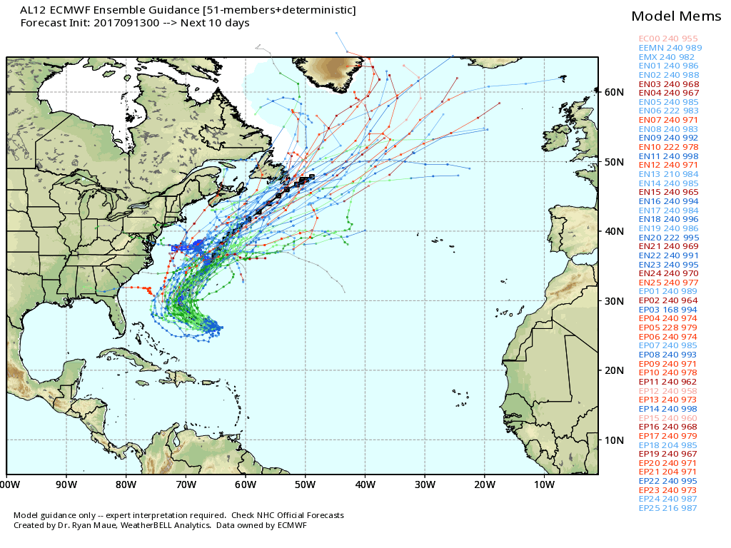
There is still some uncertainty about whether the storm will stay far enough from New England to produce no impact except for rough surf and seas. The consensus is that the storm will pass to the east of the 40/70 benchmark, but there are still a few models that want to bring it closer to the Northeast coast. It’s most likely not going to bring anything more than rough surf/seas, but I am still watching it as it completes the loop-the-loop and starts to head west-northwest. IF it were to come close to the New England coast, it would be in the middle of next week.
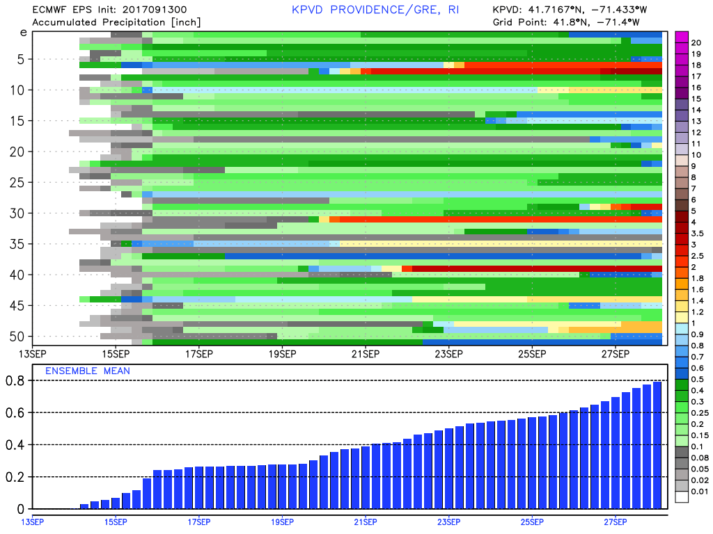
The overall weather pattern remains dry and slightly warm for this time of the year. About half of the EPS members bring less than 0.5″ of rain to the Providence area in the next 15 days. That’s less than 1/3 of what would typically fall in that time frame. Expect highs in the 70s most days in the next couple of weeks. There may be a few days where it jumps into the 80s. There is no sign of the first frost anytime soon.


