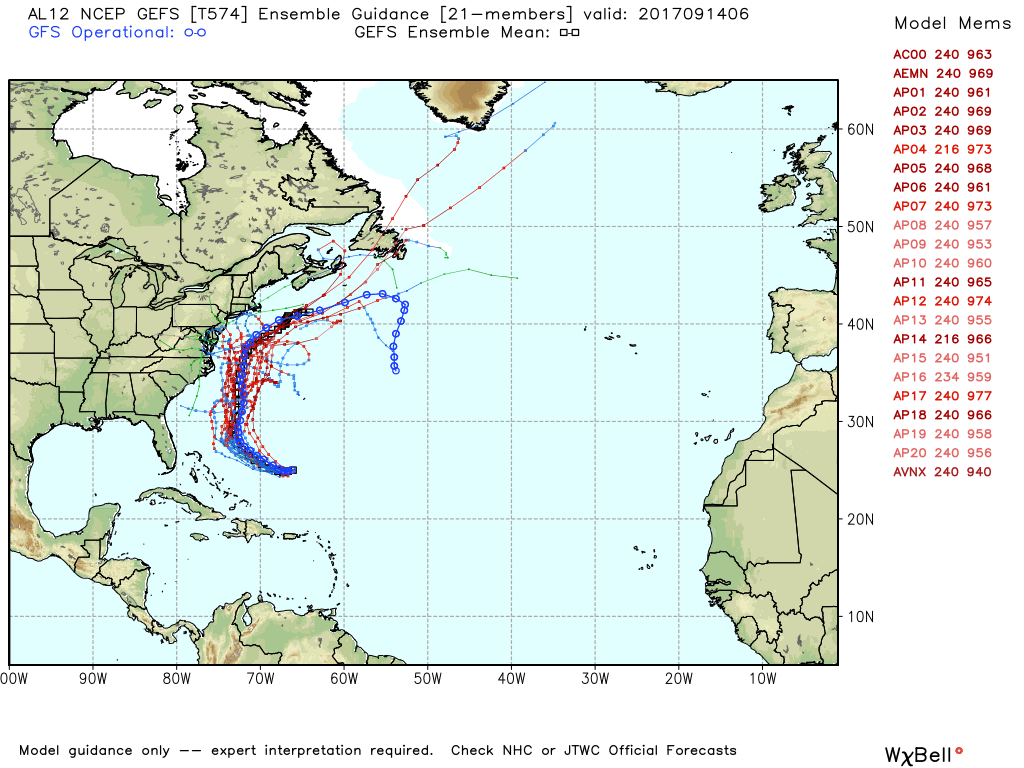
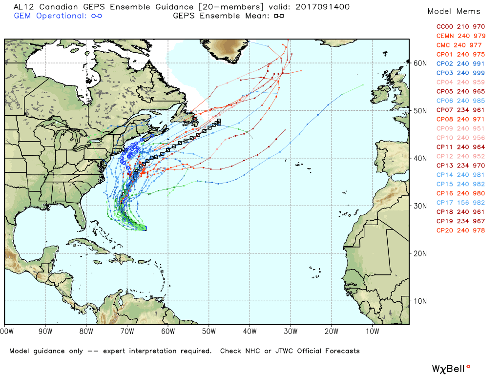
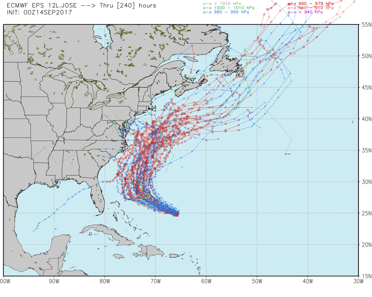
Hurricane Jose could be an issue for Southeastern New England next week as the storm moves up the Eastern Seaboard. The computer model trend is definitely west of earlier tracks, and while a direct hit from a tropical system is still unlikely in RI or SE MA, the storm may come close enough to bring more than just rough surf and high seas.

There is an increasing chance of breezy to windy conditions and some showers from the storm. It’s too early to talk specifics because of the track uncertainty, but the odds of some wind/rain from Jose are close to 50/50. A couple of days ago, I would’ve put those odds at about 10-20%. The timing of any potential wind/rain from Jose is between Tuesday and Thursday. It should also be noted that the water along the Mid-Atlantic and New England coast is cooler than normal, so the storm would likely weaken if it made it close to the coastline.
It’s still about a 5-day forecast, and there are likely to be some changes as we hone in on the exact track. Keep in mind, the forecast for Irma five days out brought it up the east coast of Florida instead of the west side of the peninsula. That, of course, made a big difference in the impacts felt throughout the state.
At this point, I would not prepare for any kind of tropical system in the middle of next week. The most likely track is still one that brings breezy/windy conditions, but not damaging wind. It will also likely send some clouds and possibly showers our way, so the temperature will be knocked back from the mid-upper 70s to the upper 60s to low 70s.