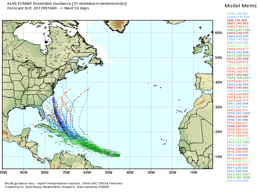
Hurricane Jose is taking a turn to the north as expected this morning. The storm may strengthen a bit in the next couple of days as it slowly moves north while paralleling the Eastern Seaboard. I still think that RI and interior SE MA will not get the brunt of the storm as it passes southeast of Nantucket in the middle of the week. Cape Cod and the Islands may get tropical storm conditions with heavy rain bands and damaging wind gusts.
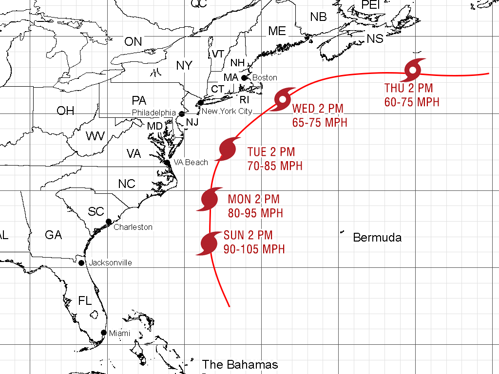

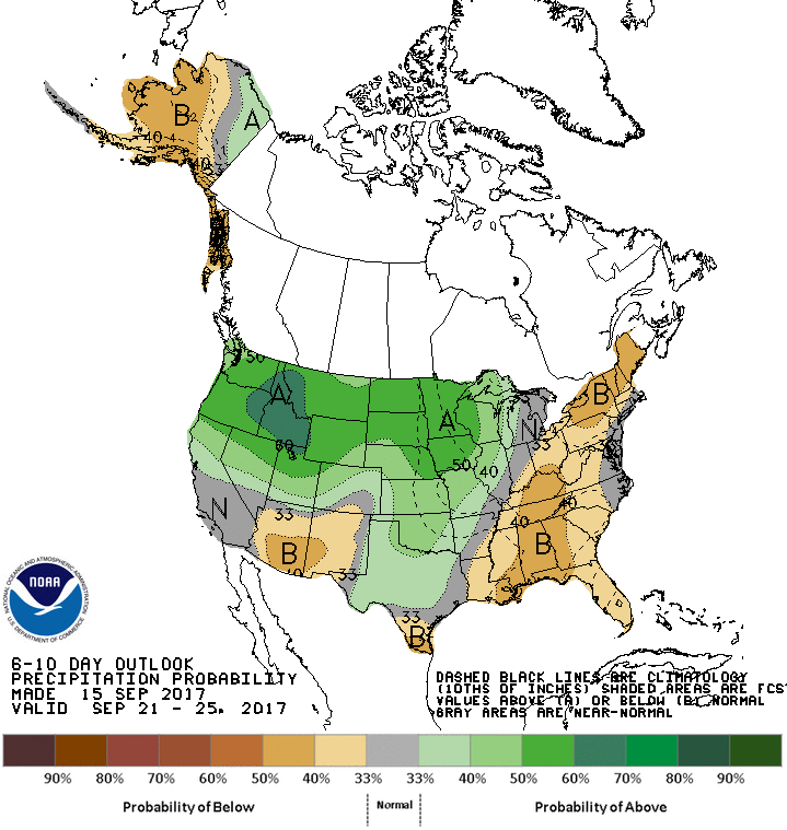
At this point, I put the over/under for peak wind gust at 60 mph for Nantucket, 55 mph for Cape Cod, 45 mph for the New Bedford and Newport areas, and 35 mph for the Providence area. 30-40 mph peak wind gusts in RI and most of SE MA would not be enough to cause damage. Rain bands could spin into RI from the storm between Monday evening and midday Wednesday, but the heaviest rain will likely stay offshore. The best bet of 2+” of rain is on Cape Cod and the islands, with less than an inch of rain likely for RI and interior SE MA. Keep in mind, it’s still 3-4 days until Jose’s closest pass by New England, and a 50 mile track shift means big changes to the weather impacts.
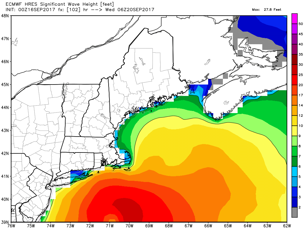
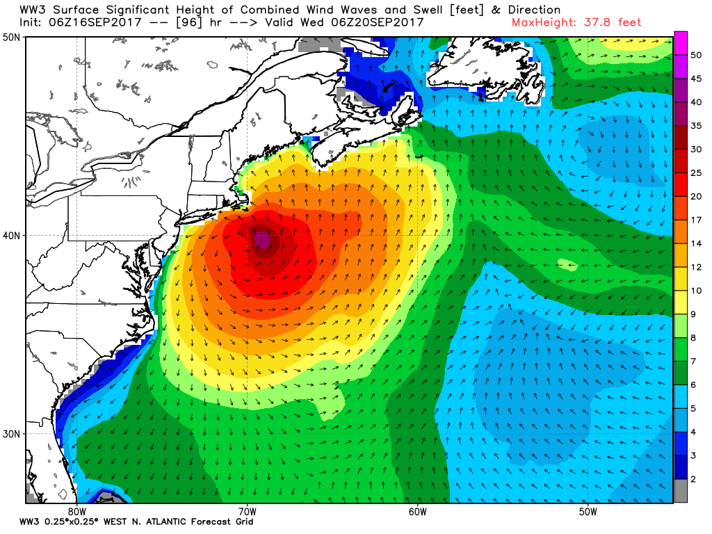
Rough surf and seas are a given when a tropical system passes by, and Jose will be no exception. There will be a few days of big breakers at the beaches this week.
There are two more tropical systems in the Atlantic. TD 14 may become Lee soon, but is still way out in the Atlantic and no threat to land at this point. The disturbance closer to the Caribbean is also developing, and should become a tropical system (either TD 15, Lee or Maria) in the next 24-36 hours. The long-range forecast for that storm brings it off the Southeastern US coast in 7-10 days. It will likely move through the Caribbean to get there, and that means insult to injury for some of the islands raked by Irma.
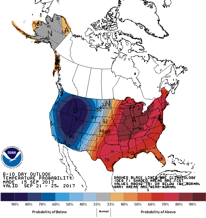
The weather pattern favors dry weather late in the workweek and through the first weekend of fall, but it will likely feel more like summer with highs possibly reaching the 80s next Saturday and Sunday.