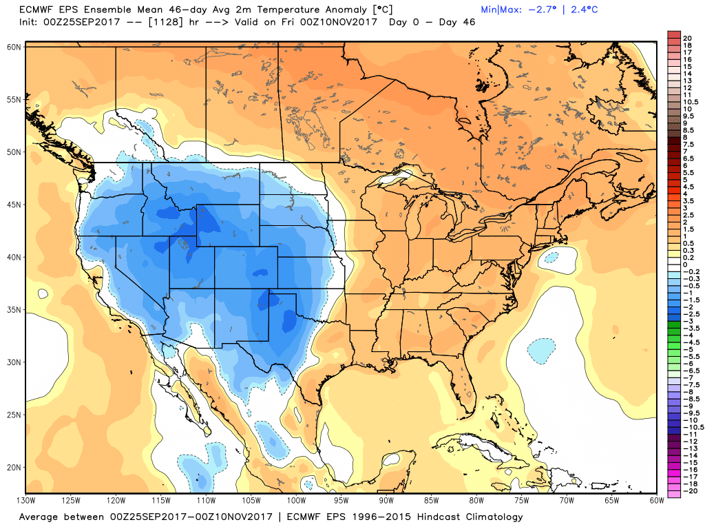
It looks like a mainly dry and relatively warm weather pattern persists into early October. The temperature will be well above normal through Thursday before it cools this weekend, but another warm-up is ahead for next week.
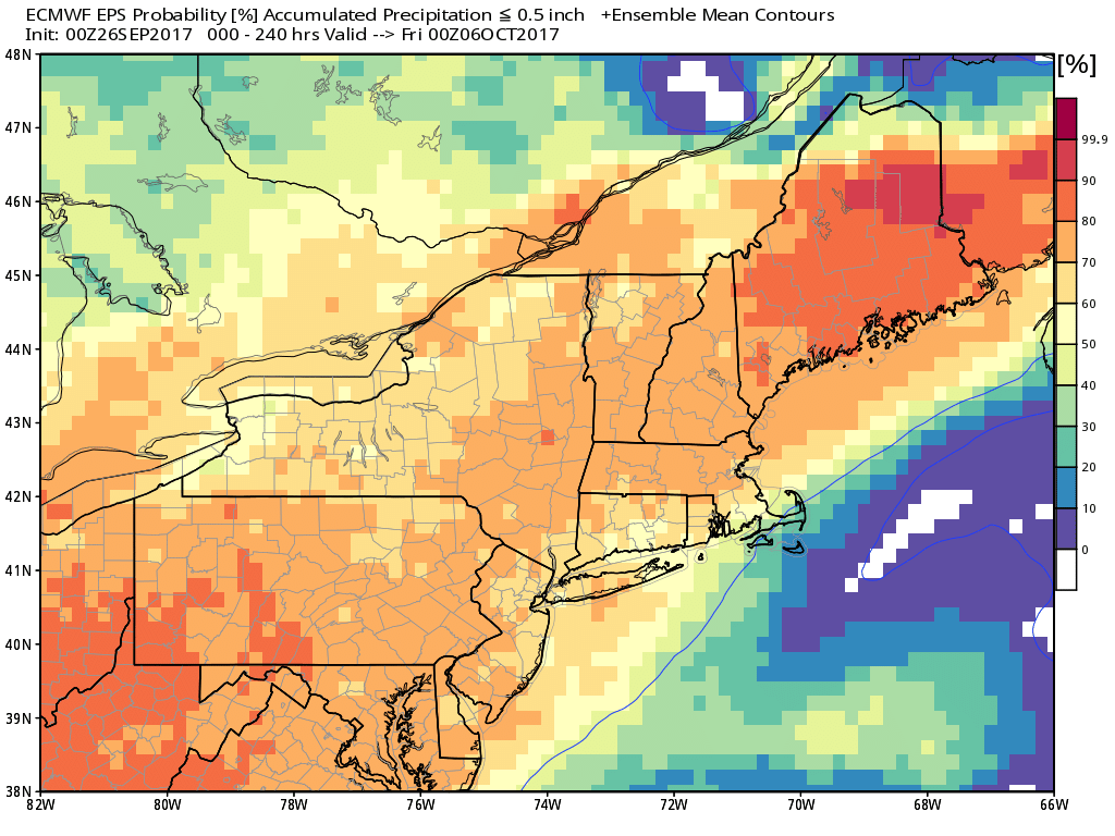
September will go in the books at 3-4° above normal in Providence, and the early signs are that October will also feature more relatively warm weather. The last three weeks of September have been mainly dry in most of RI and some of SE MA, except for Cape Cod and the islands where the rain from Jose was steadier. There is not much rain in the forecast for the next 10 days, especially if cold front coming through on Thursday morning does not interact with tropical moisture from Maria until its offshore. At this point, it looks like Cape Cod and the Islands could get heavy showers, but RI and interior SE MA may be left with mainly dry weather. I will watch the timing of that interaction in the next couple of days. For now, it’s too little, too late.
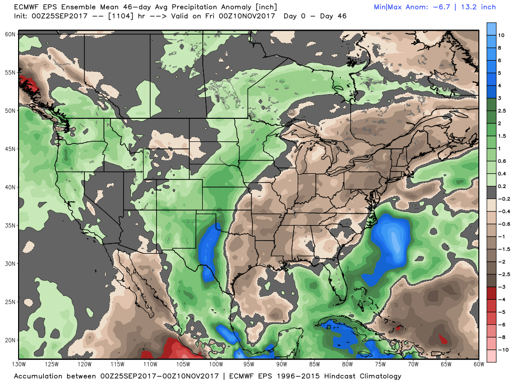
The EPS weeklies still show mostly dry and warm weather in the Northeast through October. While it’s very unlikely we will get back to the mid-upper 80s like this recent warm stretch, even the mid-upper 70s are quite warm for early October.
The tropics will briefly turn quiet later this week, but I think there’s a decent chance for something to develop in the Gulf of Mexico or Caribbean next week. If you thin September was an exceptional month for Atlantic tropical cyclones, you are correct. In fact, it set the record for monthly “accumulated cyclone energy” which is a measure of the wind energy generated by a tropical cyclone over its lifetime. There were some big in the past month.
Top 10 monthly Atlantic Accum. Cyclone Energy values for August-October. September 2017 just set the monthly ACE record. pic.twitter.com/XhgaaVvLxk
— Philip Klotzbach (@philklotzbach) September 25, 2017


