September 2017 will likely go in the books as among the five warmest on record in the Providence, RI area. The average temperature of 68.7° through September 26th puts it as tied for 4th warmest with a few days to go. The average temperature will rise after Wednesday’s warmth, and then fall a bit in the next few days. It should stay high enough to hold the fifth spot by the end of the month.
1983 – 69.6°
2015 – 69.1°
1961 – 69.0°
1971 – 68.7°
2017 – 68.7° (through 9/26)
1930 – 68.3° (also 1945, 2005, 2016)


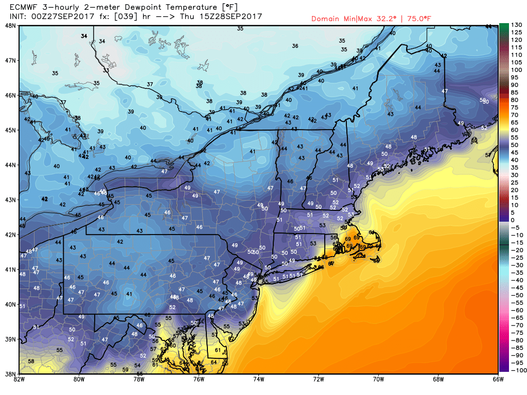
The summer-like humidity moves out Thursday morning as a front passes. It’s a close call between getting no rain in RI and most of SE MA, and getting torrential downpours as the front interacts with tropical rain from Maria. The European model shows heavy rain for Cape Cod and the islands, but very little once you get just off the coast of RI and Buzzards Bay. The new 3km NAM model has basically no rain for the entire area as the interaction between the front and the tropical system happens just offshore. I will watch it Wednesday evening for any changes. At this point, I’m inclined to side with the 3km NAM and the too little, too late solution for steady rain.
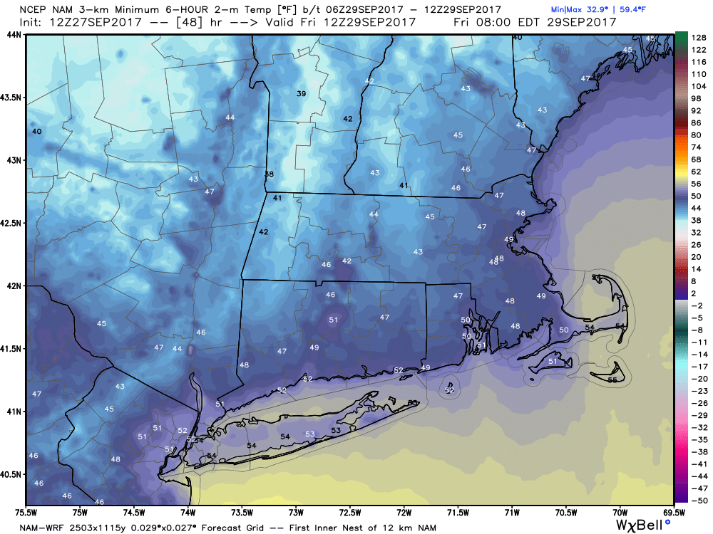
It will feel more like fall this weekend. Saturday may be unsettled with passing showers and temps in the 50s to low 60s. We’ll get back to bright sunshine on Sunday, and highs will be 65-70. Another warm-up is likely next week. It looks like temperatures will bounce back into the 70s in the midweek as a mainly dry weather pattern continues. There is no sign of the first frost in RI or SE MA in the next couple of weeks.


