September 28th Update
Abnormally dry conditions developing; Warm first week of October
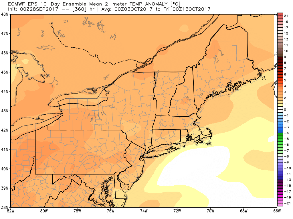
Don’t take out the A/C units yet! There will be a brief cool-down in Southeastern New England this weekend, but it’s not staying around. Expect a warm-up next week, and record highs could be challenged on before or during Columbus Day weekend.
Highs will likely reach the 80s inland sometime between the middle of next week and the end of the weekend. Expect cooler breezes near the coast, but it will still be warmer than normal.
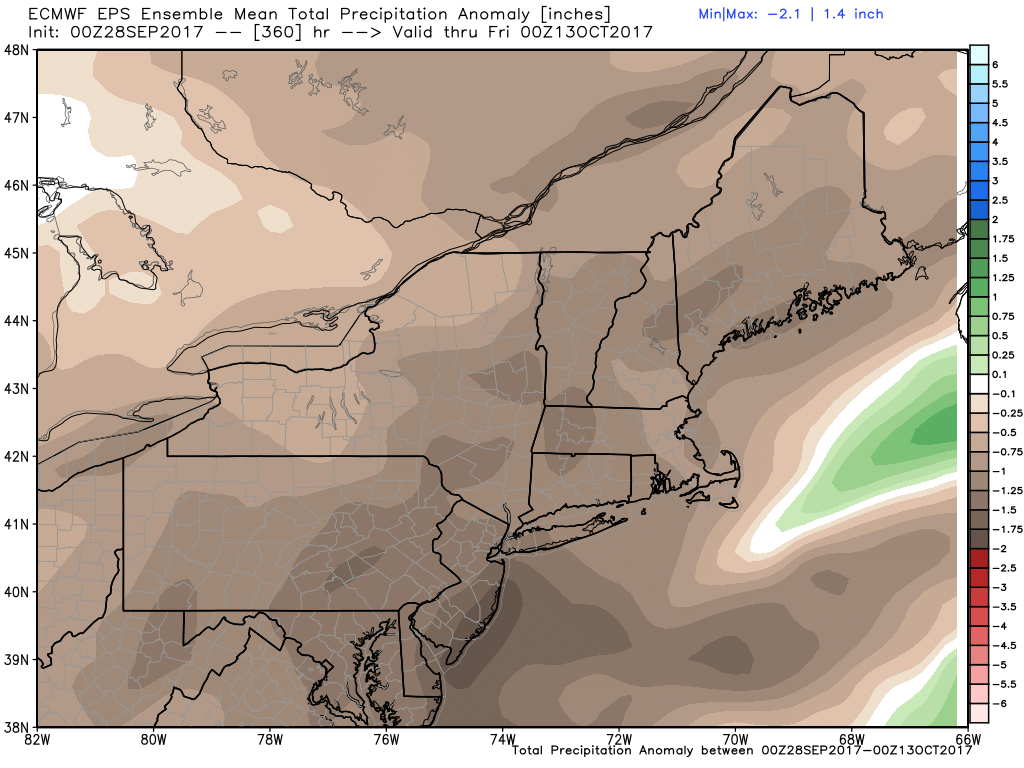
The only shot for rain is on Saturday. Some models are indicating there could be heavy downpours, but they may be localized. Right now, it looks like the best bet for more than 0.25″ of rain is in S RI. September has been very dry for all but Cape Cod and the islands, and the dry pattern dates back to mid-summer. The map below shows the percentage of normal rain since Aug 1, and it’s 50% or less for RI.
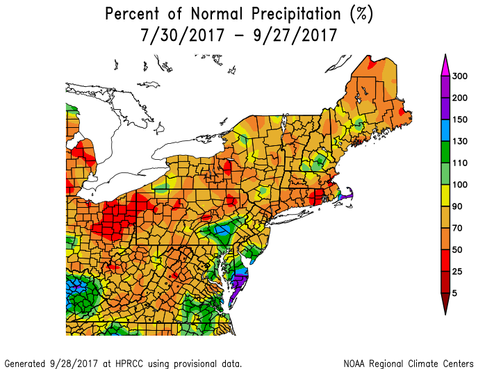
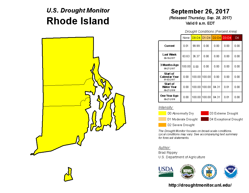
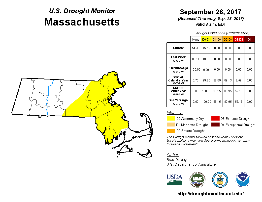
Abnormally dry conditions have developed in all of RI, and the next step is a moderate drought. It would not surprise me if part of SNE is in a moderate drought by mid-October based on the persistent dry pattern for the next 10-14 days.