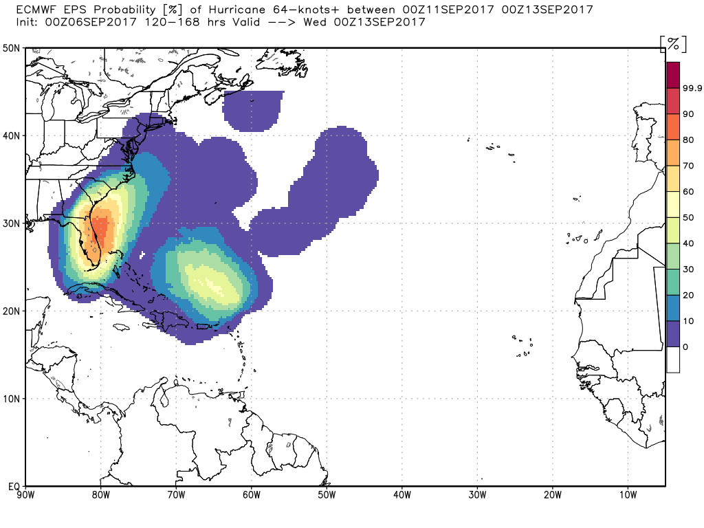
As of 11 AM Wednesday, Hurricane Irma has been a Category 5 storm for more than 24 hours, and the latest update from the National Hurricane Center keeps it as a Category 5 for another 48 hours.
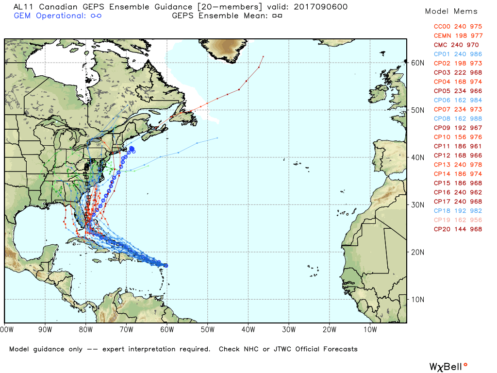
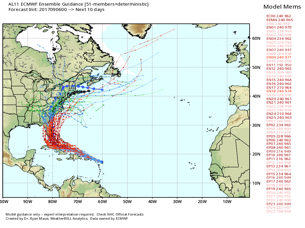
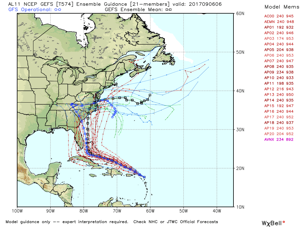
The computer model consensus is shifting a bit east of where it was yesterday, and that means a greater threat to the eastern half of Florida, and then GA/SC/NC. As for Southeastern New England, the weather pattern is not favorable for the storm to move due north up the Eastern Seaboard. It will likely either be forced into the Southeastern United States before reaching New England in a much-weakened state with rain and a gusty breeze or it will be turned out to sea and pass east of New England with some wind/rain possible, but nothing too severe. There is still a slight chance that the weather pattern changes enough to allow the storm to move up the Eastern Seaboard somewhat intact, but that is not what we are projecting at this time.