AnalysisRight Weather Pro

September 7th Update

Quiet again in New England - Irma blasts Caribbean islands

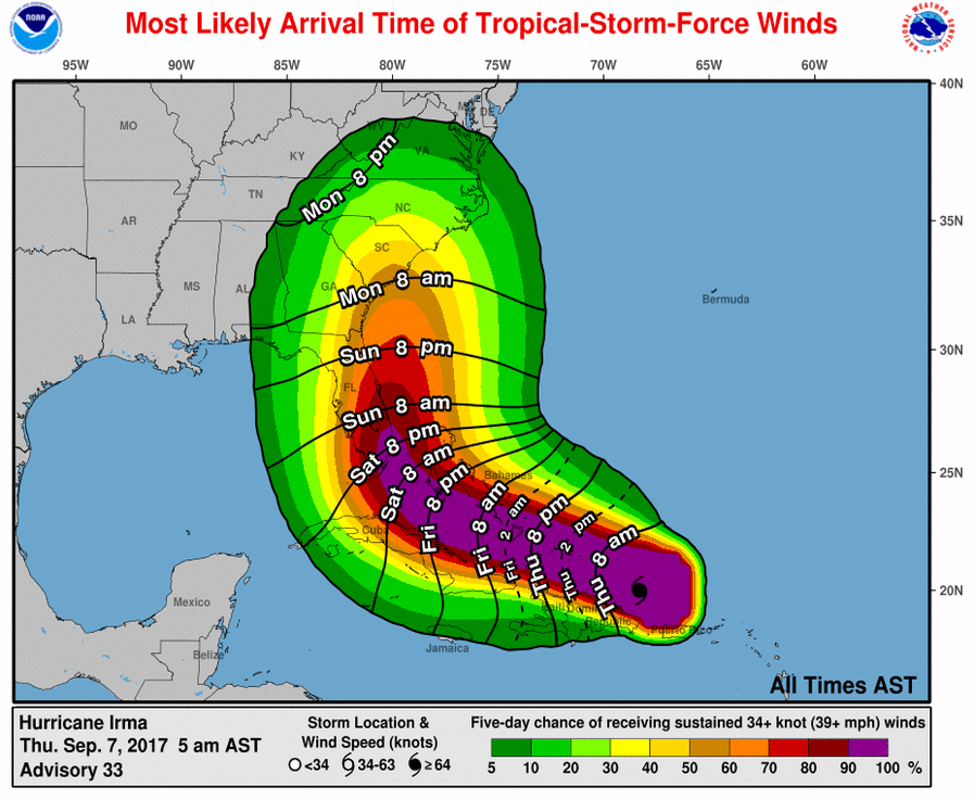
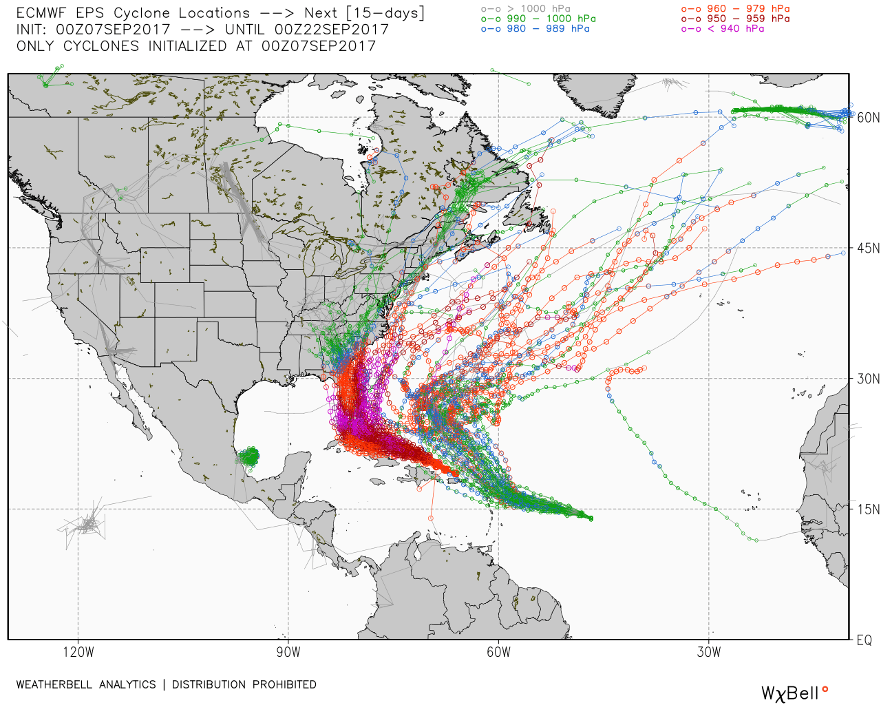
Heavy overnight rain has moved offshore of Southeastern New England this morning. Today begins a long stretch of relatively quiet weather that may last right through the middle of next week. Of course, a lot hinges on what happens with Hurricane Irma, but the long-range forecast takes it into the Southeastern United States, with little impact around here.

European pull Irma into the Tennessee Valley and weakens it to the point where there are no showers left to come into New England next week

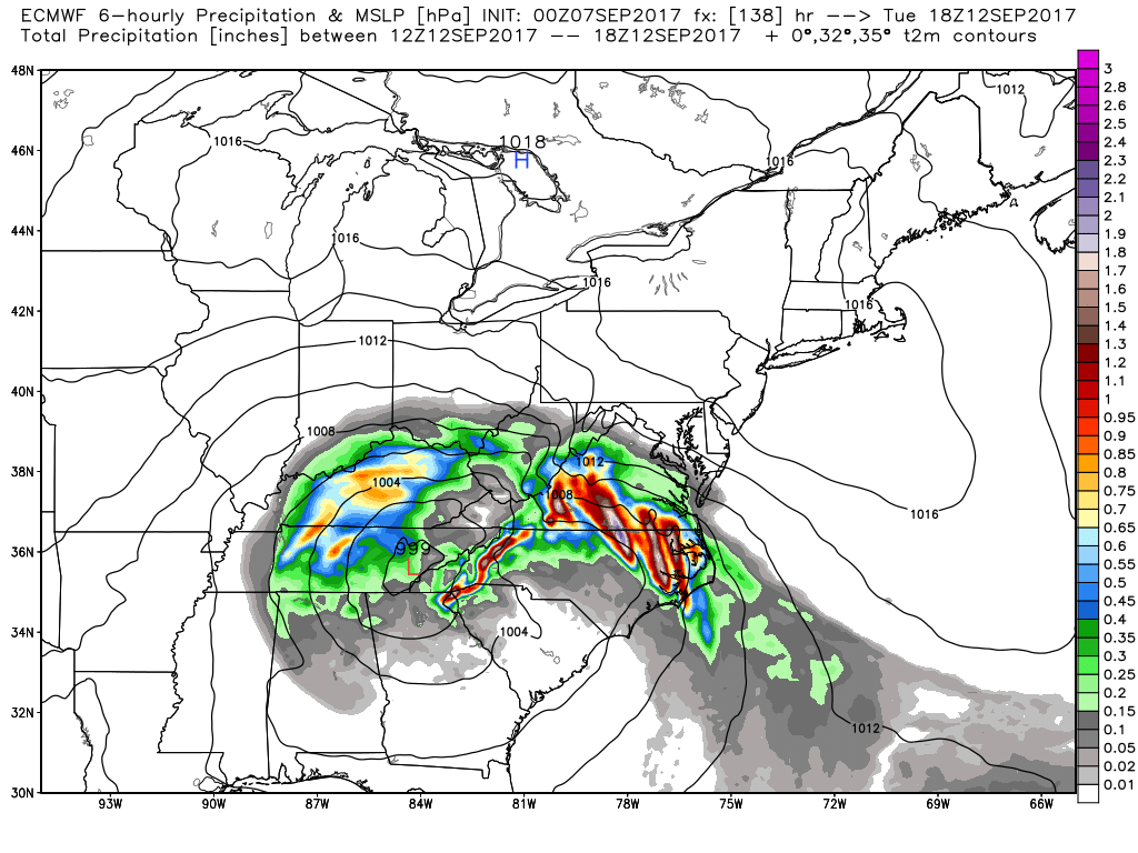
Expect highs in the low 70s and lows in the 50s through the weekend and into, at least, early next week. If Irma moves inland into GA/SC, then it will weaken considerably, as the strong ridge of high pressure to the north keeps it away from New England. Eventually, what’s left of it may head our way, but it will likely not be more than some rain at that point.

Warm water temperatures are favorable for Irma to keep up intensity or strengthen as it nears Florida, but there may be some wind shear to offset the bath water.
Hires GOES-16 showing the Cat 5 storm on Thursday morning. It maintained 185 mph winds for longer (35 hours) than any tropical cyclone on the planet in recorded history.
EPS model shows possible tracks for all three hurricanes. Irma mainly into FL and SE US, with 1-2 out of 50 threatening New England. Jose meanders around but mainly out to sea. Katia affects Mexico

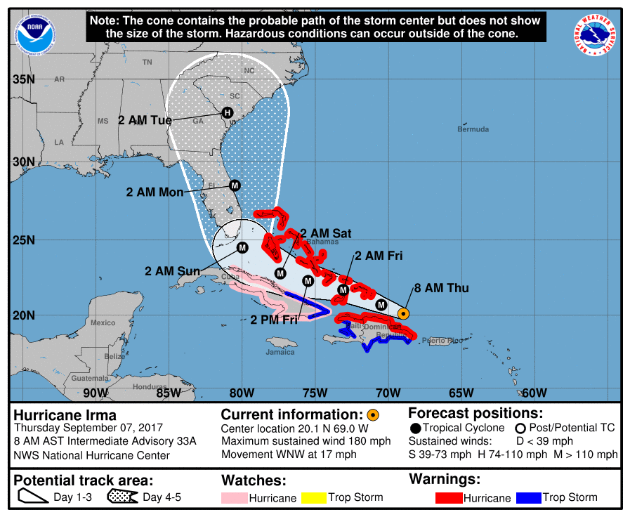
Official forecasts as of 9 am Thursday from the National Hurricane Center

The exact track is critical for south Florida. Slightly east of the peninsula would spare it the worst. If the eye passes over Miami, Ft. Lauderdale, etc., the damage could be devastating.

Fred Campagna

President and Chief Meteorologist - Right Weather LLC AMS Certified Consulting Meteorologist #756 AMS Certified Broadcast Meteorologist #126

Related Articles

Back to top button