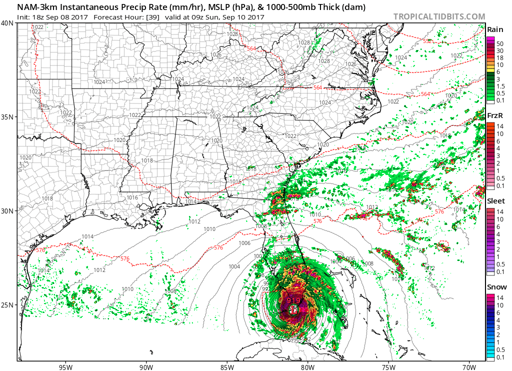
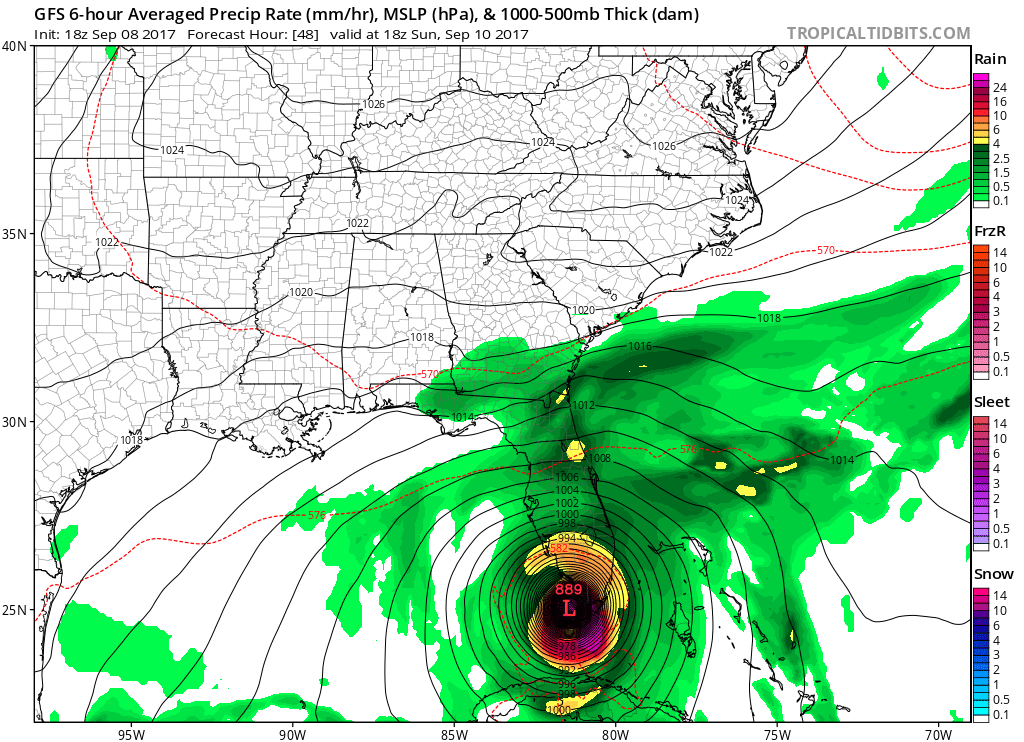
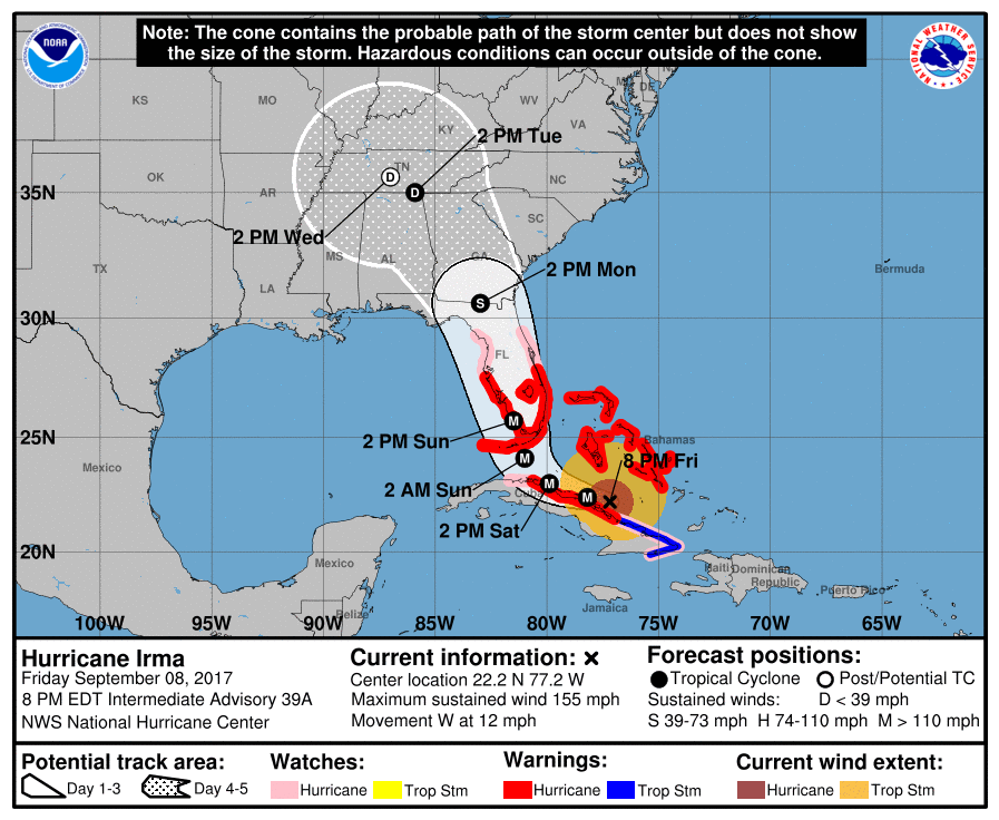
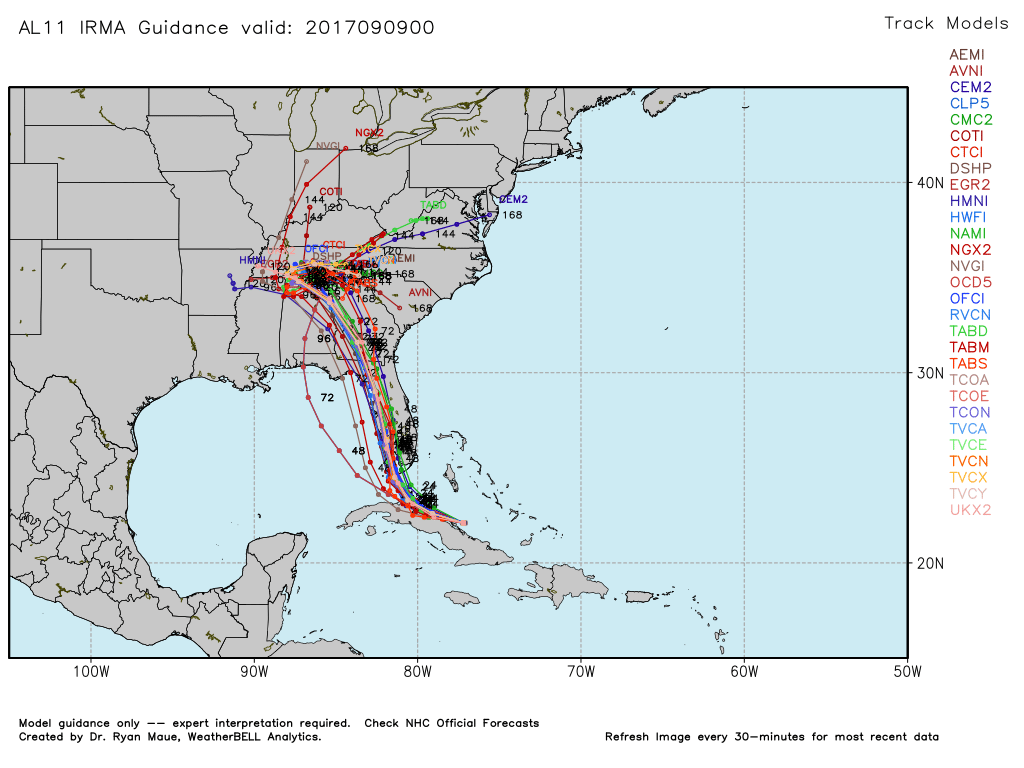
Irma, once one of the strongest Atlantic hurricanes on record, is zeroing in on a direct hit for part of Florida. The storm weakened to category 4 on Friday, but it may regain winds of 160 mph and category 5 strength as it nears southwest Florida this weekend. The entire state will have some impact from this large and destructive hurricane, with the worst weather possible between Miami and Naples based on the latest consensus track.
It has been nearly 12 years since a major hurricane has made landfall in the United States. Wilma hit Florida in October 2005 as a category 3. Irma may well be stronger than that if/when it makes landfall this weekend. See the graphics below for the latest on this impressive storm.
Irma will weaken over the Southeastern United States and what’s left of the storm could bring a few showers to Southeastern New England in the midweek. At this point, I would not be surprised if it stayed dry because the high pressure that is forcing the storm’s path into the Southeastern United States will hang around for several days in the Northeast.