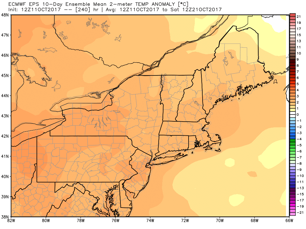
The first third of October has been incredibly warm. The temperature in Providence is averaging 8.8° warmer than normal through Wednesday. There have been seven straight days with temperatures at least 10° above normal. During that stretch, the temperature averaged a whopping 14° above normal!
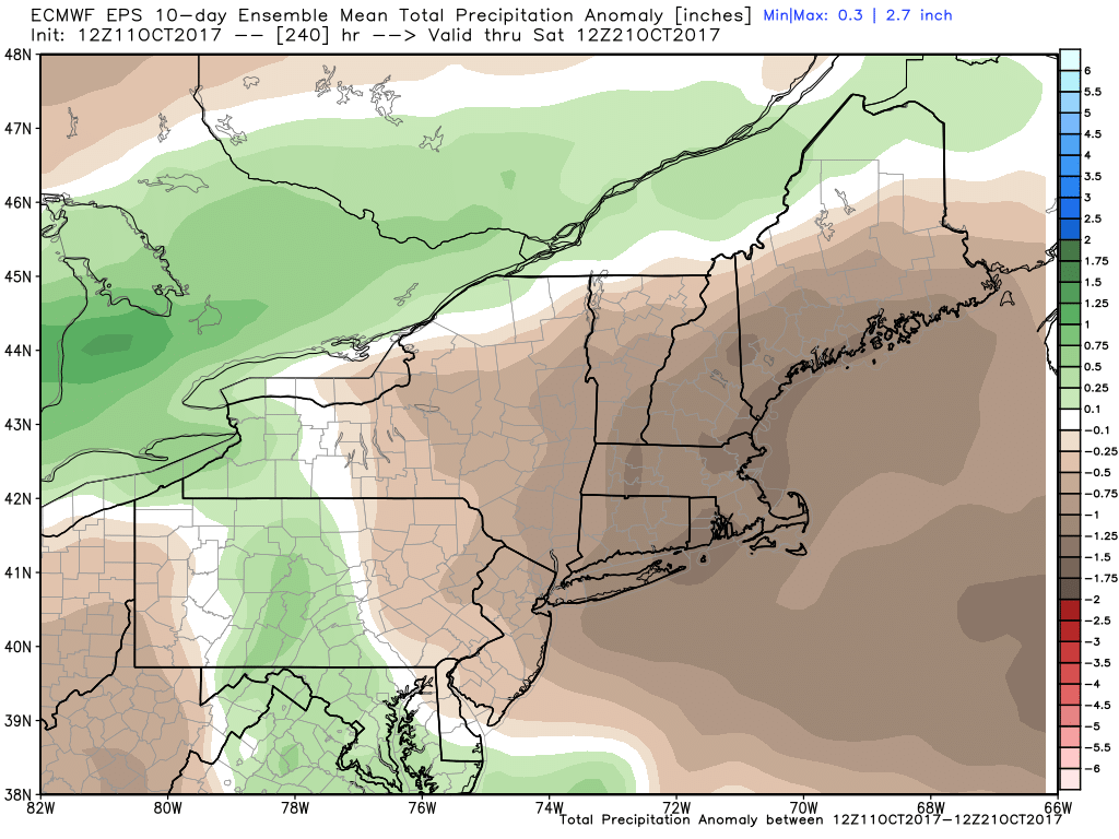
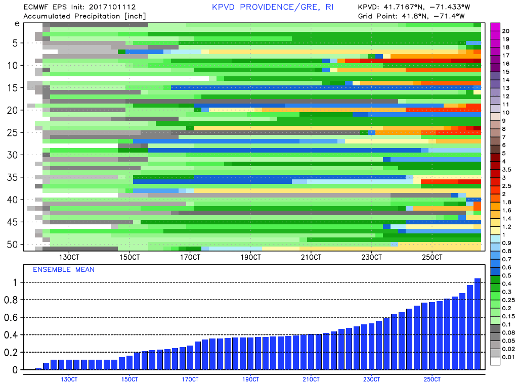
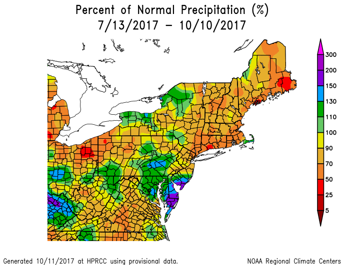
It has also been quite dry, without much rain from the remnants of Nate. There is a pronounced rainfall deficit in Southern New England over the past two months. That deficit will likely grow in the next 10 days. Just a few showers are likely Wednesday night as a disturbance is shunted off to the south by an area of high pressure arriving from the northeast. Expect increasing sunshine on Thursday with an east-northeast breeze, and highs in the low 60s – just about normal for mid-October.
Dry weather is likely again on Friday before a gradual warm-up this weekend. The weekend forecast is tricky because the front that moves through Wednesday night will linger to our south, and may come back with some showers either Saturday or Sunday. The timing is uncertain, and that make the weekend forecast challenging. I expect some clouds both days, with a better chance of a few showers on Saturday. Highs will be in the 70s both days – warm again!
The long-range forecast favors dry weather for most or all of next workweek. A cool shot arrives in the early to middle part of the week, but quickly eases to above normal temperatures by next Thursday and Friday.