October 25th Update
More rain Wed and Thu; Possible tropical connection with next storm this weekend
Rain continues, heaviest in Eastern Massachusetts, through the day on Wednesday. Most of RI will see about a half-inch of rain by sunset. SE MA could see 1-3″, with the highest totals likely on Cape Cod and the Nantucket. The best chance of t-storms is in far E MA.
The storm system lingers nearby on Thursday, and more showers are possible, especially in the morning. Final rain totals from Tue-Thu are likely to be between 1-2.5″ in RI and 2-4″ in most of SE MA.
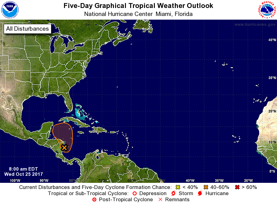
Quiet weather is likely Friday and Saturday. Expect highs near 60 on Friday, and in the mid 60s on Saturday. The weather will gradually go downhill on Sunday as clouds increase. More rain and wind is likely Sunday night into Monday. While the storm current storm has a very deep connection to tropical moisture all the way down to near the Yucatan Peninsula, the next system late in the weekend may scoop up a tropical or sub-tropical storm and ride it up the Eastern Seaboard. Both the GFS and Euro models show this small system (Philippe?) getting drawn north and enhancing rainfall as the front moves through Sunday night into Monday.
Part of Connecticut was hit hard with more than 4″ of rain on Tuesday, and if the Sunday PM – Monday AM system has a tropical component, another few inches of rain are possible. That would lead to a very wet stretch of weather in the past week, and possibly river and stream flooding in that part of SNE. Rhode Island looks like it will be spared from more than 2″ of rain from this first storm, so the ground is not quite as saturated. We’ll see what happens today in E MA, but some of those towns could see 3-4″ of rain from this first storm, and they’d be more vulnerable to flooding from a second heavy rain storm later in the week.
It’s early, but “potential Philippe” looks small, but could contain some strong winds near the center. This is a long way down the road, and we’ll see how it evolves. After a quiet stretch, the weather is action is picking up!