October 26th Update
Nice Friday-Saturday; Heavy rain and strong wind potential by late Sunday
The bothersome storm bringing its third straight day of dreary weather will finally move away from New England Thursday night. You can expect fine weather Friday and Saturday before we turn our attention to a dynamic storm heading for New England late in the weekend.
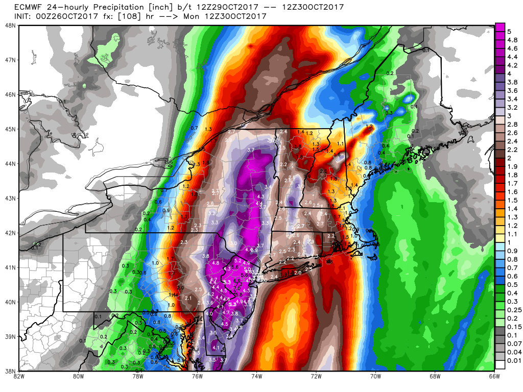
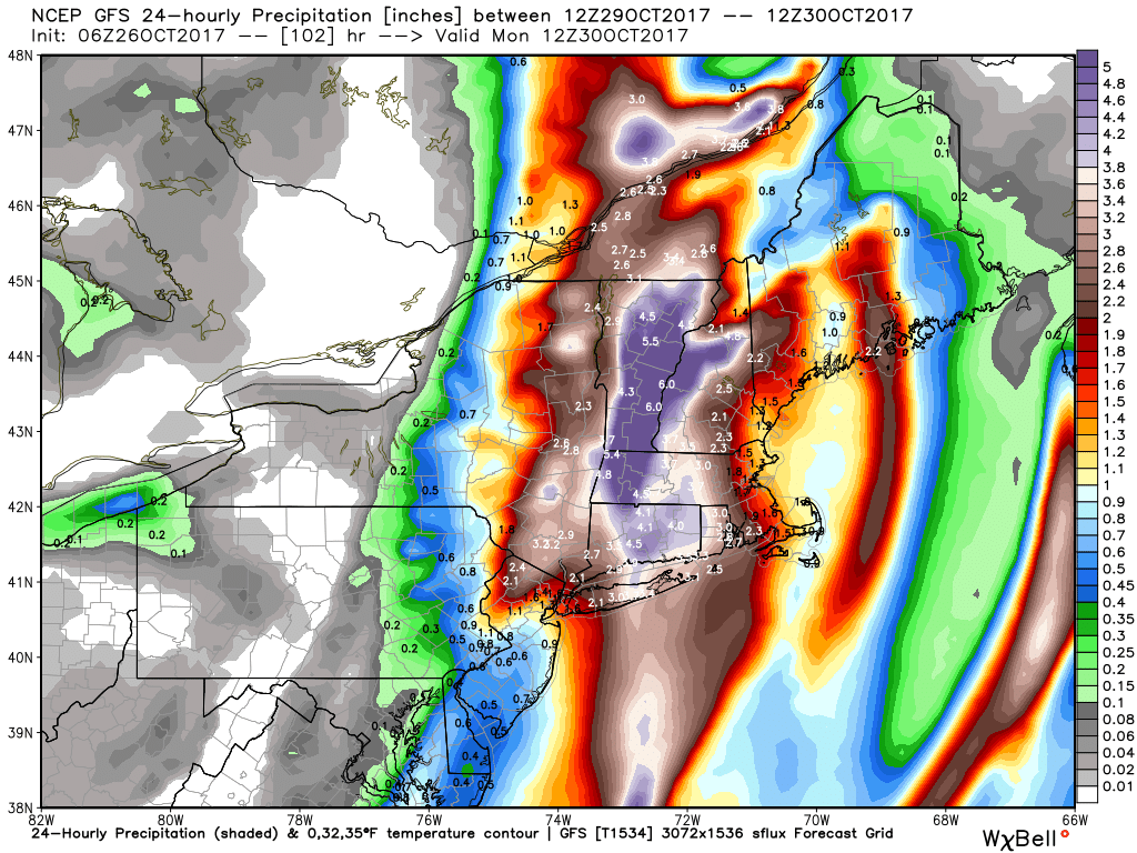
An approaching cold front will scoop up one (two?) disturbances with tropical origins and bring a heavy rain and strong wind threat to the Northeastern United States. The details are vague about who will get the heaviest rain and strongest winds, but the potential exists for several inches of rain and damaging winds in the hardest hit areas. It’s unlikely the heaviest rain and strongest winds will happen in the same areas. At this point, it looks to me like the highest likelihood of 3-6″ of rain is in western New England and the Hudson Valley of NY. The strongest wind potential is along the coast of RI and SE MA, particularly Cape Cod and the islands.
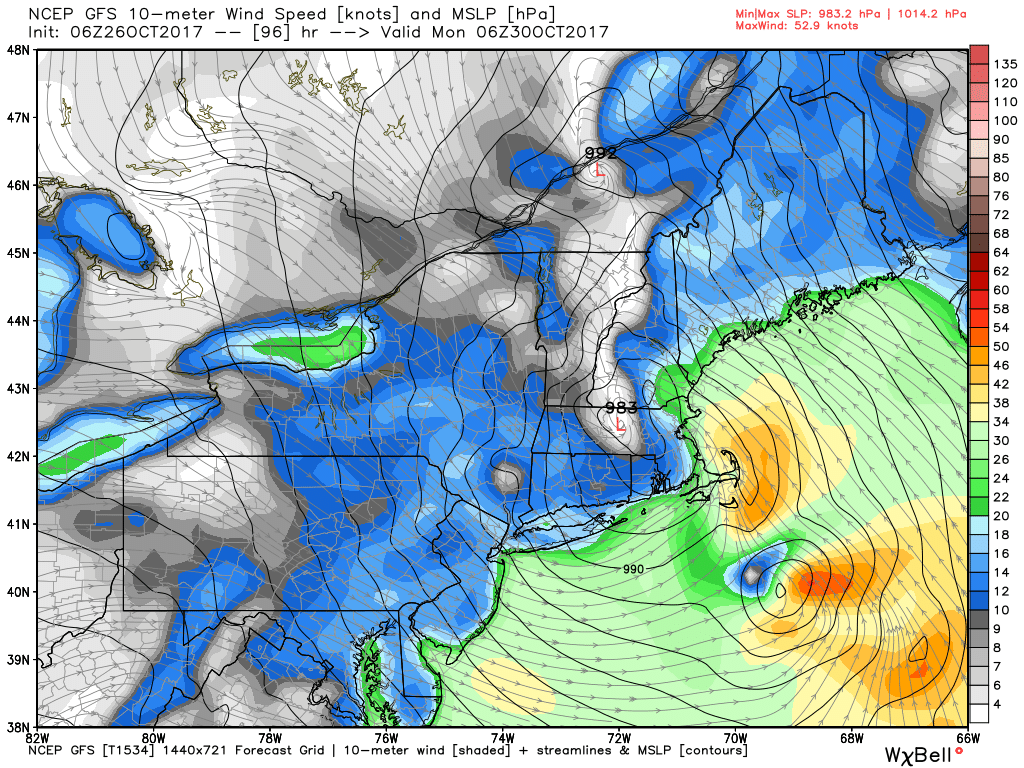
The European model is predicting hurricane-force wind gust potential, but the GFS is closer to tropical storm winds. I’m not willing to discard any scenario until we get a better idea about how organized the tropical or sub-tropical system will be once it gets off the Southeast US coast. That does not happen until late Saturday into early Sunday. It will be shot north by very strong jet stream winds with the cold front moving in from the west. It looks like a dynamic scenario to me. I would not be surprised if it carried a core of very strong winds, but questions remain about whether the storm center will travel along the coast or offshore.
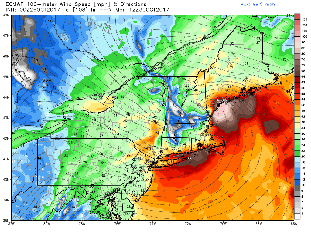
Based on what I know so far, I’d prepare for another 1-3″ of rain in RI and SE MA, and the potential for 50+ mph wind gusts. The timing is late Sunday into early Monday, with the brunt of it between sunset and sunrise. It’s a fast-moving system, and the weather should improve by late Monday, with quiet and seasonably cool weather following for Halloween through the midweek.


