November ends with a very quiet weather pattern in Southeastern New England. Expect some ups and downs temperature-wise this week, with the warmest weather on Wednesday when it gets into the 50s. The other days will be in the 40s. A disturbance moves through Friday morning with some rain showers before dry weather returns in the afternoon and continues through the weekend. The first weekend of December will be dry and seasonable – great weather for putting out Christmas decorations.
It will likely stay relatively quiet through early next week before rain threatens in the midweek. I expect a change to a colder and more active pattern after about December 7th. This could be the first December since 2013 with more than 6″ of snow in the Providence area. The pattern will most likely be ripe for some wintry weather through Christmas, but whether it actually comes together is always questionable.
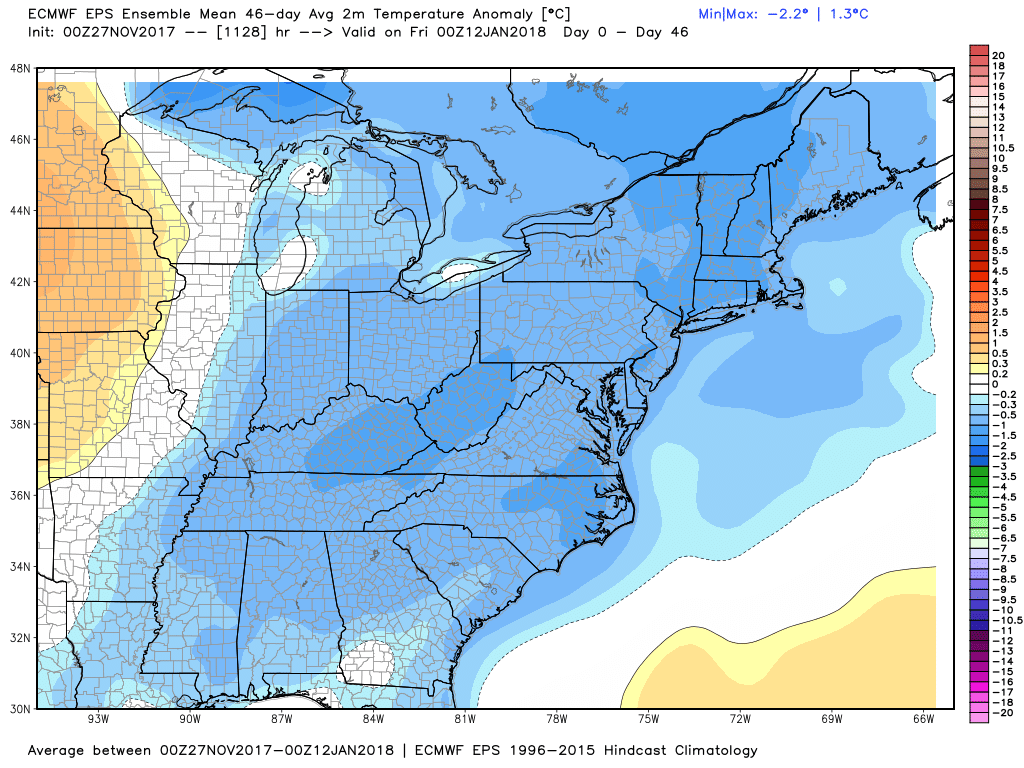
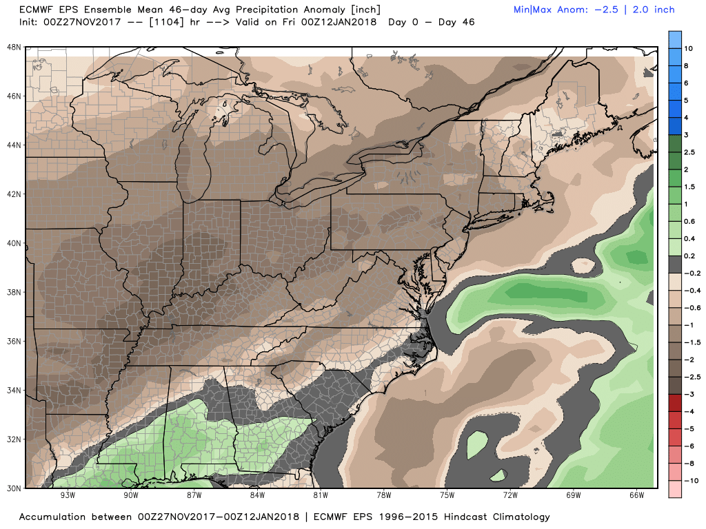
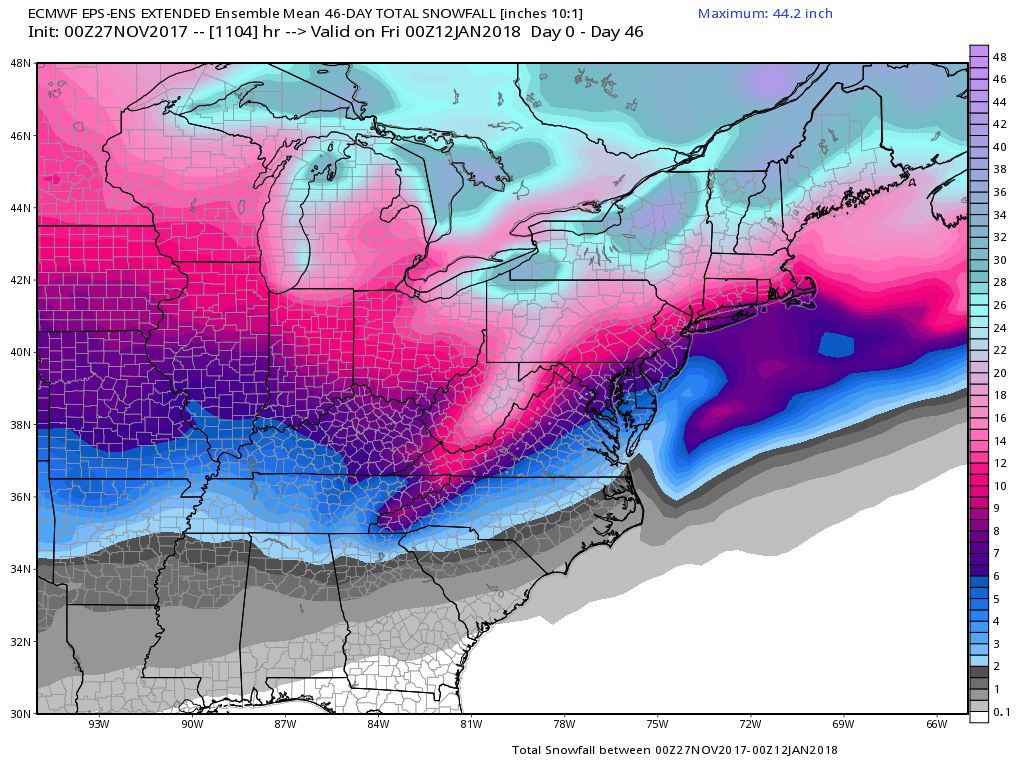
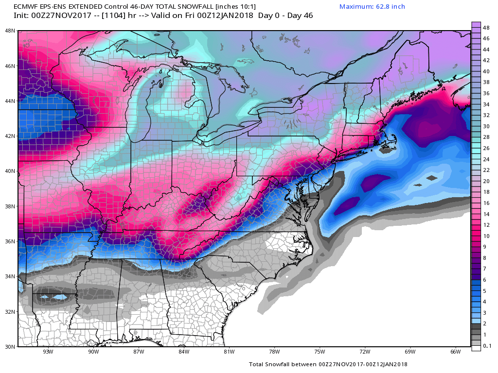
The long-ranger European model is advertising a relatively dry, but chilly weather pattern through the first week of January. The ensemble mean has a healthy amount of snow in Southern New England over the next six weeks.