You have to make hay while the sun shines. In this case, the sun is Arctic cold, and the hay is snow. It looks like a very cold weather pattern will evolve in the next week, and stay around for a while, giving ample opportunity for snow in Southeastern New England. A weak storm system coming through Friday night will bring mainly rain to RI and SE MA. A bit of freezing rain is possible in N RI, but I do not expect it to be a problem in the I-95 corridor. The temperature on Friday morning is a few degrees warmer than projected in the Providence area.
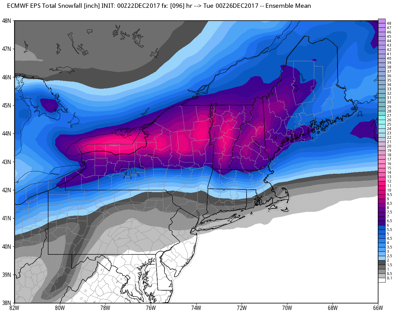
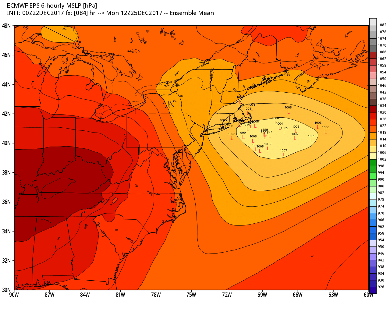
Saturday looks showery and eventually warmer, with temps climbing from the 30s to the upper 40s/low50s by late in the day. The shower threat ends overnight. Expect dry skies during the day on Sunday. It will be seasonably mild, with highs in the low 40s. A storm system passing by Christmas eve into Monday morning brings the threat of mainly light snow/rain to RI and SE MA. The best bet for a white Christmas is north of a Providence to Plymouth line. The track of the fast-moving system is important because there is not a lot of cold air around. An early estimate is 0-2″ south of I-95, and 2-5″ from north of Providence to Worcester.
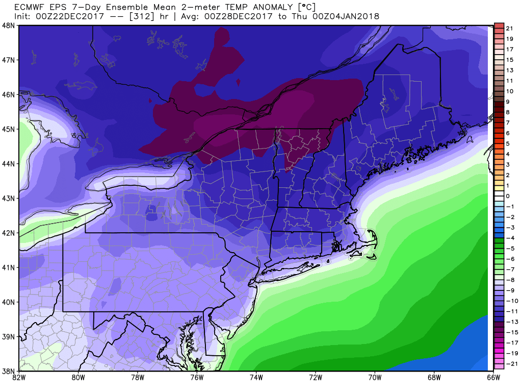
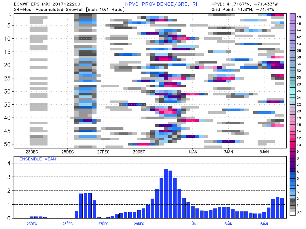
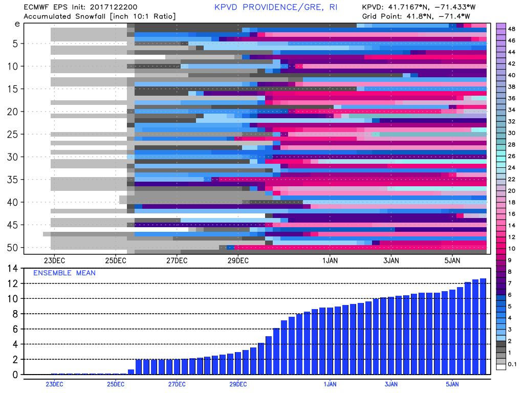
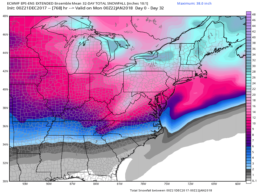
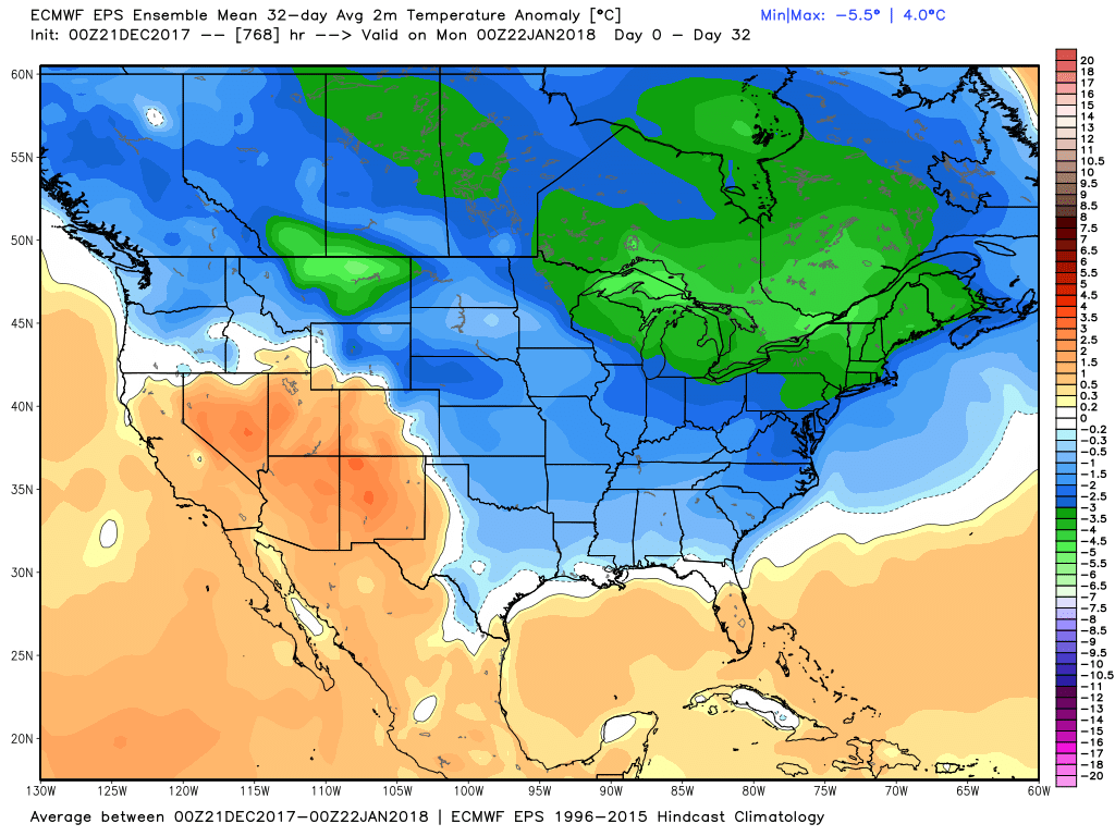
Very cold air gradually moves in next week, and the stage is set for a potential winter storm sometime between December 28 and January 1. There may even be multiple systems to deal with. The temperature looks frigid, even for late December. The relatively cold pattern continues into the New Year. The new Euro weeklies suggest a January thaw by mid-month.