We are heading for another weekend warm-up. Look for temperatures to reach the 40s both Saturday and Sunday. The best chance of rain this weekend is late Saturday night through Sunday morning. Skies will be dry Sunday afternoon. If the sun breaks through on Sunday, which is an iffy proposition, the temperature may reach the low 50s with a light westerly wind.
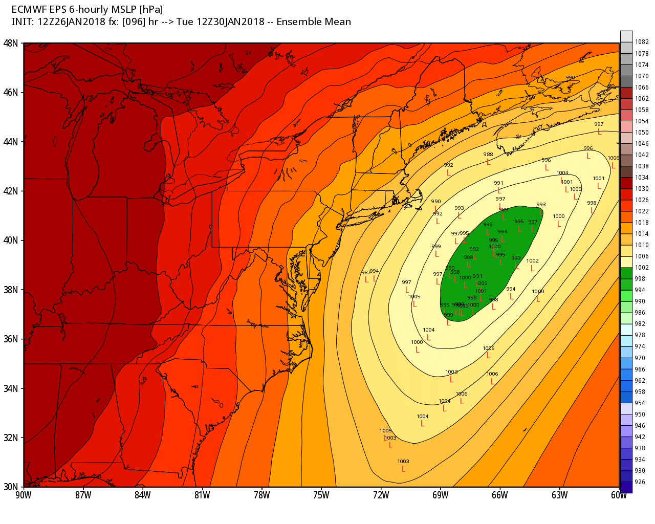
The wind shifts to the northeast on Monday as a storm moves east of New England in the Atlantic Ocean. It looks dry through the day with highs near 40. That system may come close enough to bring snow to RI and SE MA Monday night into Tuesday. At this point, there’s about a 50-70% chance of 1″ snow, and a 25-35% chance of 3″ of snow. There’s also a disturbance to our west that could bring snow showers if the main area of snow with the ocean storm misses Southeastern New England.
Look for a chill in the middle of the week, but it will not last for long. The temperature moderates on Thursday, before another storm threatens by late in the workweek, with rain or snow possible
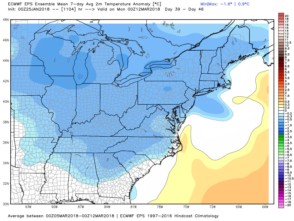
Thursday night into Friday. Next Friday is Groundhog Day, and if Phil does not see his shadow, he could be in trouble. Very cold weather will move into central Canada and possibly the Northern Plains and Rockies early in February. There are strong signs that the cold will move east as February progresses. It may not be as brutal as the stretch we had earlier this winter, but a trend to colder weather is likely in late February and early March. So much for an early spring!
Long-range temperature forecasting is easier than projecting how much snow/rain we’ll see for the rest of the winter. At this point, given the temperature outlook for the next six weeks, I think it’s reasonable to expect at least the normal amount of snow for the rest of the winter. The Providence area typically sees about 16″ of snow from today through the end of the season.