February 2018 is well on its way to reaching the top 10 warmest and possibly top 10 wettest on record in the Providence area. The average temperature after reaching 63° on Tuesday is 36.8°. That now sits at the fourth warmest on record. It will go up on Wednesday before seasonable weather returns from Thursday through the end of the month. Even with a normal or slightly cool finish, there is likely enough warmth in the bank to keep February 2018 in the top 10 warmest.
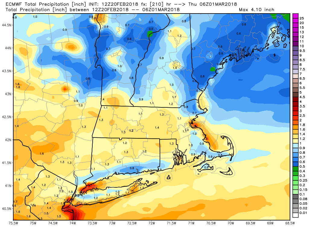
There has been a lot of rain this month. Through February 20th, 4.17″ of rain has fallen at TF Green. That’s 127% of the normal amount for the month. It’s not close to the top 10 wettest on record, but there are still 8 days left in the month, and the pattern looks fairly active. The European computer model predicts about 1″ of rain in the next 8 days. That would be enough to get this month up to around 10th highest on the list.
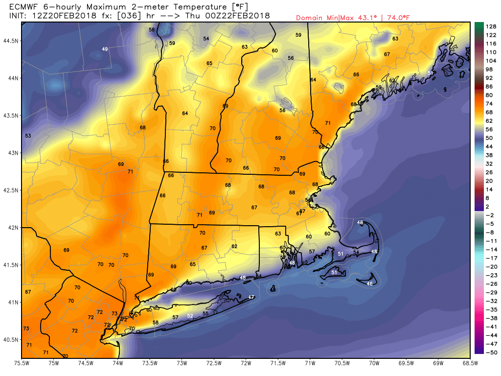
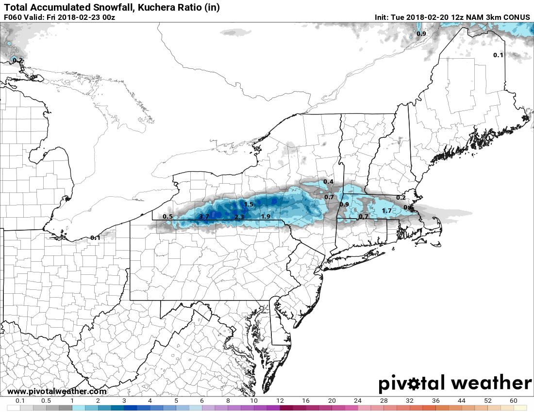
Near-record warmth is likely again on Wednesday. Once again, it will be cooler and probably cloudier at the coast. An onshore breeze and early low clouds/fog will keep the temperature near the ocean/bay in the low-mid 50s at best. Inland it will reach the 60s again, and if there’s enough sunshine, 70° cannot be ruled out. Cooler weather arrives with a wind shift Wednesday night. A disturbance cutting through the colder air will bring chilly rain showers and possibly a bit of sleet/snow Thursday afternoon. The best chance of icy precipitation is north of the RI/MA and CT/MA borders. The timing on the precipitation is 2-8 pm. A coating to 2″ of snow is possible near the MA Pike.

It looks unsettled Friday through the weekend. Expect showers, especially afternoon/evening on Friday. Highs will be in the 40s. Most of Saturday looks dry, with the best chance of rain in the evening and overnight. It may be a bit warmer with highs in the upper 40s to mid 50s if the sun can break through for a bit. Showers return on Sunday, and highs will be in the 40s. We have had a run of storm Sundays dating back to late January. Hopefully, we’re getting them out of our system now!
Looking ahead to March, there’s a reason they say it comes in like a lion! The North Atlantic Oscillation will go negative, and that’s a good indicator that it will at least be chilly in early March. It’s less certain whether it will be stormy (snowy), but cold air is one of the ingredients needed to keep winter going into March. At this point, I wouldn’t stow the shovels away just yet, even with a spring feel this week.


