March 10th Update
Odds of another Nor'easter increasing for Monday night into Tuesday
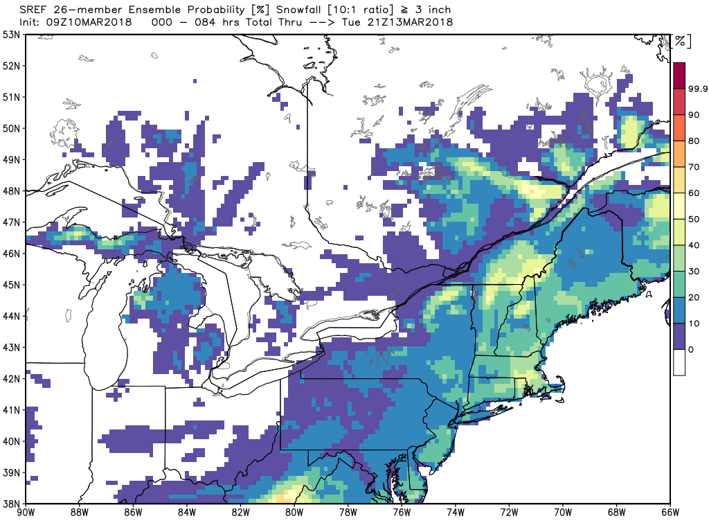
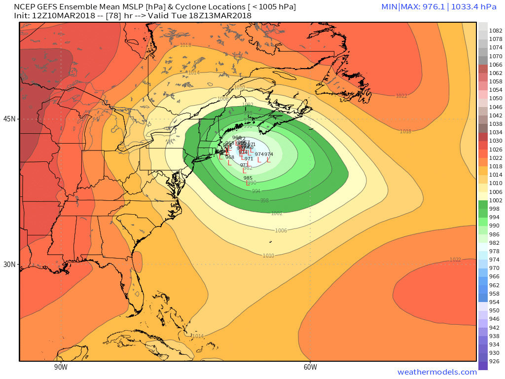
I have had a lot of people asking me about another potential Nor’easter on Monday. Since there was some confusion about when the last Nor’easter was expected to get bad, I want to set the record straight on this one. It will likely be dry through most or all the day on Monday, with snow and/or rain arriving Monday evening and continuing into Tuesday. The consensus storm track has shifted west on Saturday, and that puts it closer to the coast with a greater impact for Southern New England.
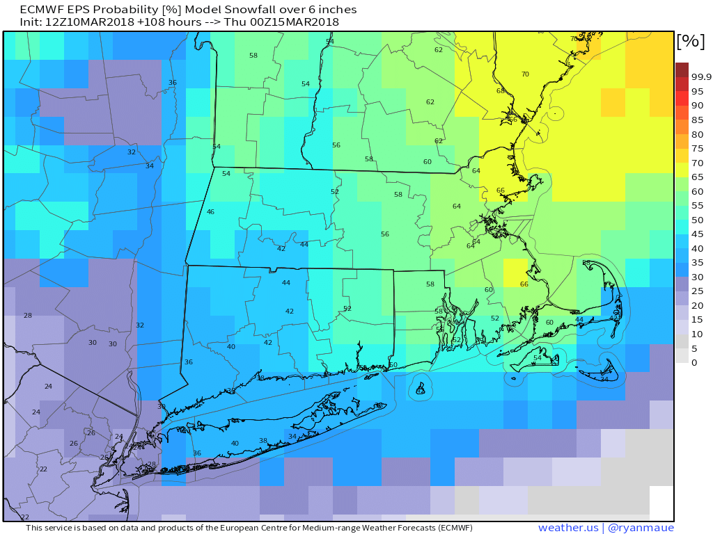
As always, a mid-March storm needs to thread the needle if it’s going to bring exclusively snow to Southern New England. This one looks like it will be a mainly snow event based on the most likely track predicted by today’s computer model runs. There is still a chance that the track wiggles west or east, and that will change the precipitation type, wind, and overall impact. A track further west will likely mean a more intense storm with stronger winds, but also a better chance of snow going over to rain – especially in the coastal plain of RI and SE MA. A track to the east means a lower overall impact, but a better chance of mainly snow for all of Southern New England. So, I guess it’s pick your poison!
Given the track/intensity uncertainty, it’s too early to get into specifics for the snow totals and wind impact. Astronomical tides are relatively low, and that’s good news about coastal flooding. While flooding is possible, it’s unlikely to be moderate/major in Eastern Massachusetts. The bottom-line is most, if not all, of Southern New England is facing another round of accumulating snow. The storm begins Monday evening, and likely lasts into or through Monday morning. The odds of accumulating snow diminish after sunrise on Tuesday.