The “high potential” weather pattern that we advertised for early March is certainly coming to fruition. It looks like we’ll get at least a glancing blow, and probably more, from a Nor’easter moving by New England Monday night through Tuesday. Southern New England is under the gun for more heavy snow and strong winds. The current consensus storm track favors the worst weather in Southeastern Massachusetts, but Rhode Island and part of Connecticut also gets belted.
There is still a chance that the storm center passes far enough east that Southern New England is on the fringe of it with a moderate impact of some snow/wind, but not a full-fledged Nor’easter or blizzard. As of Sunday night, there’s about a 35% chance of a lower impact storm, and a 65% chance of a heavy Nor’easter with possible blizzard conditions.
Here’s the forecast based on the current consensus storm track:
Expect snow to develop between 9 pm – 12 am Monday night into early Tuesday. The snow will be heavy at times late at night as the wind picks up late at night. Expect several inches of snow on the ground by Tuesday morning. For most of Southern New England, the snow should not be particularly heavy/wet like the past couple of storms. The exception could be along the coast, especially in SE MA.
Snow continues, heavy at times, Tuesday morning before getting lighter in the afternoon, and ending before sunset. It will be windy, with temperatures in the low 30s. Most of the snow accumulation should happen between 12am-12pm Tuesday.
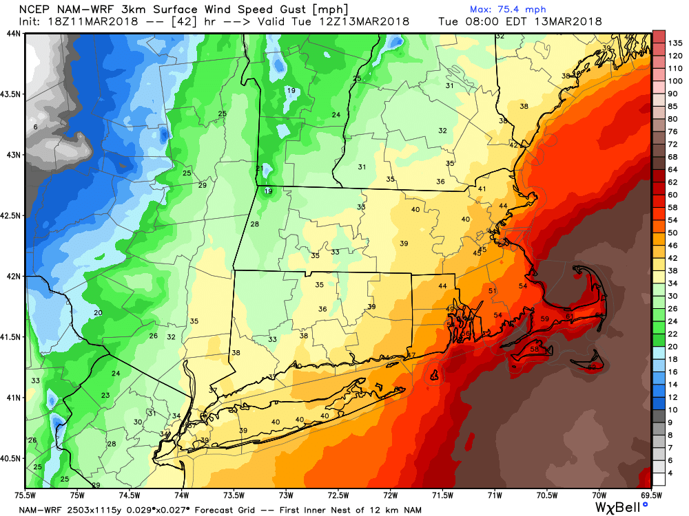

Storm Impacts
Rhode Island
Peak winds 35-45 mph – strongest near the coast
Snow – 8-16″
Southeastern Massachusetts
Peak winds 45-55 mph – strongest near the coast
Snow – 10-18″
Connecticut
Peak winds 30-40 mph – strongest near the coast
Snow 6-12″ (most east, least west)
Keep in mind, if the storm track shifts, so do the impacts, and the snow totals could come down considerably. I do not expect a change in the track that would cause the totals to go higher than the high-end for RI and SE MA, but if the track shifts closer to the coast, Connecticut’s totals may increase.
The rest of the workweek looks dry and chilly, with daytime temperatures running 6-10° colder than normal. That means highs in the 30s to low 40s at best.


