Gray skies continue on Friday, with scattered showers likely through the day. A slow-moving front will not pass by Southern New England until late in the evening. Before it passes, showers are possible. Expect highs in the 50s on Friday. It’s not a total washout, but keep the umbrella handy. A gusty northwest wind brings in drier weather Friday night into Saturday. The wind will relax some during the day on Saturday, and there should be pleasant sunshine with highs in the 50s.
A cold front passing through on Easter Sunday will bring some clouds, and the slight chance of an early shower. I think there’s a better chance that it will stay dry. Expect temperatures in the 40s at dawn, and it will reach the 50s by midday. The timing of the front is important because cool air moves in behind it. Right now, it looks like it will pass slowly enough that Sunday will be relatively mild with some sun. A cool breeze arrives late Sunday and we’re set up for a mainly cool first week or two of April.
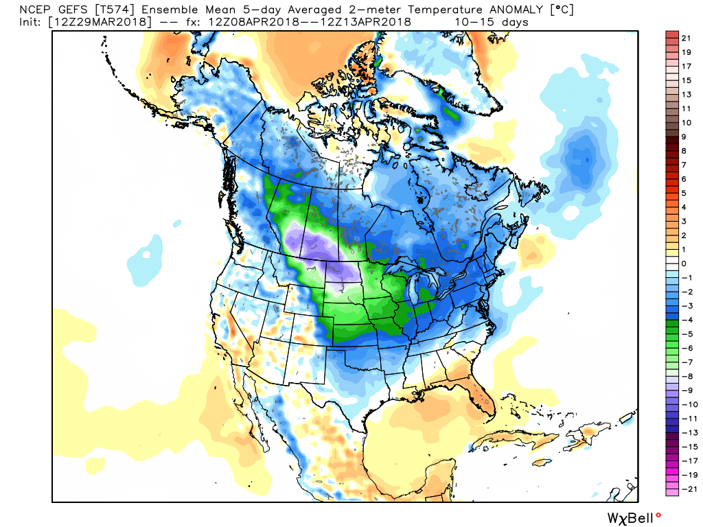
Showers are possible on Tuesday and Wednesday of next week. The temperature could struggle to get out of the 40s Monday and Tuesday. It will briefly get milder on Wednesday before a cool-down late in the workweek.