Expect quiet and seasonable weather to start the workweek. Monday and Tuesday will both feature some sun, but also clouds and seasonably cool temps in the low 40s. Monday will be breezy to windy, but Tuesday looks a lot calmer with a less than 10 mph breeze, for a change.
The calm weather will not last for long as a storm develops off the Mid-Atlantic coast south of New England on Wednesday. It’s too soon to say exactly what this storm will bring, but the potential exists for a significant spring snow event – especially inland. The track of the storm is very important because there’s not much cold air around.
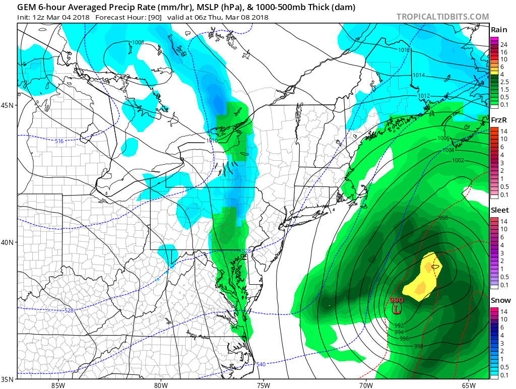

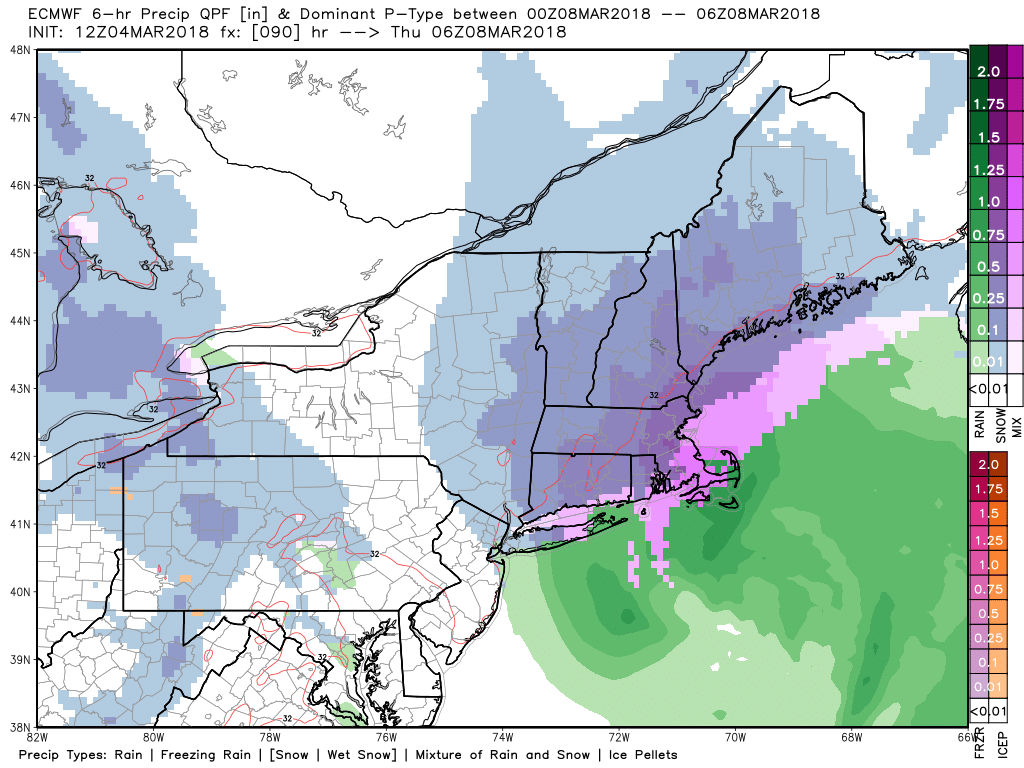
At this point, I favor somewhere between the Euro and GFS models, with a storm that brings moderate to heavy precipitation, but takes a track close enough to bring snow AND mix/rain to most of CT, RI, and SE MA. The best chance of accumulating snow is inland, and especially at higher elevations.
The timing of the storm is Wednesday morning through most of Wednesday night. We should have a better idea of the storm’s track by Monday.
The weather will likely be quiet and seasonable Thursday afternoon into next weekend. There’s a decent chance that it stays dry until at least late Sunday. And, here’s your first reminder to set your clocks ahead an hour before going to bed Saturday night!


