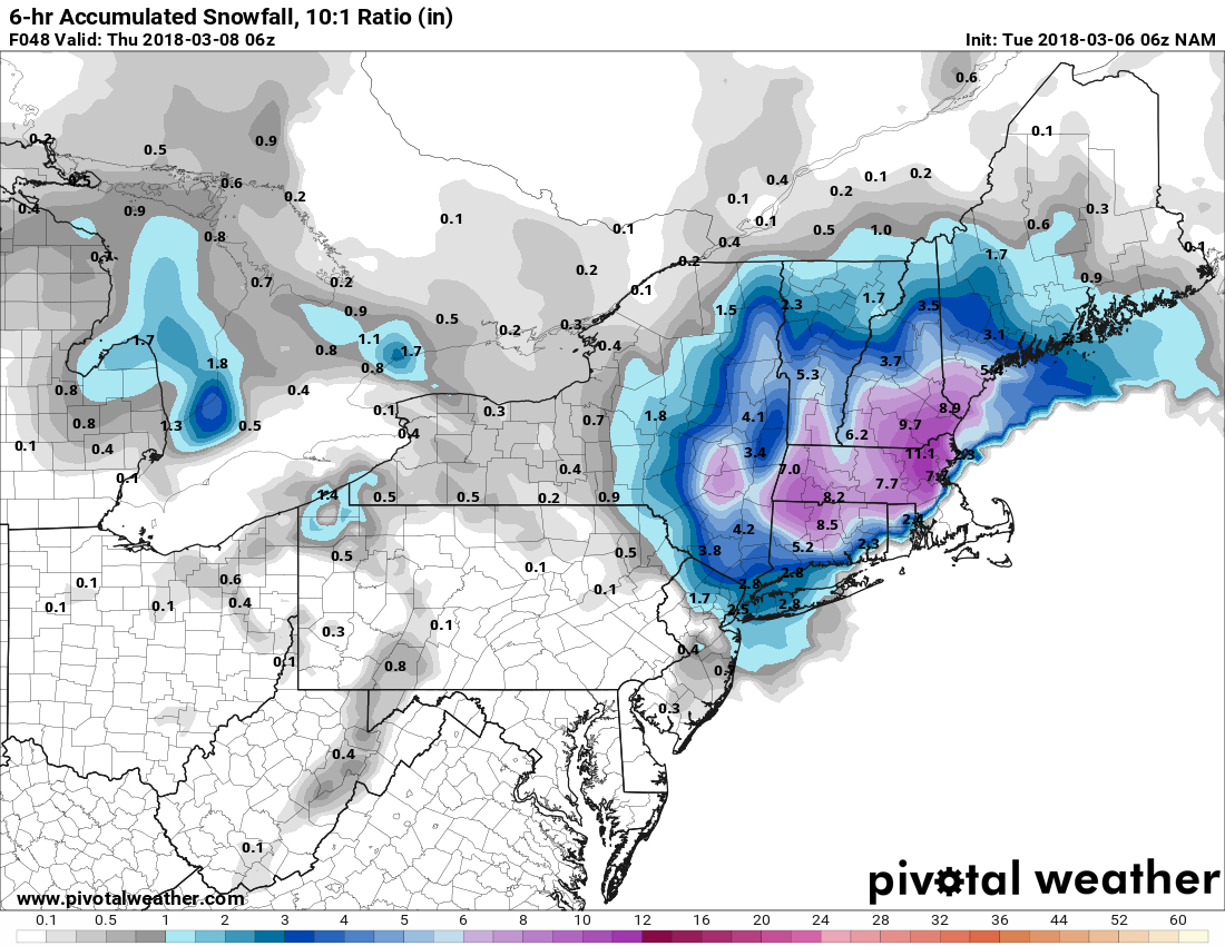
As has often been the case this winter, it is a very close call between snow and rain with the storm heading for Southern New England Wednesday into early Thursday. The best chance of snow with this one is inland and at high elevations. There is a lower chance of accumulating snow in the coastal plain, especially Southeastern Massachusetts.

Light rain/snow will develop during the day on Wednesday, and the precipitation should become heavier by late in the day or early in the evening. A burst of snow is possible in most of Rhode Island early Wednesday evening, but it may not last as snow near Narragansett Bay and the south coast. It looks like mainly rain in the Buzzards Bay area and Cape Cod. It should stay snow in all of CT except for New London County.
There will be snow inland (NW RI) Wednesday night, and rain or snow in the Providence area. It will most likely be rain near the coast. Expect a gusty breeze, but winds will not be nearly as strong as they were in Friday’s storm. The areas that see heavy/wet snow are most at risk for power outages if winds gust over 30 mph. The snow will cling to trees and power lines.
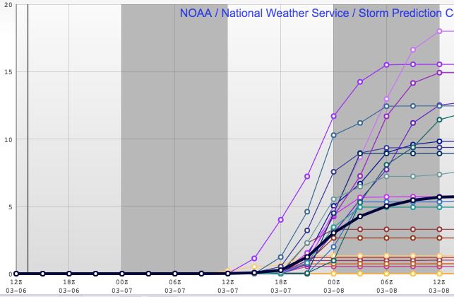
At this point, and it’s a very close call, I expect little, if any, snow accumulation near the coast of RI, in SE MA, and in SE CT. The I-95 corridor is right on the edge between 6″+ heavy snow, and 2″ or less with mainly rain. I am leaning towards the warmer/wetter scenario. North and west of I-295 and most of CT are in line for 6″+ of heavy/wet snow. There could be much difference between snow accumulation on grass and pavement. Temperatures will be borderline, and the ground is not very cold, but most of the heavy precipitation is coming after dark. A slight shift in the storm track will move the rain/snow line by 10-20 miles west or east, and that will have a big impact in the I-95 corridor.
The storm will basically be over by around 7 am on Thursday, with lingering light precipitation possible Thursday morning. It will not amount to much. Quiet and chilly weather is likely from Thursday afternoon through the weekend. Do not expect high temperatures to get much above 40° during that stretch. The normal high is in the mid 40s.


