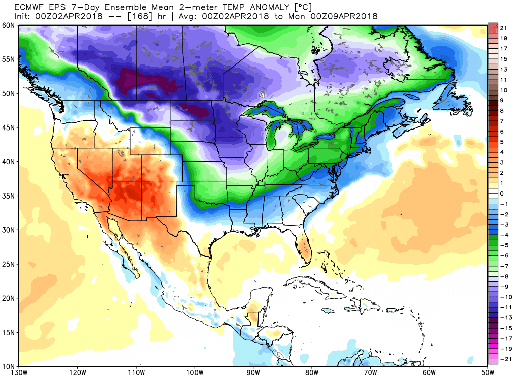
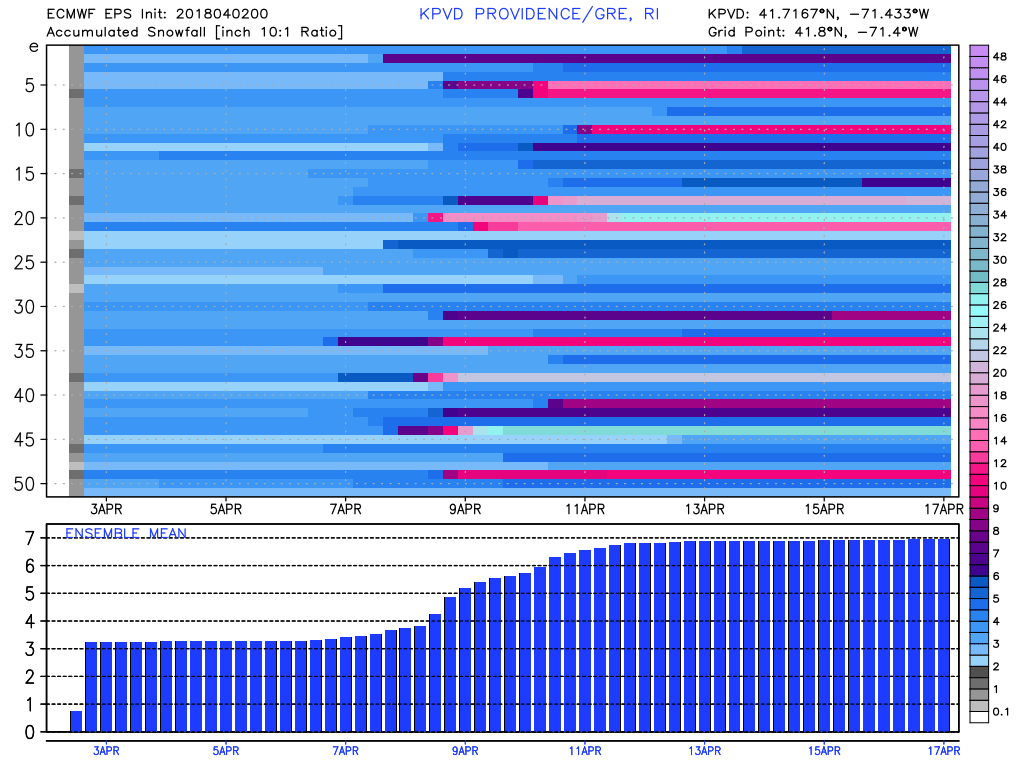
It will be a chilly first half of April. Monday morning’s snow will go in the books as 1-4″ in RI and SE MA, but the impact was minimal given the high sun angle that hindered accumulation on pavement. Snow will quickly melt Monday afternoon and Tuesday. Watch out for a few icy spots Monday night as the temperature dips to near freezing.
Tuesday will be cloudy and chilly, with highs in the low to mid 40s and an easterly breeze. Rain showers arrive late in the day and continue into the evening. A surge of warmer weather moves in on Wednesday. The temperature will jump through the 50s and possibly reach the 60s inland. The warmth comes ahead of a cold front that will bring another round of showers, and possibly a t-storm, late Wednesday afternoon or early in the evening.
Chilly wind returns on Thursday as the temperature dips to near freezing by dawn, and it will only be in the mid 40s Thursday afternoon. That’s about 10° colder than normal. More showers are possible on Friday as an Alberta Clipper system passes by. Expect highs in the 40s on Friday, too. The weekend looks cool, and potentially unsettled. We need to watch a system in the Southeastern United States. It may pass harmlessly out to sea keeping dry/cool conditions in Southern New England, but if it tracks farther north, it could threaten us with more snow/mix. At this point, I’m leaning towards a dry/cool weekend, but it bears watching.
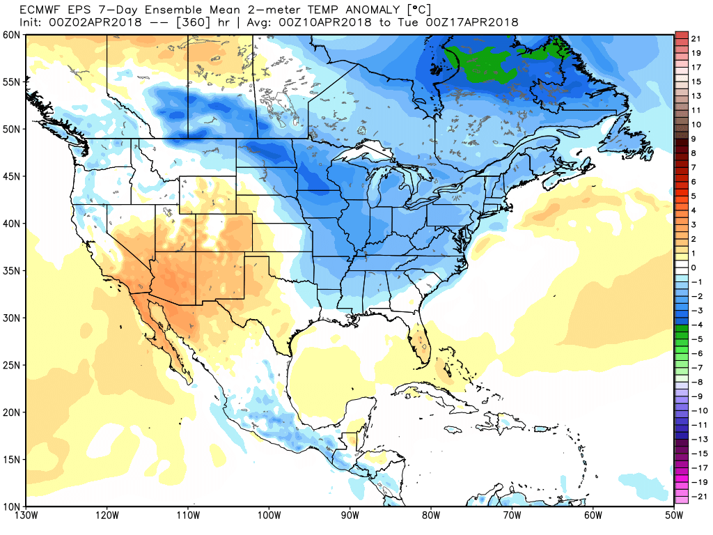
Another storm system will make a run at us Monday-Tuesday of next week. Once again, it’s not a lock that the precipitation would be all rain. There may still be enough chilly air around for some mix/snow during part of the event. The bottom-line is we’re not looking at a pattern change for at least the first two weeks of April. Last April was 3.5° warmer than normal. This April should be much cooler than that, and possibly colder than normal if the pattern persists through April 20.