It’s fitting that April ends with a cool and unsettled day in Southern New England. The month was much cooler than normal with above normal precipitation. May begins tomorrow, and with it will come a very quick change to warm weather. Expect highs in the in the 60s on Tuesday. The best part of the day will be the afternoon.
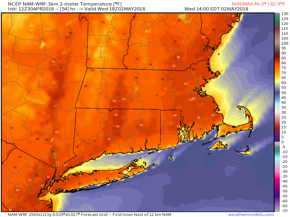
It jumps to near 80° inland by early Wednesday afternoon. The coast will be in the 60s/70s. The summer preview continues Thursday and Friday. Both days will feature some sunshine with highs temperatures 10-15° above normal. It will likely reach the low 80s inland, and stay in the 70s at the coast. Overnight lows will be in the 50s to near 60° Wednesday and Thursday night. It may actually feel a bit muggy Thursday and Friday afternoon.
Scattered showers/storms are possible Friday afternoon and early evening – especially inland. A cold front eases through by Saturday, but it will not be a huge cool-down. It looks like highs will still be in the 70s on Saturday for all but the coast where it will be in the 60s. Sunday also looks dry and seasonable with highs in the 60s. Fairly quiet weather is likely in the early to middle of next week. Highs will probably stay in the 60s – just about normal.
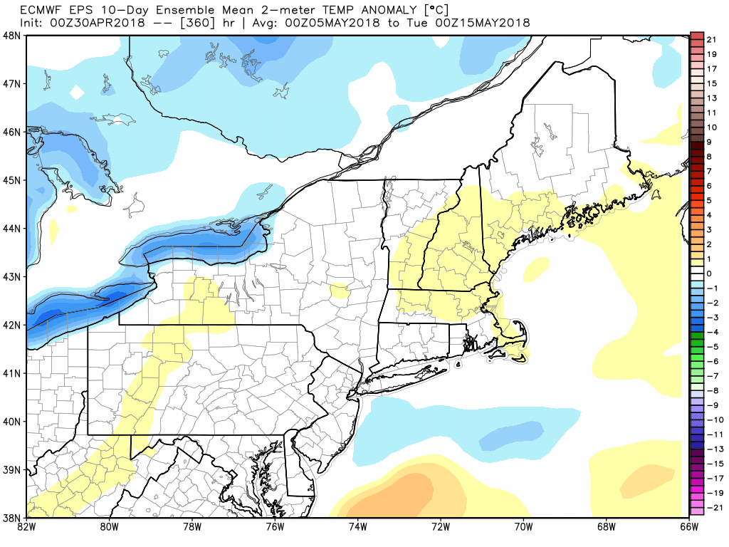
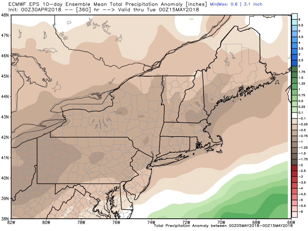
The weather pattern looks rather dry for the first half of May. After seeing the temperature revert to seasonable from May 5-15, it could get warm again in the middle of the month.