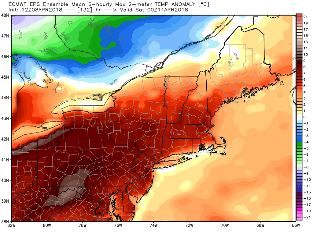
The first 8 days of April are averaging about 5° colder than normal in the Providence area. It will stay quite chilly early in the week before a late-workweek warm-up brings the warmest weather of the month (maybe since late February) to southern New England.

The low temperature will be in the 20s on Monday, and it’s possible it will be the coldest low temperature we see until the fall. Look for some sunshine, and highs in the mid 40s in the afternoon. A storm system develops in the Atlantic Ocean o Tuesday, and it will throw some clouds our way. It’s unlikely that there will be much steady precipitation, but some rain/snow showers cannot be ruled out. Look for highs in the 40s again.
We’ll have baby steps to warmer weather Wednesday and Thursday. Highs go from the low 50s on Wednesday to the low-mid 50s on Thursday. A few showers are possible on Thursday. Both of those days will likely still be cooler than normal. The normal high late in the workweek is around 57°. There’s a good chance that Friday and Saturday will be warmer than normal, for a change.
Highs inland may reach the 60s/70s Friday and/or Saturday. A west-southwest wind on Friday gets the temperature up into at least the 60s inland, and possibly the low 70s. The coast will be about 5-10° cooler. Saturday will also be quite mild, and it may reach the 70s inland if there’s enough sunshine.
A slow-moving storm system threatens with rain between Sunday and Monday of the next week. Boston Marathon runners, myself included, will be watching this forecast very closely. Sunday looks showery, and there will likely be a band of heavier rain that comes through sometime between Sunday night and Monday afternoon. Of course, the timing is important because the marathon begins at 10 a.m. on Monday. Highs will be in the 50s both days.
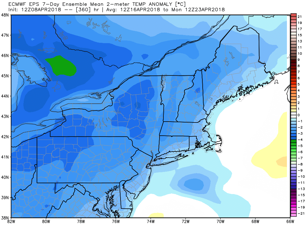
The overall theme is for relatively cool weather most of the time into late April.


