A showery Saturday gives way to dry skies on Sunday. It will be unseasonably cool Saturday with temps in the low-mid 50s. Sunday looks a bit brighter and milder with highs in the low to mid 60s. Quiet weather is likely early in the week. Expect highs in the 60s/70s with some sun on Monday. It may reach 80 inland on Tuesday. Scattered afternoon showers and t-storms are possible as a front moves south.
A frontal boundary nearby can make the long-range (4+ days) forecast very difficult in May. The temperature can vary by 20° or more depending on the wind direction. It’s best to keep a close eye on the forecast for the latest on where the front will set up. It’s not just the temperature uncertainty that comes with a fickle front, there’s also the potential for rain as jet stream disturbances ride along the boundary. The bottom-line is the extended forecast is rather uncertain for this week!
Much cooler weather is ahead for Wednesday. Expect highs in the 60s. A few showers cannot be ruled out, but it looks mainly dry. We’re back into warmer weather on Thursday with highs in the 70s and a scattered afternoon shower threat.
The best chance of steady rain next week is Friday as a more organized storm system moves out of the Mid-Atlantic. The timing of the rain may change, but there is likely to be a period of steadier rain at some point late in the workweek or next weekend.
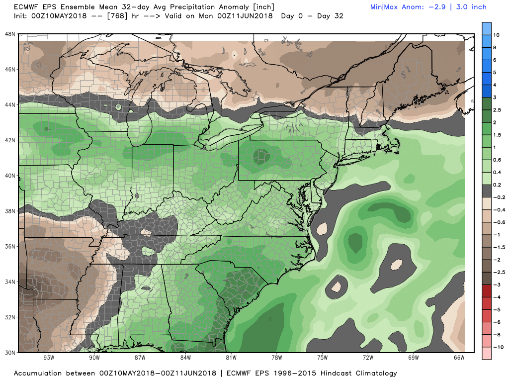
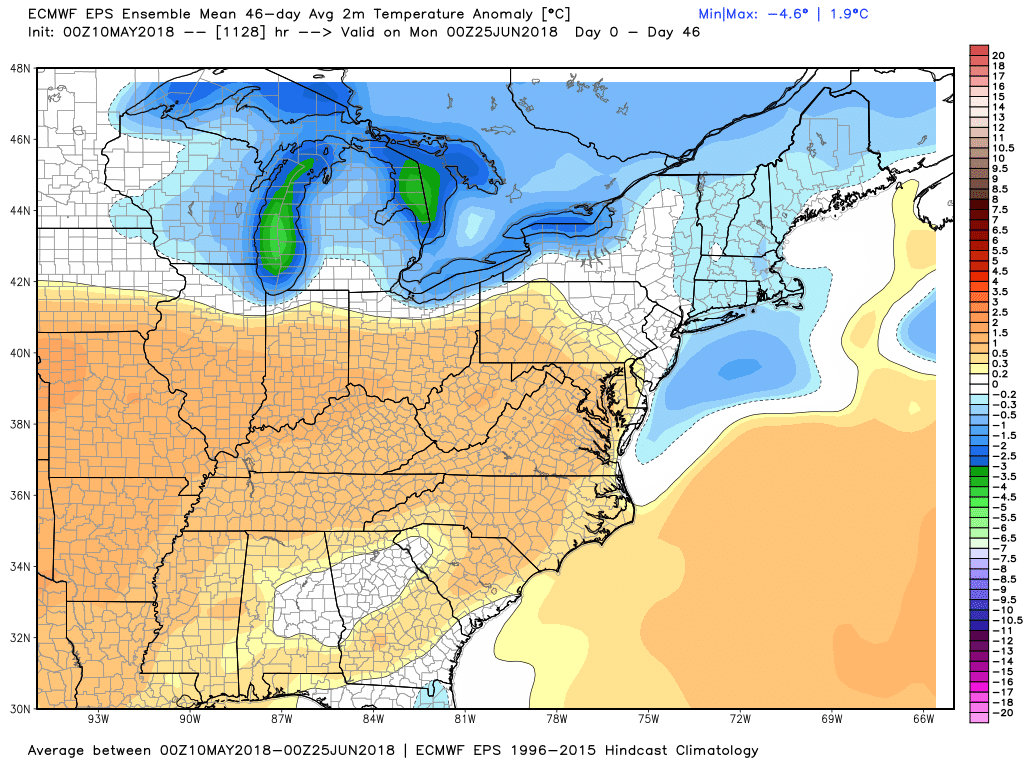
The latest European model weeklies show a relatively wet and slightly cool picture in Southern New England for the next 4-6 weeks. It’s somewhat of a flip from earlier forecasts, and we’ll see if the trend continues with the next update Monday evening.