The temperature will bounce around a little bit in the next few days. Expect highs in upper 70s to low 80s on Tuesday. An approaching cold front will trigger thunderstorms in the Northeastern U.S. Tuesday afternoon and evening. There is an enhanced risk of severe weather in parts of PA, NY, CT, and western MA. The heavy action may weaken as it approaches RI and SE MA, but some t-storms are possible. Wednesday looks much cooler with some showers around. Highs will only be in the low 60s.
The temperature jumps back into the 70s on Thursday with dry skies expected. Clouds thicken on Friday, and it will turn cool again. Highs will be in the 50s or low 60s. Showers are possible by late in the day, and some rain is likely at night. Expect more showers on Saturday with highs only in the upper 50s.
A few lingering showers are possible Sunday morning before warmer weather returns in the afternoon. Highs will be in the upper 60s to low 70s. The weather pattern does not look as unsettled next week. Look for seasonably warm weather in the early to middle part of the week.
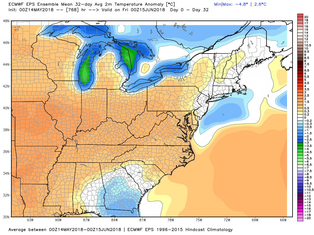
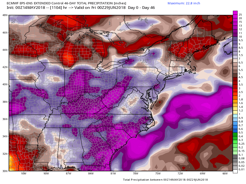
The EPS Weeklies show near-normal temperature and above-normal precipitation in Southern New England in the next 4-6 weeks.