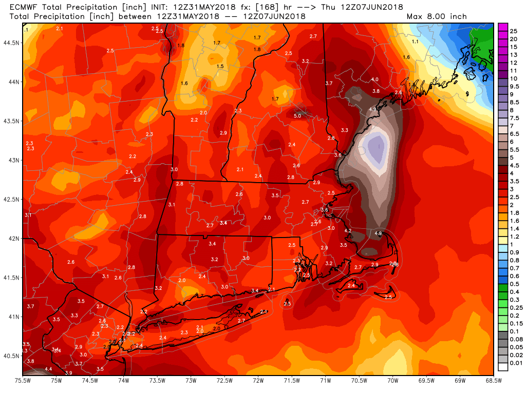
We are heading for a relatively cool and unsettled start to June. Expect near or below normal temperatures for the first week to 10 days in Southern New England. Rainfall is expected to be above normal, with at least one slow-moving storm system having an impact. The best chance of steady rain is in the early to middle part of next week.
Friday will be warm/muggy, but mainly dry. Expect highs near 80 inland and in the 70s a the coast. Mist and fog is possible early in the day, and the afternoon will not be full sunshine. Fog returns Friday night as it stays muggy. There’s a better chance of some rain Saturday morning as a front moves through. The wind will shift to the northeast and bring in cooler/drier air by late in the day. Highs will be in the 70s before falling through the 60s early in the evening.
Sunday looks dry, but unseasonably cool. Expect highs in the 60s for most of the area, with some 50s near the coast. The first weekend of June will not be one to write home about!
A slow-moving storm system brings rain on Monday. Heavy downpours are possible. 0.5-1.0″ is a reasonable early estimate for the rain total Sunday night and Monday evening. It may also be quite cool with temps in the 50s and an east-northeast breeze. Tuesday is better, but not nice. Expect cool temps in the 60s and some clouds. Another round of rain is possible on Wednesday. If you’re looking for warm-up, you may have to wait until the second weekend of June. Odds are it will stay on the cool side through next workweek.


