Saturday is the pick of the weekend with some sun and temps in the upper 60s coast to mid 70s inland. It will be noticeably less humid. Clouds thicken Saturday night. Passing showers are likely on Sunday. It will not be a total washout. Expect 0.15-0.3″ rain between late Saturday night and Sunday night. Highs will only be in the upper 50s to low 60s.
We’ll get back on track on Monday with some sun and highs in the 60s. A quiet stretch of weather is likely through next workweek. Temperatures will be seasonable – 60s coast to some low 70s inland. Sea breezes are likely most days. Expect it to be comfy overnight with lows in the 40s to low 50s. The pollen count will be high with tree pollen causing problems all week.
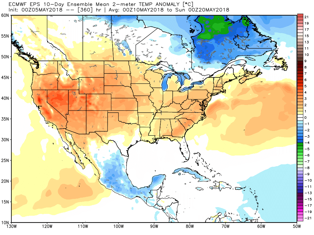
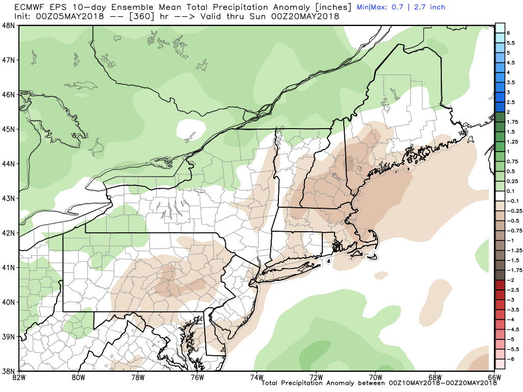
The overall theme for mid-May, and probably the month as a whole, is warmer than normal with near or below normal precipitation. Another summer preview is possible by the end of next weekend into the following week.