The weather will will stay quiet and mainly or all dry through the end of the workweek. There may be patchy fog in the morning, but the afternoons will mainly sunny skies. The high temperature will not stray too far from normal – in the 60s at the coast and low 70s possible inland. Expect comfortable humidity, with lows in the 40s. A storm system passing by east of New England may throw a shower into Eastern Massachusetts Wednesday night.
Unfortunately, the weekend does not look as nice as the workweek. A frontal system nearby brings a shower threat Saturday into early Sunday. It looks like Saturday afternoon could be wet, with a greater than 50% chance of at least 0.25″ of rain between 8 a.m. Saturday and 8 a.m. Sunday. At this point, it looks like the best chance of rain is Saturday afternoon and night. The temperature may not get above 60° on Saturday.
There is a lower chance of rain during the day on Sunday, which is good news for Mother’s Day plans, but showers cannot be ruled out. It does not look particularly warm, with highs in the low 60s. A gradual warming trend continues into next week. Highs will be seasonable in the mid-upper 60s on Monday. It may bust into the 70s to low 80s Tuesday and Wednesday.
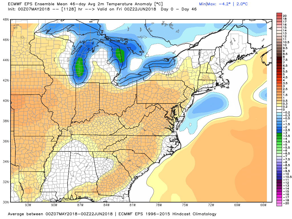
The long-range outlook is for near-normal temperatures in Southern New England from late-May into early-June. The same model predicts near-normal precipitation in the same time frame. It looks like we’ll get a spring after all!