June 28th Update
Much-needed rain will move through Southern New England on Thursday. Morning downpours will be followed by scattered afternoon/evening showers and thunderstorms. More than an inch of rain is possible in many locations on Thursday. However, like many summer systems, there will be areas that do not receive nearly as much. The heaviest rain will likely be in the western half of New England, with lower amounts in eastern RI and SE MA.
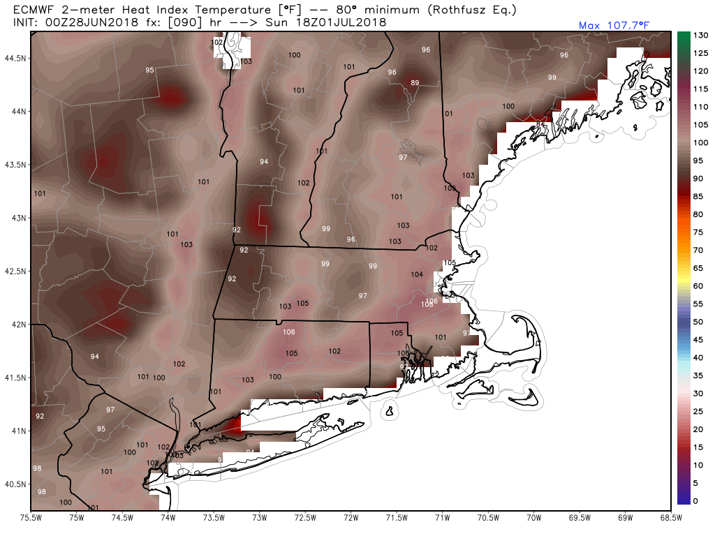
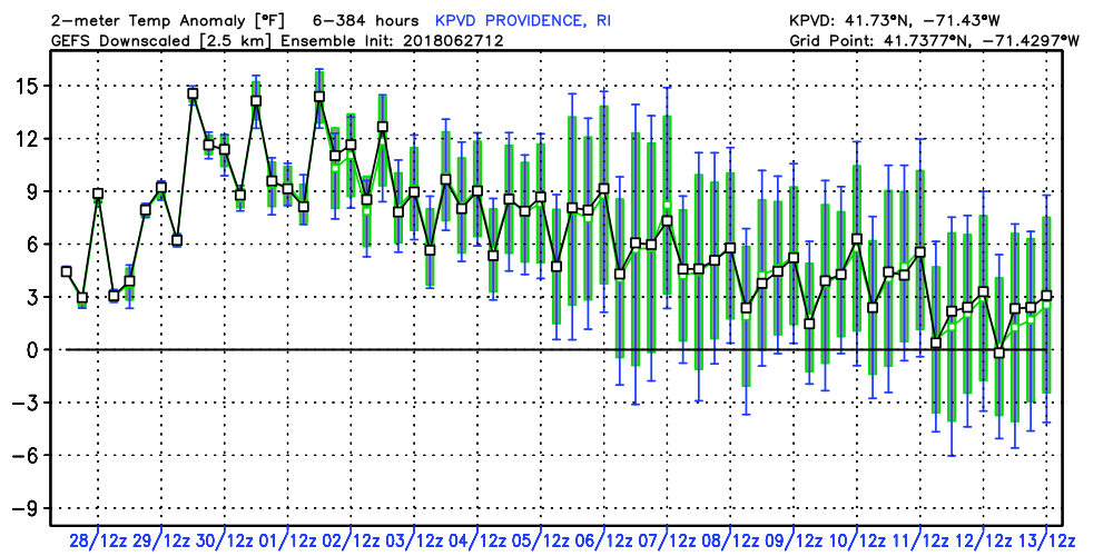
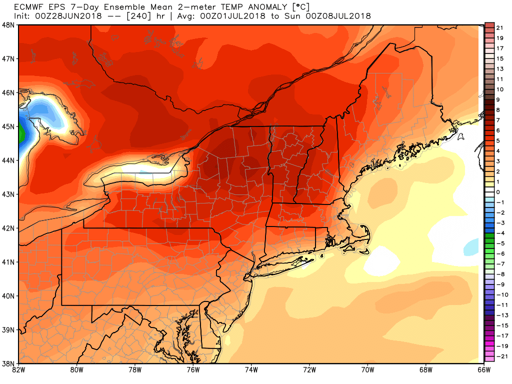
It will be very muggy on Thursday afternoon, and that’s the start of a summery stretch that will last through the week of the 4th. Highs near 90° inland are likely on Friday afternoon, and it will get even warmer this weekend. You can get relief at the beaches and near the coast with temperatures in the 80s. Air conditioners will be running overtime in the next 7-10 days as it stays very mild at night. The temperature may not get below 70° too often between July 1-8. At this point, Sunday looks like the hottest day with highs well into the 90s inland, and humidity that may make it feel like triple digits.


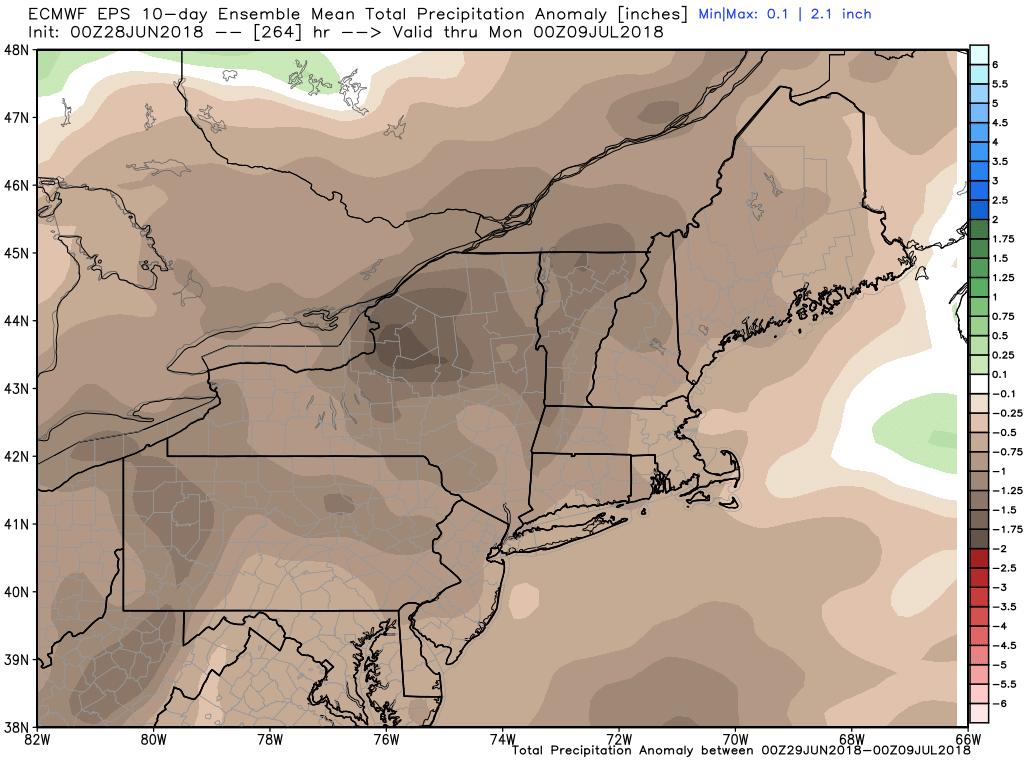
There is a low threat of widespread rain in the first week of July. Scattered showers and thunderstorms cannot be ruled out in the afternoon/evenings of July 3-4, which is an important forecast to watch for area parades and fireworks displays. The best chance of pop-up storms is away from the coast, and there is a better chance of dry weather. Look for highs in the 80s/90s right through the first week of July. Briefly cooler weather may arrive around July 7-8 with showers/storms followed by less humid weather for a couple of days.


