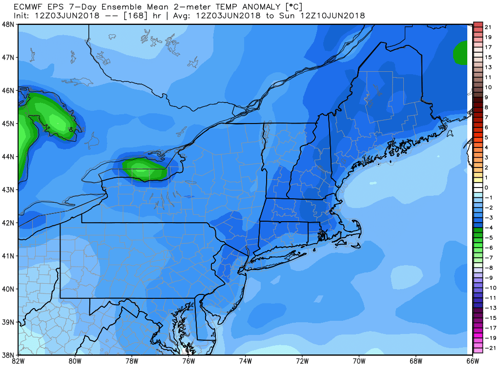
The workweek will get off to a rough start with a rainy and raw Monday. The best chance of rain is in the morning, but it will still be damp in the afternoon. The temperature will stay in the 50s, and there’s an outside chance that the record cold high temperature will be set in Providence. The current record is 55°, and it’s possible it will stay below that from 12:00 am until 11:59 pm!
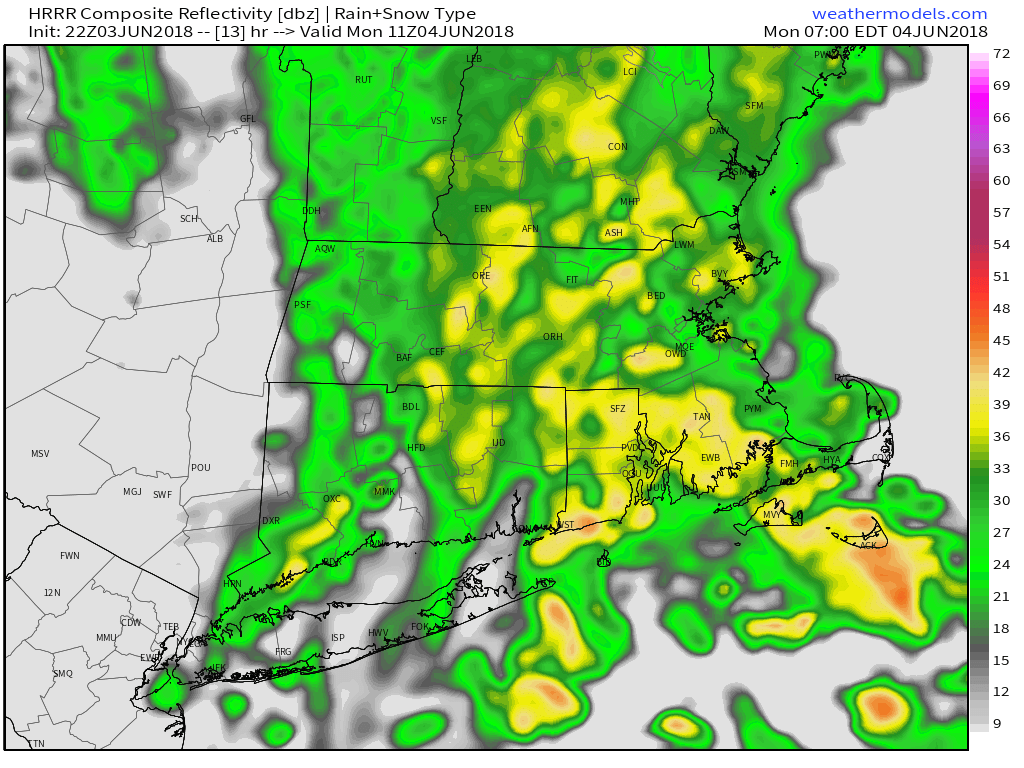
Expect a half-inch or so of rain between dawn and noon, with lighter showers or drizzle in the afternoon. It will likely be rain-free from Monday night into Tuesday morning. Another round of showers will move through Tuesday afternoon. It’s possible some areas will not see rain, but I wouldn’t bank on a dry day. Highs will be in the 60s – not exactly warm for June.
Clouds and cool conditions continue on Wednesday. It may not be a rainy day, but some mist/drizzle is possible – especially in the morning. Once again, temps will struggle to get out of the 50s. It looks better late in the workweek, with seasonable temperatures well into the 70s by Friday. It will likely be dry on Saturday. I’m watching another storm system that could bring rain by the end of next weekend. It’s something to track this week.