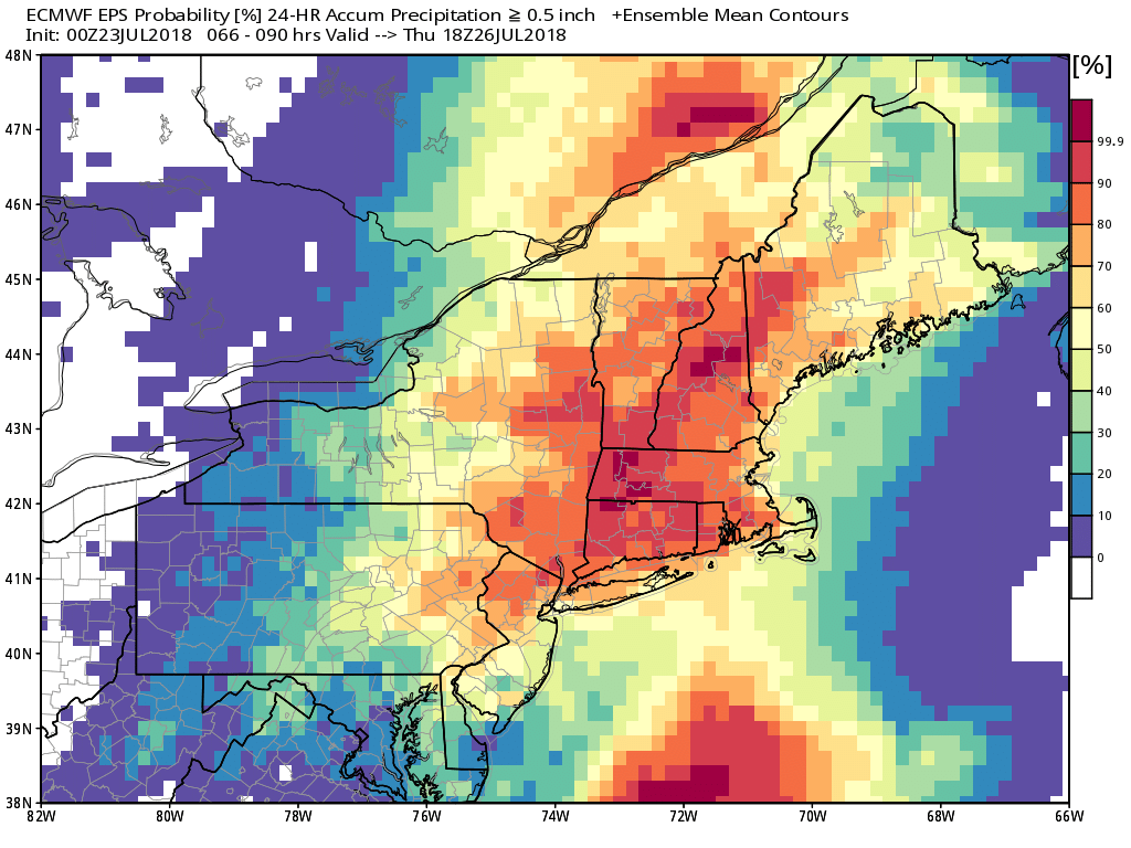
Expect a very humid week in Southern New England with lows in the 70s and highs in the 80s. The pattern favors heavy rain in the Eastern United States, but the high pressure ridge in the Atlantic Ocean should be strong enough to push the axis of heaviest rain west of Southeastern New England for a couple of days.
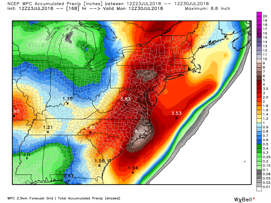
More than six inches of rain is likely this week in part of the Mid-Atlantic states. The heaviest rain in New England will likely be in western Connecticut or western Massachusetts. Scattered showers are likely on Monday in RI and SE MA, especially in the morning. It looks mainly or all dry from Monday afternoon into Wednesday as the rain threat shifts west. There may be some sunshine on Tuesday, and highs could reach the mid to upper 80s inland.
Showers and thunderstorms push east into western New England during the day on Wednesday. The shower threat increases in RI and SE MA by late Wednesday. The best chance of rain this week is Wednesday night into Thursday morning. Heavy downpours are possible, and some areas could pick up more than an inch of rain.
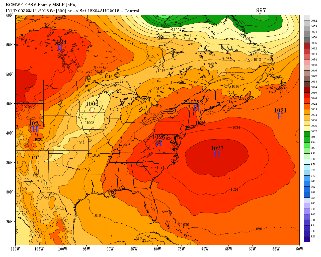
The weather looks dry, but still humid from late Thursday through Friday. A cold front brings a shower/storm threat Saturday morning-midday before slightly less humid weather arrives for the rest of the weekend. At this point, the weather looks good Saturday afternoon and Sunday.
Looking down the road into early August, the Bermuda High looms large and in-charge with continued summer-like warmth and humidity for the Northeastern United States. The pattern favor near or above normal precipitation early in the month, too. It looked like drought could be an issue for a while this summer, but that’s highly unlikely now with this shifting weather pattern. The only area to watch for continued dry conditions is far eastern Massachusetts, including Cape Cod.
The tropics look quiet for the next week or two.


