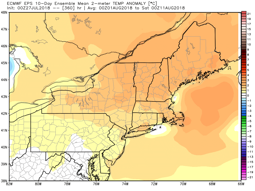
Tropical humidity eases for a couple of days early next week before it returns in the middle of the week. The overall pattern in the next 10-15 days favors muggy and warm weather in New England. That’s not too shocking considering we are right in the middle of the dog days of summer.
Friday looks like a rare rain-free day in RI and SE MA. A line of thunderstorms will enter western New England before sunset, and what’s left of it may move through RI and SE MA late in the evening or overnight. The storms may pack a punch in the early-evening in western CT and MA, but they should weaken as they move east. The front that brings the storms will still be draped over Southeastern New England on Saturday, and more pop-up showers/storms are possible. It will stay very humid Friday and Saturday.
Saturday is by no means a washout, and it will be partly cloudy between any showers. Expect highs in the 80s. The rain threat diminishes by Saturday evening. It will turn a bit less humid on Sunday. Look for some sunshine with highs in the 80s – a fine late-July day. Quiet and seasonable weather continues on Monday.
Humidity increases again on Tuesday as the a deep southwesterly flow develops around the Bermuda high pressure center in the Atlantic Ocean. Scattered showers/storms are possible in the afternoon in the mid to late workweek. It looks like we’ll squeak out a dry day on Tuesday before the rain threat increases on Wednesday. Low temperatures will be back above 70° and highs will be in the 80s. The beat goes on…
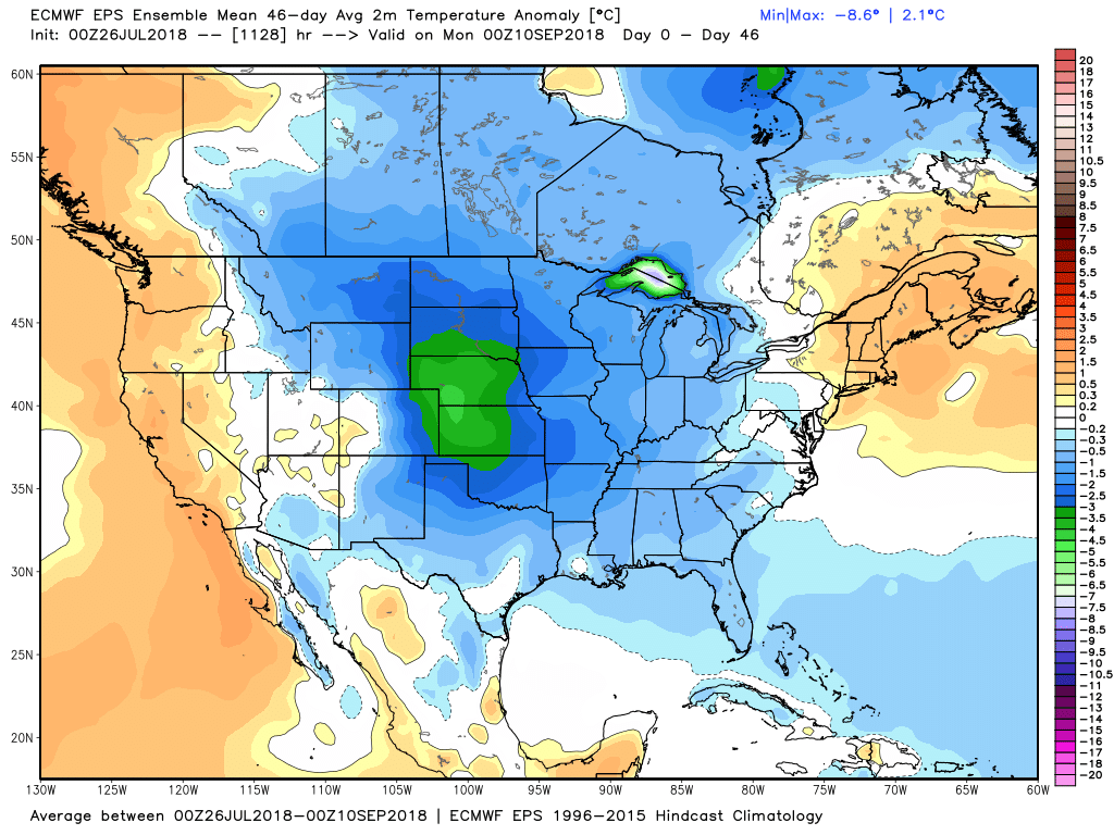
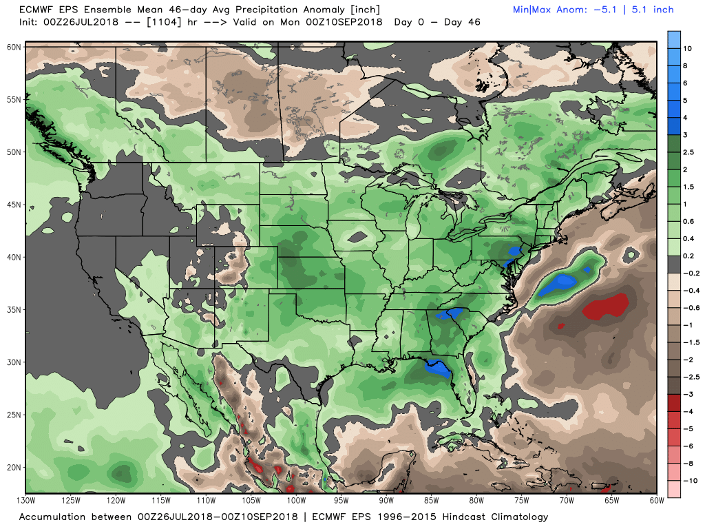
The EPS weeklies suggest much cooler weather in the central United States in the next 6 weeks. Warmth will hang on the Northeast for at least the next couple of weeks. It looks wetter than normal for a big chunk of the country, including the Northeast. Keep in mind, this pattern favors above-normal precipitation for inland locations, but it’s not as likely to be wet at the coast – especially when the main source of rain is afternoon/evening t-storms. Those tend to develop more readily away from the ocean.