July 29th Update
We will get a two day break from tropical humidity before it returns in the midweek. The pattern looks somewhat similar to last week, but with a lower chance of afternoon showers/thunder. The best chance of widespread showers this week seems to be on Wednesday as a warm front brings the extreme humidity back into New England.
A seasonable Sunday is followed by more of the same on Monday. There may be a some clouds that dim the sun a bit at times, but it should still be bright enough for highs in the low to mid 80s. Dew points will be in the 60s – closer to the typical “dog days” humidity than the tropical feel we had last week – and will have later this week. A stray shower cannot be ruled out on Tuesday, but there’s a better chance it’s dry and humid with some clouds and highs in the low 80s.
The tropical humidity returns with a warm front on Wednesday. Expect some clouds, and there will likely be scattered showers and t-storms. Highs will be in the low-mid 80s depending on how much the sun can break through. The dew point climbs into the low to mid 70s. Low temperatures will most likely stay in the 70s for the rest of the week.
The weather pattern will most likely not change much from Thursday through Sunday. It looks like a sun/cloud blend with highs in the 80s. The best bet for any rain is with isolated to scattered afternoon and early-evening showers/storms. There is a better chance it stays dry in most towns – especially south and east of I-95.

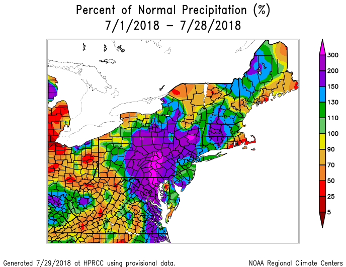
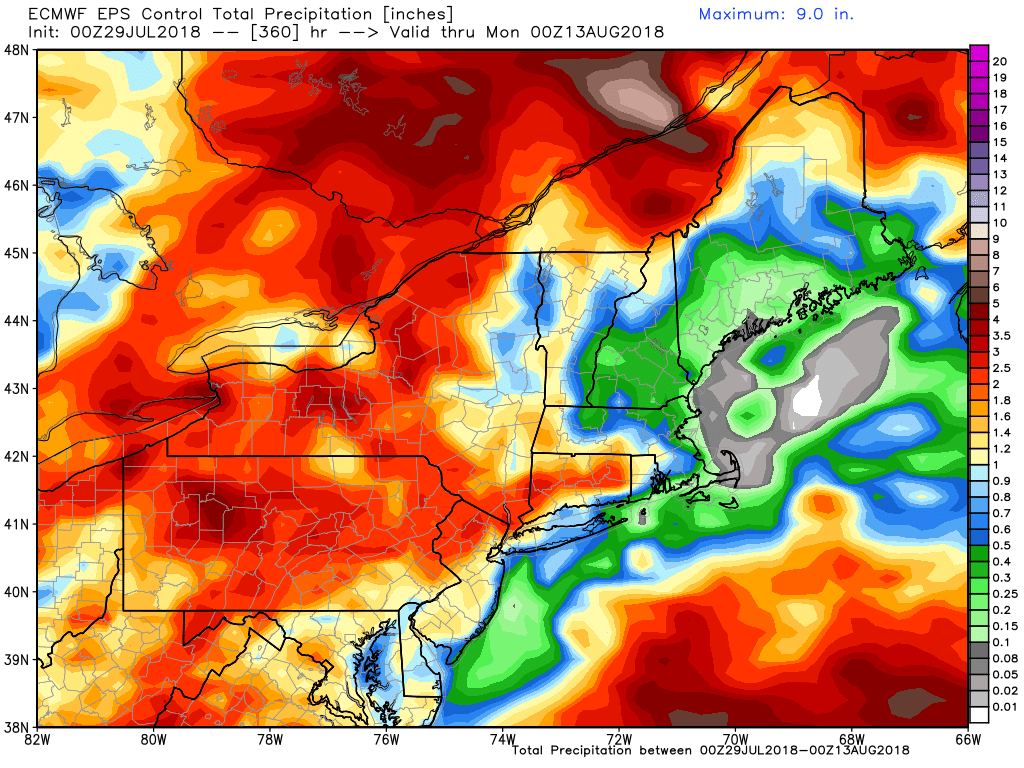
July will go in the books as a rather warm and wet month in interior Southern New England. While it’s been warm at the coast, it has not been wet in the southern half of RI and all of SE MA. The overall pattern for the next couple of weeks does not favor above normal precipitation in these areas. The EPS control run (below) has less than 0.5″ of rain near the coast of RI and MA in the next 15 days.


