July 7th Update
A dry and seasonably warm stretch is ahead through mid-July. The weekend ends with another amazingly nice day on Sunday. It will be a few degrees warmer with plenty of sunshine and low humidity. Expect highs in the low to mid 80s inland, and upper 70s at the beach. It will be comfortably mild Sunday night.
The weather warms on Monday under mostly sunny skies. Expect highs in the upper 80s to low 90s inland and 80s at the coast. It will not be terribly humid, but you will notice some mugginess near the coast. Tuesday looks warmer with low 90s inland and 80s coast. A stray shower is possible Tuesday night, but there’s a better chance that it stays dry.

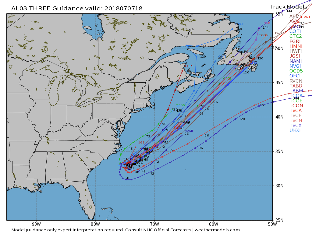
The front that passes through Tuesday night will bring slightly cooler weather Thursday and Friday. Expect highs in the 70s coast and 80s inland with a blend of clouds and sun. The front also helps steer Tropical Depression Three (Chris) out to sea rather harmlessly. The storm may hang around long enough to generate swells and surf for the New England coastal waters.

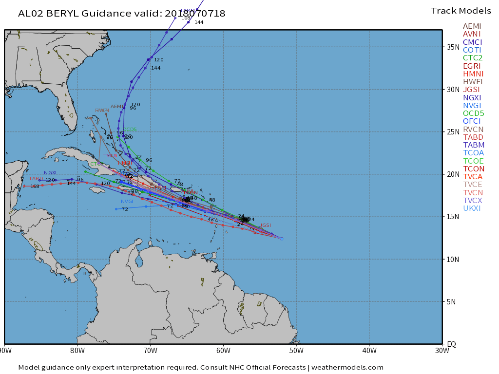
The other tropical system, Beryl, is heading towards the Caribbean and weakening. It may be a tropical storm as it brings squally rain to the islands, including Puerto Rico. Right now, it does not look like a major threat, but any heavy rain and strong wind is not welcome in Puerto Rico as the residents struggle to recover from last year’s hurricanes.
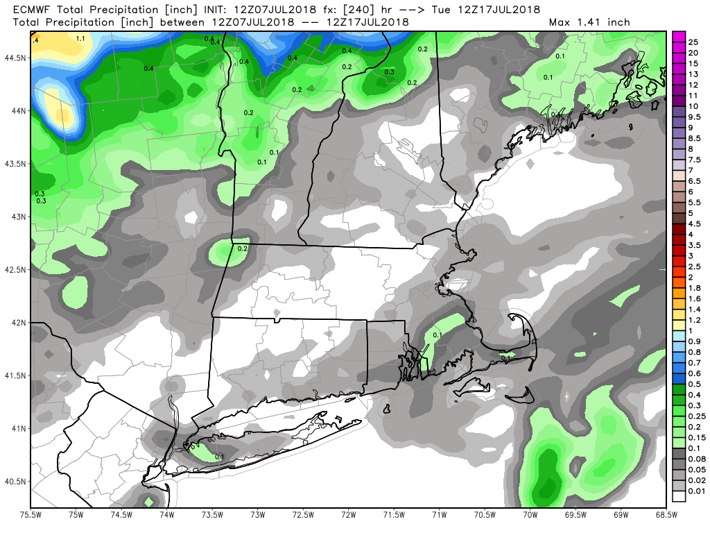
Eventually, if Beryl can survive a hostile environment in the Caribbean, it may emerge in the Bahamas and then move off the Eastern Seaboard near the end of next week. It looks like there will be a Bermuda high pressure system that turns it out to sea, and keeps it relatively warm and dry in Southern New England. We may get more than halfway through July without much rain at all in most of CT, RI, and MA.


