We are looking at a basically dry forecast for the next few days as we await the remnants of Hurricane Florence. Rain from the tropical system is likely on Tuesday. However, it’s unlikely that Florence will still be a named storm when it passes by. It will probably be a tropical depression or extratropical storm. It has the potential to bring soaking rain through Southern New England.
Expect high temperatures in the 70s Friday and Saturday. It will be brighter on Saturday. Noticeable humidity continues for a couple of days, but it will not be unbearable. Sunday looks nice with highs not far from 80. Monday should be about the same, with clouds moving in during the afternoon.
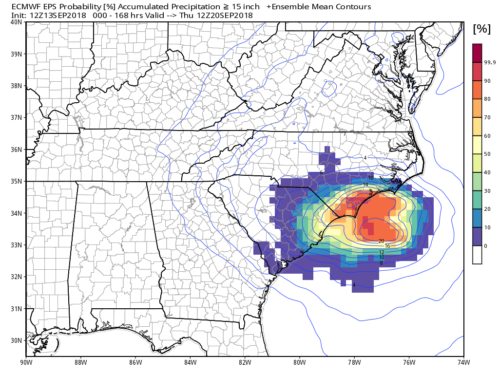
Rain from Florence likely arrives on Tuesday, and it could be heavy at times. The storm will be moving rather quickly as it will be caught in the jet stream, and it rain will likely last for less than 12 hours. Some computer models are projecting 2+” of rain for CT, RI, and SE MA. Others hint at about 0.5″. I think it’s too early to talk about specific totals because we need to see how the storm evolves as it moves along the Carolina coast and then into the Southeastern United States.
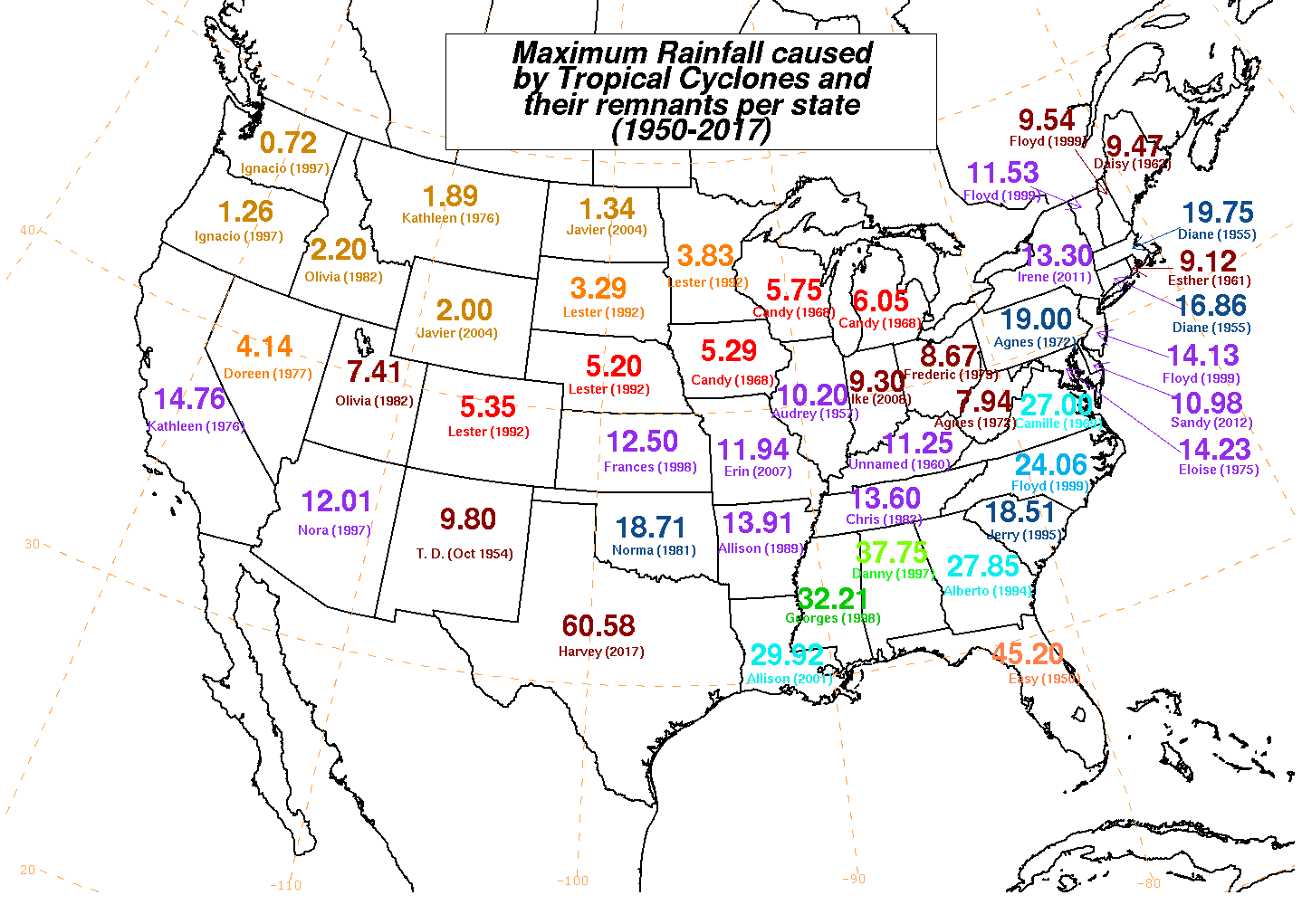
Parts of the SE United States coast could see more than 2 feet of rain in the next couple of days. Record rain from a tropical system is possible in NC and SC.
Looking way down the road, I expect dry weather at the end of next workweek into, and probably through, next weekend.


