We are looking at rain for the third straight Tuesday. It arrives around dawn in Connecticut and later in the morning in Rhode Island and Southeastern Massachusetts. It may just be showery between 8 a.m. and 12 p.m. in RI and SE MA before rain gets steadier in the afternoon. The heaviest rain is likely in Connecticut where 2″+ is possible in some towns – particularly the western half of the state.

Tuesday rain forecast
Rain tapers Tuesday evening and it will stay mild and muggy overnight with patchy dense fog into early Wednesday. There may not be a ton of sun on Wednesday, but it will be relatively warm with highs in the 70s and a bit muggy. It looks like a mainly dry day. There is a better chance of showers and possibly a t-storm Wednesday night as a cold front swings through.
Thursday and Friday look pretty nice with seasonable highs near 70. It will likely get a bit warmer on Saturday before cooling into the 60s again on Sunday. Mainly dry weather is in the forecast from Thursday through the weekend.
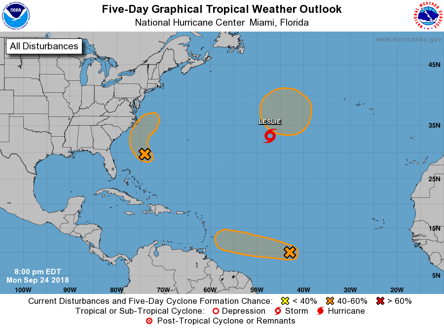
The National Hurricane Center is watching a disturbance off the Southeastern United States coast. It may become a tropical system, but likely stays offshore with little or no impact in New England late in the workweek.


