Late-afternoon and evening showers and thunderstorms bring an end to the very warm and humid start to September. The best chance of storms in CT, RI and SE MA is after 5 p.m. until around 10 p.m.. Some storms could contain frequent lightning, torrential downpours, and gusty wind. It will stay mild and humid for most of Thursday night before drier air arrives from north to south late at night.
Friday looks ok, but not great. Expect some clouds, and a stray shower cannot be ruled out. There will still be a hint of humidity, especially near the coast. Highs will be in the mid 70s if there is not much sunshine, and closer to 80° if the sun can break through for a few hours.
Much less humid weather arrives on Saturday and stays through the weekend. Expect partly cloudy skies with highs in the low to mid 70s on Saturday. It will be cooler on Sunday as clouds arrive in the afternoon. Highs will only be in the upper 60s to low 70s with morning sunshine giving way to cloudy skies by sunset. Lows will be near 60 Sunday morning, and probably in the 50s on Monday – enjoy it while it lasts.
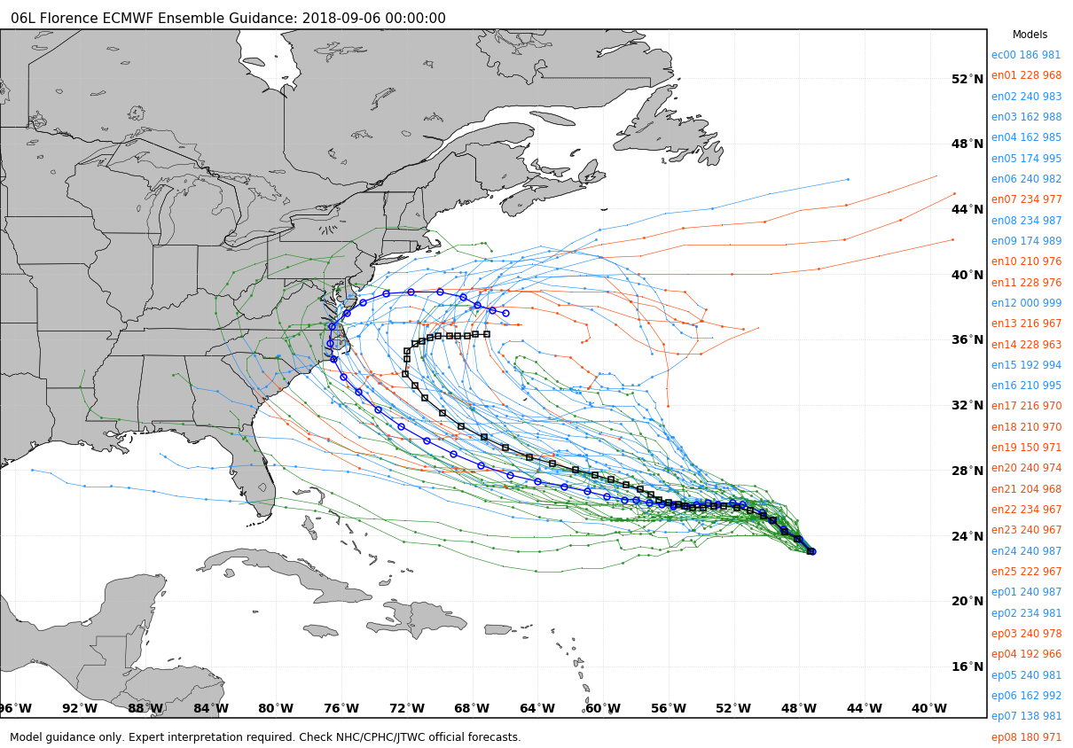
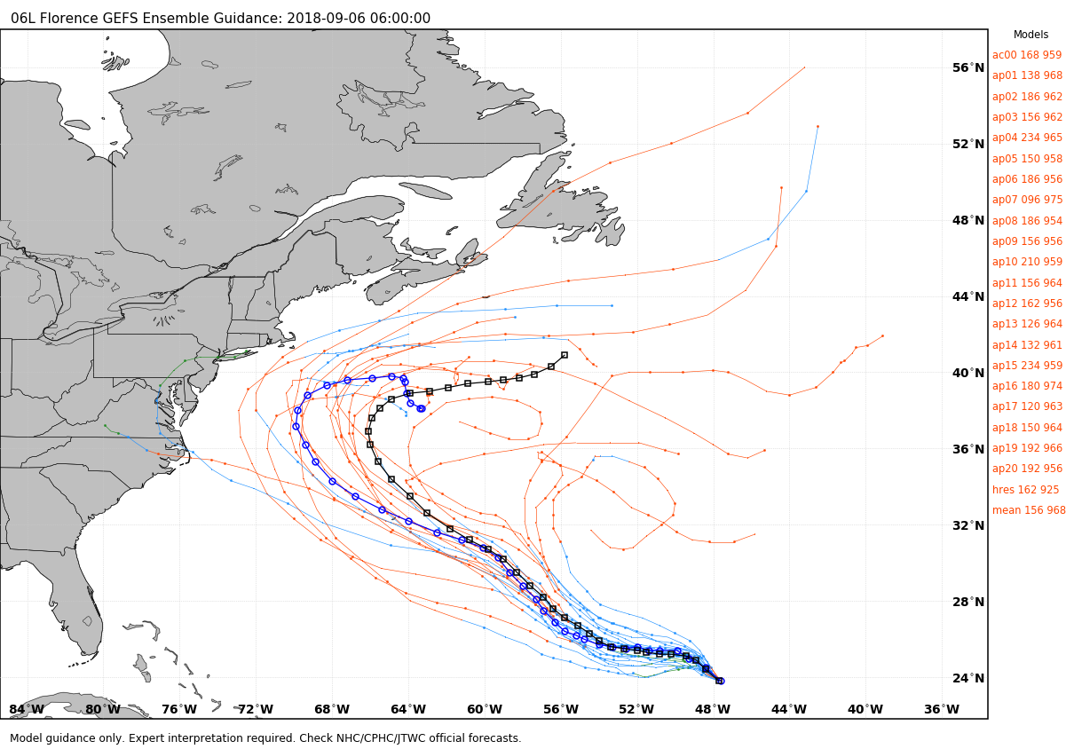
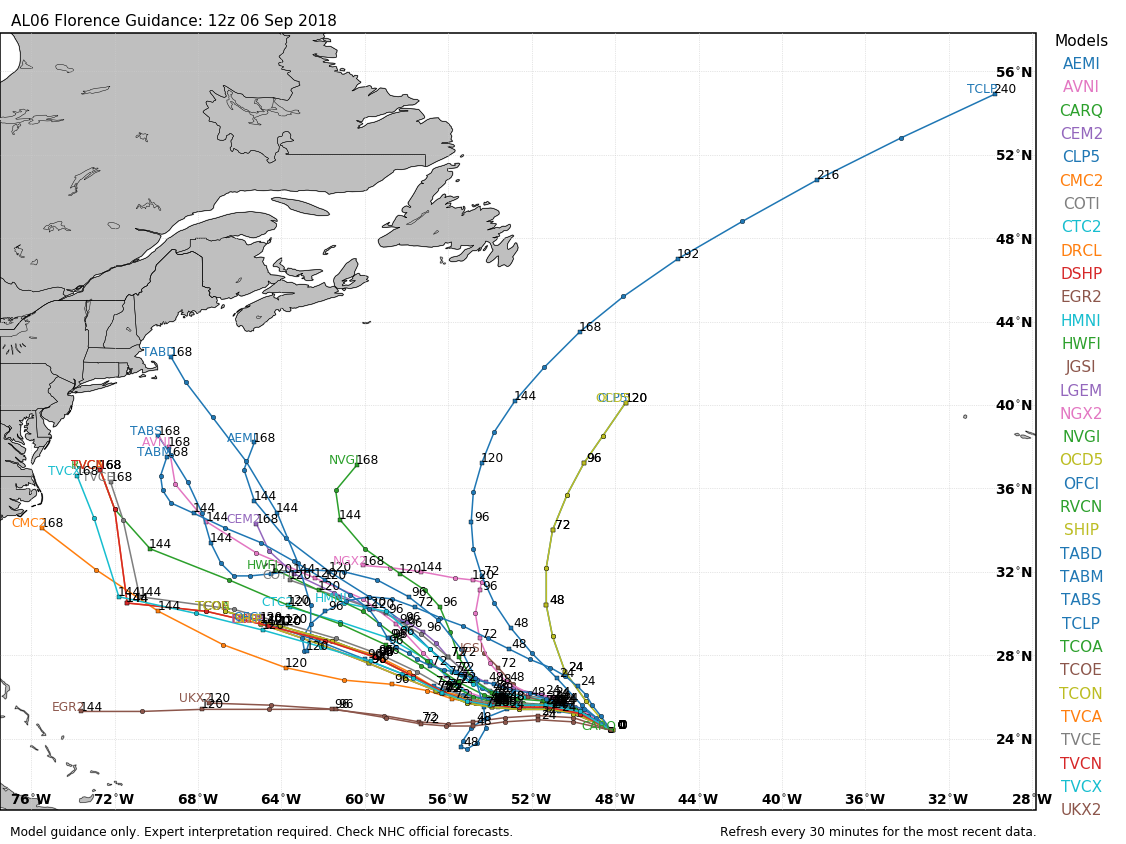
Next week looks somewhat unsettled with a disturbance bringing showers early in the week. Tuesday and Wednesday look mainly dry. The late-week forecast hinges on what happens with Hurricane Florence. The trend for the past couple of days if for Florence to make a closer pass to the United States East Coast. It’s too early for specifics because storm tracks ranging from a northern Florida hit to curving out to sea east of Bermuda are still on the table. Based on what I’ve seen from the models and overall weather pattern, the most likely scenario is Florence skirting the Southeast or Mid-Atlantic United States coast before curving or drifting out to sea. That path is way too close for comfort for anyone along the Eastern Seaboard, and at least a glancing blow in Southern New England cannot be ruled out. The timing of any potential impact is not until the mid to late week, so there are still a few days to get this figured out. At this point, the best course of action is to keep an eye on the forecast once or twice a day for the latest on the storm’s strength and projected track.
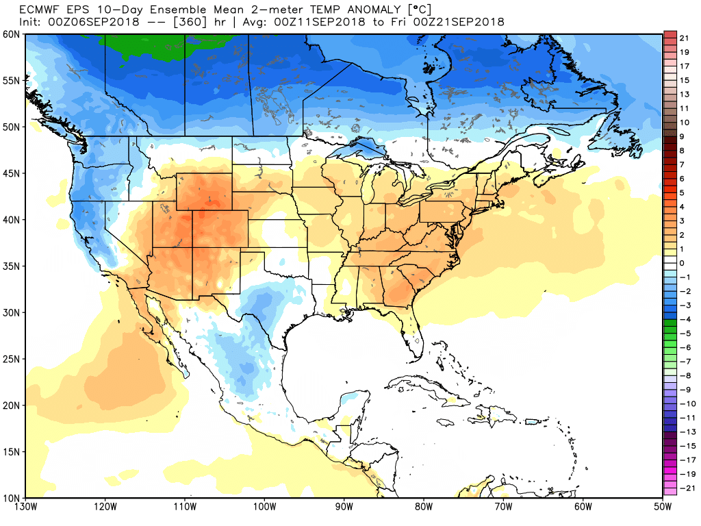
Regardless of Florence’s track, a relatively warm weather pattern persists in the Eastern United States. The 90s may be gone, but highs could reach the 80s with lows not too far from 70 as it stays humid most of the time between September 10-20.