September 7th Update
The mid-summer heat has finally left Southern New England, and the weekend looks seasonable Saturday and cool on Sunday. Of course, most of the weather chatter these days is about Florence. The storm looks like it will make a run at the Eastern Seaboard, and the odds on favorite for landfall around Thursday of next week is between northern Florida and North Carolina. It’s not out of the question that the storm makes a run in some form or fashion into New England, but that is not close to the most likely scenario at this time.
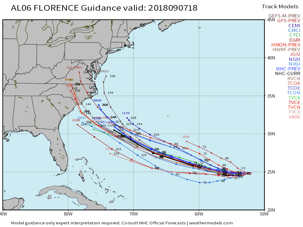
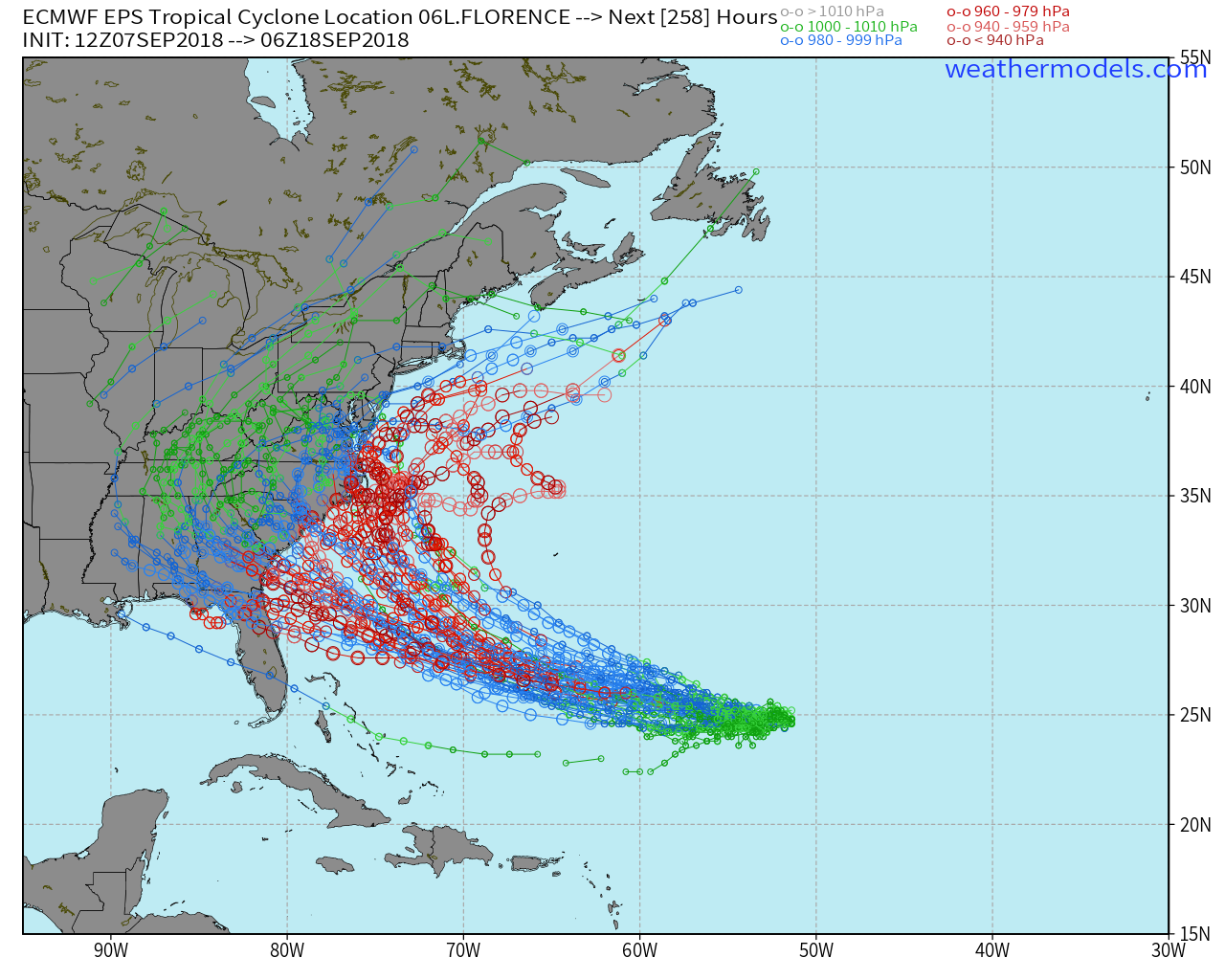
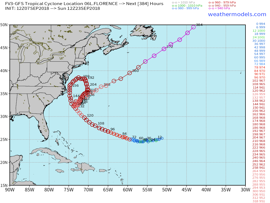
Florence’s track has been fickle thus far, and there is still plenty of time for changes to the track and all-important intensity forecast. At this point, I’d be on high alert if I lived south of the New Jersey, and we in New England should continue to keep an eye on it – just in case.
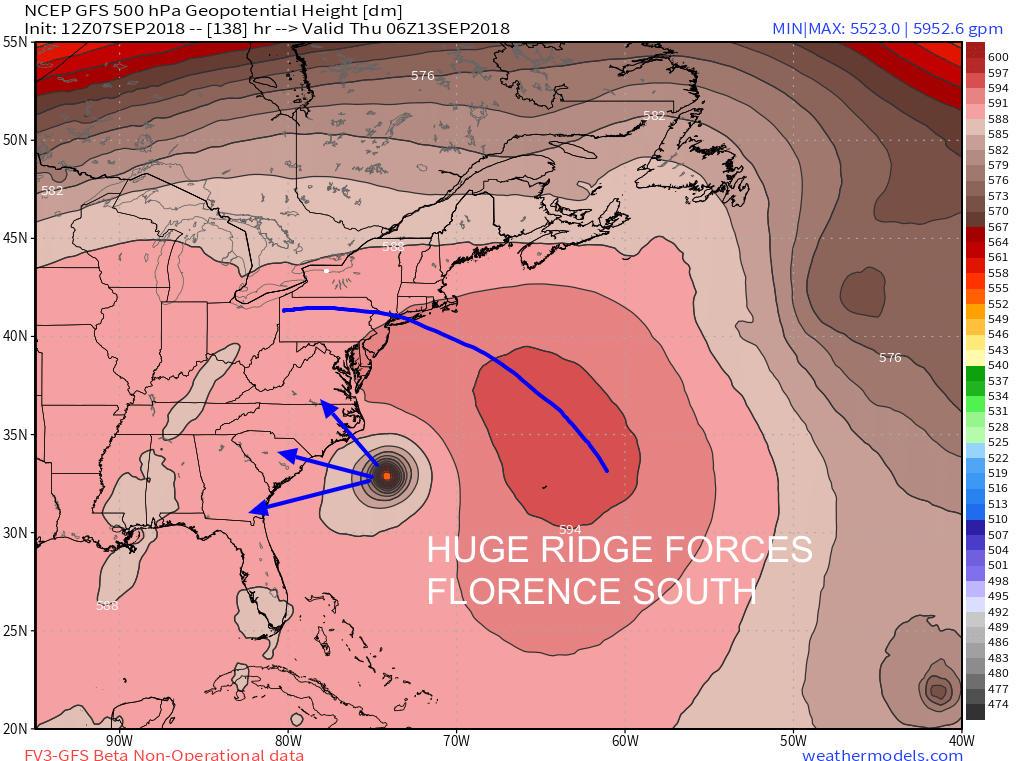
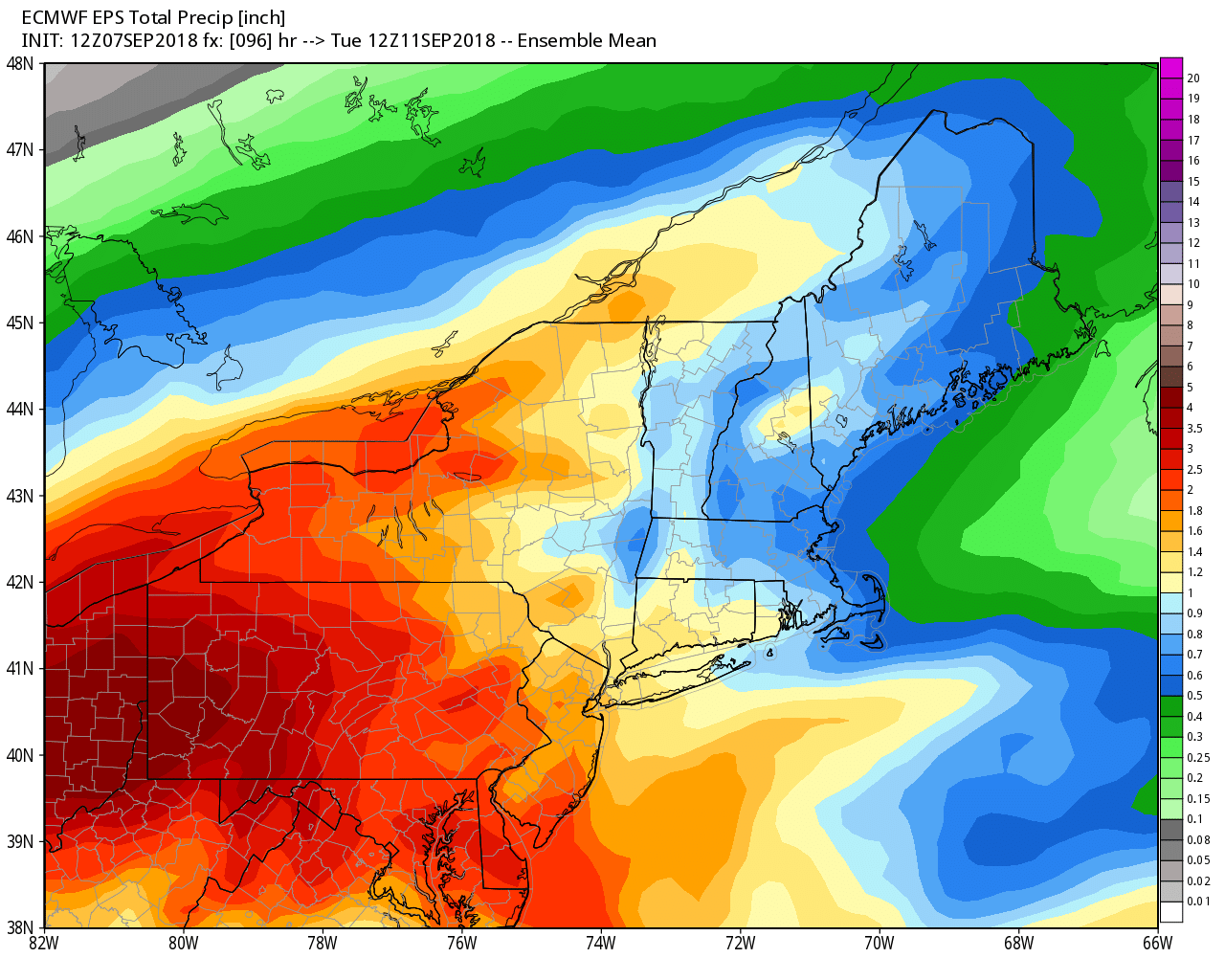
Before Florence even comes into the picture, there is likely to be some rain as the remnants of Gordon get caught in the jet stream and head our way early next week. The best bet for a decent soaking is Monday into Tuesday. An inch or more of rain is possible.
If Florence stays to our south next week, you can expect some pleasant weather – and possibly nice sunsets. Temps will likely be in the 70s to low 80s during the day, and in the upper 50s to mid 60s at night. A bit warm for mid-September, but nothing like we saw in the first week of the month!


