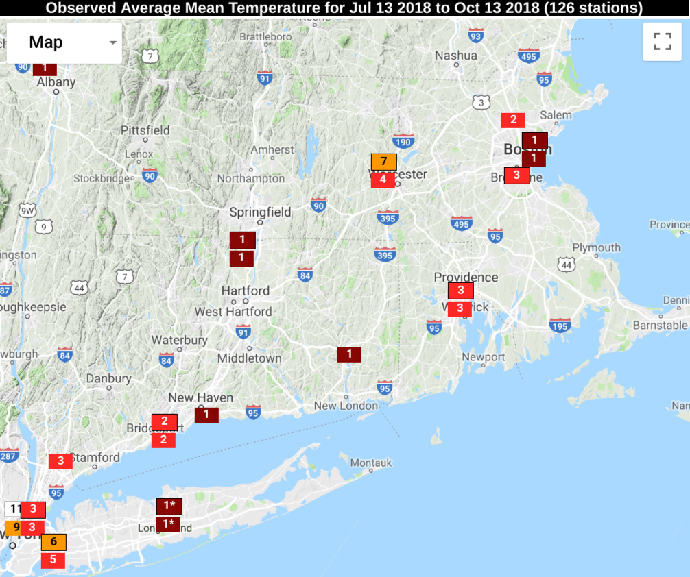
The first half of October is among the top ten warmest on record in Southern New England. In fact, you can go back a lot further than just the start of this month to see a long trend of relative warmth. The past 90 days are in the top 5 warmest for the stretch from mid-July to mid-October.
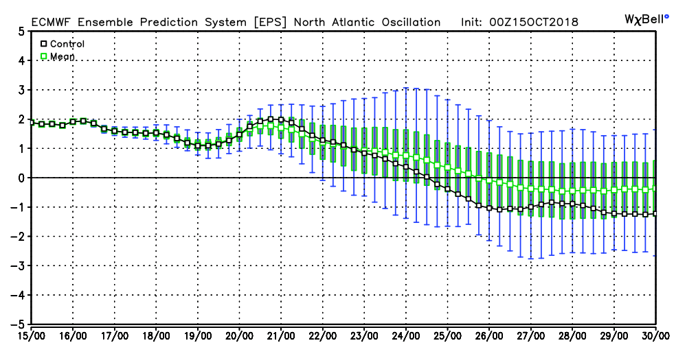
At some point, you have to figure that this run of warm weather will end, and I think we have reached that point. The weather pattern for the next couple of weeks, and possibly longer, looks slightly cool (relative to normal) most of the time. There are some signs that it may stay relatively cool in the east through a good chunk of November.
With a colder pattern upon us, we need to watch for stormy weather near the Northeast coast in late October. We’re no stranger to strong storms (rain/wind even snow) at this time of the year, and I think it’s something to closely monitor for the last week of this month.
As far as this week is concerned, it starts with unsettled weather on Monday. Expect passing light showers during the day. It’s not a total washout. The better chance of rain, and it may come with some t-storms, is this evening until shortly after midnight as a cold front passes. A few towns could pick up an inch of rain, but most will get a lot less than that. The temperature will reach the low to mid 60s this afternoon and evening before turning cooler late at night after the front passes.
Tuesday and Wednesday looks seasonable with some sunshine. Expect highs in the mid to upper 50s. Lows will be in the 40s. There is a slight chance of a shower Wednesday afternoon/evening as another cold front passes and sets us up for a chill on Thursday. Look for highs in the 40s (ouch) with a brisk wind under partly cloudy skies.
The early outlook for the weekend calls for a nice Friday with highs in the upper 50s followed by a chance of showers on Saturday with highs near 60. Sunday looks quite cool, with a few flurries possible inland, and temps in the 40s for most of the day. The wind will make it feel like the 30s. The chill sticks around early next week when there may be more days with highs only in the 40s.


