If you do not like chilly weather, then I suggest that you get out there and enjoy today’s “mild” highs near 60. A cold front moves through this evening and opens the door to the coldest weather of the season (so far) on Thursday. Passing rain showers are possible from west to east through Southern New England between 4-8 pm. I do not expect widespread rain. The wind will increase to 15-30 mph ahead of the cold front, and it stays gusty as it shifts to the northwest tonight. If you have outdoor plants that are sensitive to the cold, I’d bring them in today.
The animation at the top of this post shows the wind chill from tonight through tomorrow. You can see plenty of 20s by dawn on Thursday, and it will feel like the 30s during the afternoon. The actual temperatures will be in the low to mid 30s early in the day, and in the mid to upper 40s in the afternoon.
Thursday night looks cold with lows in the 30s and less wind. The temperature moderates Friday with highs in the mid to upper 50s under dry skies. A few showers may roll through late Friday night ahead of a cold front. The front will not pass until Saturday night, so a passing shower cannot be ruled out on Saturday. Expect highs near 60.
It turns blustery and colder on Sunday with dry weather. The afternoon temperature will hover around 50, but feel colder because of the wind. The temperature nosedives into the 30s again Sunday night, and Monday looks quite chilly, with highs in the 40s.
I still think this pattern is favorable for a close call with a storm in the middle or end of next week. It’s unclear if it will develop and how close it will be to the Eastern Seaboard, but the pattern could sustain a slow-moving storm that brings wind/precipitation to part of the Mid-Atlantic or Northeast next week. Again, I’m not predicting wild weather, but I think it’s something to keep an eye on.
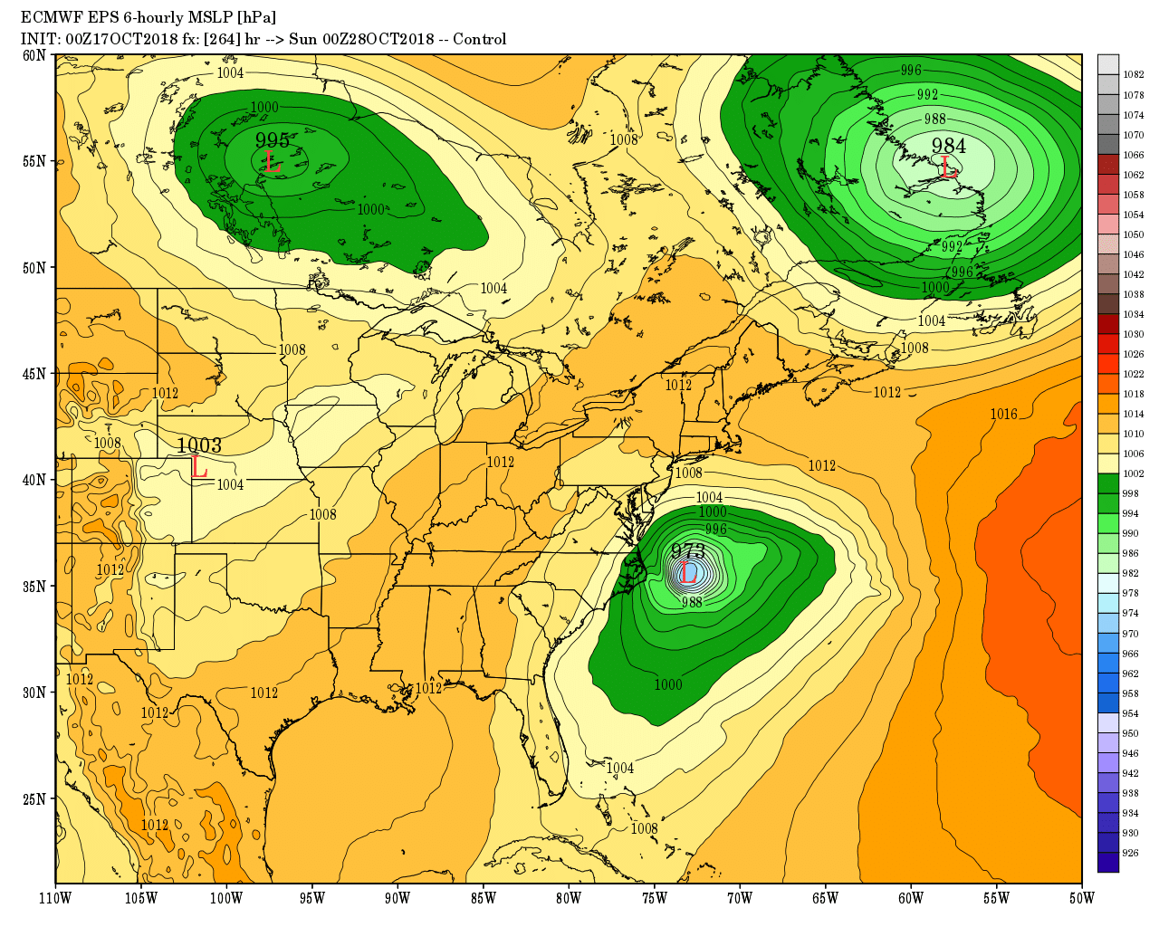
This computer model forecast for next Friday shows and intense storm of the NC coast. While I wouldn’t put too much stock in the specifics of a 10-11 day forecast, I think it’s a sign of the type of weather pattern that we’ll see next week.


