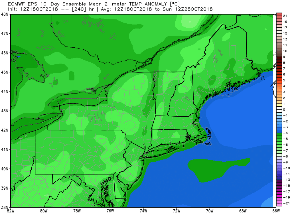
A mostly chilly weather pattern will continue in Southern New England through the end of the month. Cold air charged in early Thursday on a gusty northwest wind. The high temperature struggled to get out of the 40s on Thursday, and Thursday night will be cold under clear skies. It may get to freezing inland with a diminishing wind.
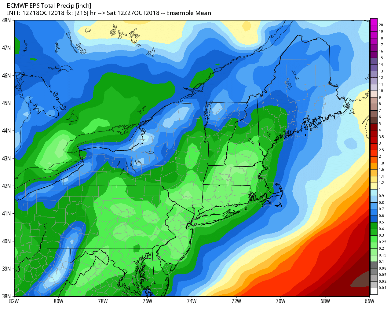
Friday does not look as chilly, and, overall, I expect it to be a pretty nice day. There should be a decent dose of sunshine and the temperature will bounce back to near 60 in the afternoon. A west-southwest breeze will be noticeable, but not as strong as Thursday. Spotty light rain showers are possible Friday night through Saturday night. The temperature will likely reach the low 60s on Saturday afternoon. Do not expect steady precipitation – most towns will probably get 0.1″ of rain or less.
A cold front sweeps through Saturday night, and we’re right back into some cold (for October) weather Sunday into early next week. Sunday afternoon looks blustery and chilly. A few snow flurries cannot be ruled out. Highs will be in the mid to upper 40s, but it will feel colder due to a 15-30 mph northerly wind. A few gusts near 40 mph are possible. More freezing temperatures are likely Sunday night.
It may not reach 50 again on Monday with dry skies. A weak system will shift the wind and bring temps back to near 60 on Tuesday. A few showers cannot be ruled out, but, once again it does not look like much rain. Cold air plunges in again late in the workweek. Expect highs in the 50s on Wednesday, and it looks like 40s or 50s Thursday and Friday.
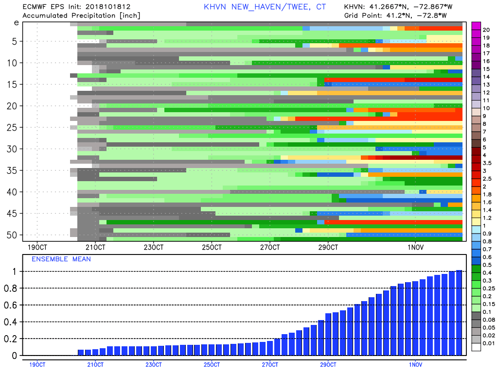
I still think that this pattern can produce an East Coast storm. It will persist through the end of the month and into early November. There are some signs that something could develop next weekend or early the following week. Odds favor rain over snow with any storm that hits, but there’s enough unseasonably cold air around that an early-season inland snow event is still on the table.