The work week is underway with a very cold start this morning. Many towns were below freezing under clear skies. Sunshine today should get the temperature back close to 50 in the afternoon. It will not be as chilly tonight with some clouds arriving and lows in the upper 30s to low 40s – coolest inland.
Tuesday looks like a cloudy or mostly cloudy day, with passing showers possible. It certainly will not be a washout, and there is a low chance of more than 0.1″ of rain in CT, and less than 0.25″ is expected in RI and SE MA. The temperature will reach the 50s on Tuesday – still a bit cool for late October.

Scattered showers on Tuesday
The middle to end of the workweek looks dry and chilly. Expect highs in the upper 40s to low 50s with some clouds and a gusty wind on Wednesday. It will feel colder because of the 15-30 mph breeze. It stays blustery and gets even cooler on Thursday. Look for lows in the 30s and highs in the 40s under dry skies. Sub-freezing weather is possible Friday morning, and it will stay in the 40s during the afternoon with some sunshine and a lighter wind.
Weekend Storm Ahead
I have been talking about it for a while, and it looks like my prediction of stormy weather late in October will come true. A storm moving up the Eastern Seaboard this weekend will bring rain and possibly gusty wind. The rain may begin as soon as Saturday morning, and it looks like Saturday afternoon will be wet. There may even be just enough cold air leftover on Saturday morning for a brief period of snow/sleet before cold rain arrives in the northwest and northeast Connecticut hills. There is a better chance of accumulating snow in the Berkshires and points north.

East Coast storm develops early this weekend
It’s only Monday, so the details of the weekend forecast will likely change in the next few days. For now, I would plan on a wet and possibly windy Saturday (especially afternoon), with gray skies and a few lingering showers Sunday morning. The storm could shift by 12-18 hours, pushing the steadier precipitation into Saturday night and Sunday. I will keep you posted!
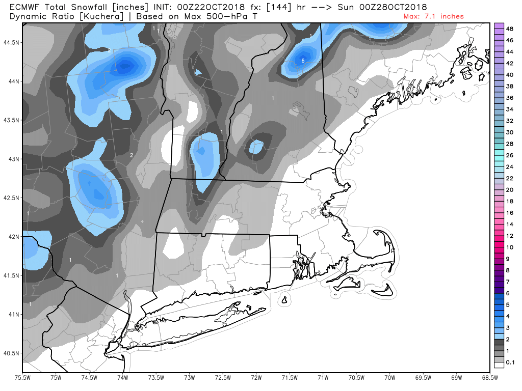
Weekend storm may bring snow to high elevations of the Northeast
Expect temps in the 40s to low 50s at best on Saturday, and a bit milder on Sunday as the storm moves to the north of Southern New England. Dry weather is likely Monday and Tuesday of next week, and I’m cautiously optimistic that it will hold through Trick or Treating on Wednesday. The overall pattern looks cool and unsettled into early November.


