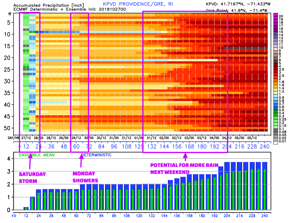
The wind/rain storm continues this afternoon with more showers moving through and winds gusting to 40+ mph near the coast. Rain moves out overnight and the the wind relaxes as the storm moves north of Southern New England. Rain totals of 0.75-2.00″ will be common. Sunday looks mainly or all dry with a west-southwest breeze and temperatures in the upper 40s to mid 50s depending on how much sunshine can break through. It will be mildest in RI and SE MA. Overall, it’s not a bad day for storm clean-up.
A disturbance moving through late Sunday night into Monday morning brings showers. About 0.25″ rain is possible between 6 a.m. – 2 p.m. from west to east. I don’t expect more tornadoes, but given the track of the storm system we need to watch for a few thunderstorms. Highs will be in the 50s. Tuesday looks dry and seasonably cool with highs not far from 50.
Look for a midweek warm-up, with temps getting close to 60 under dry skies on Wednesday. It will be in the 50s for Trick or Treating Wednesday evening. Thursday looks mild, with highs in the 60s – a rare warmer than normal day. It could be the first day in three weeks that’s more than 5° above normal.
The weather pattern turns unsettled again late in the workweek and/or next weekend. The details are fuzzy, but there’s a good chance of showers sometime between Friday and Sunday. It’s possible there could be more than one round of rain in that time frame. Right now, it looks like Friday morning and late Saturday are the best bets for rain. I’ll keep you posted.